MyTopo
Plainfield Pennsylvania US Topo Map
Couldn't load pickup availability
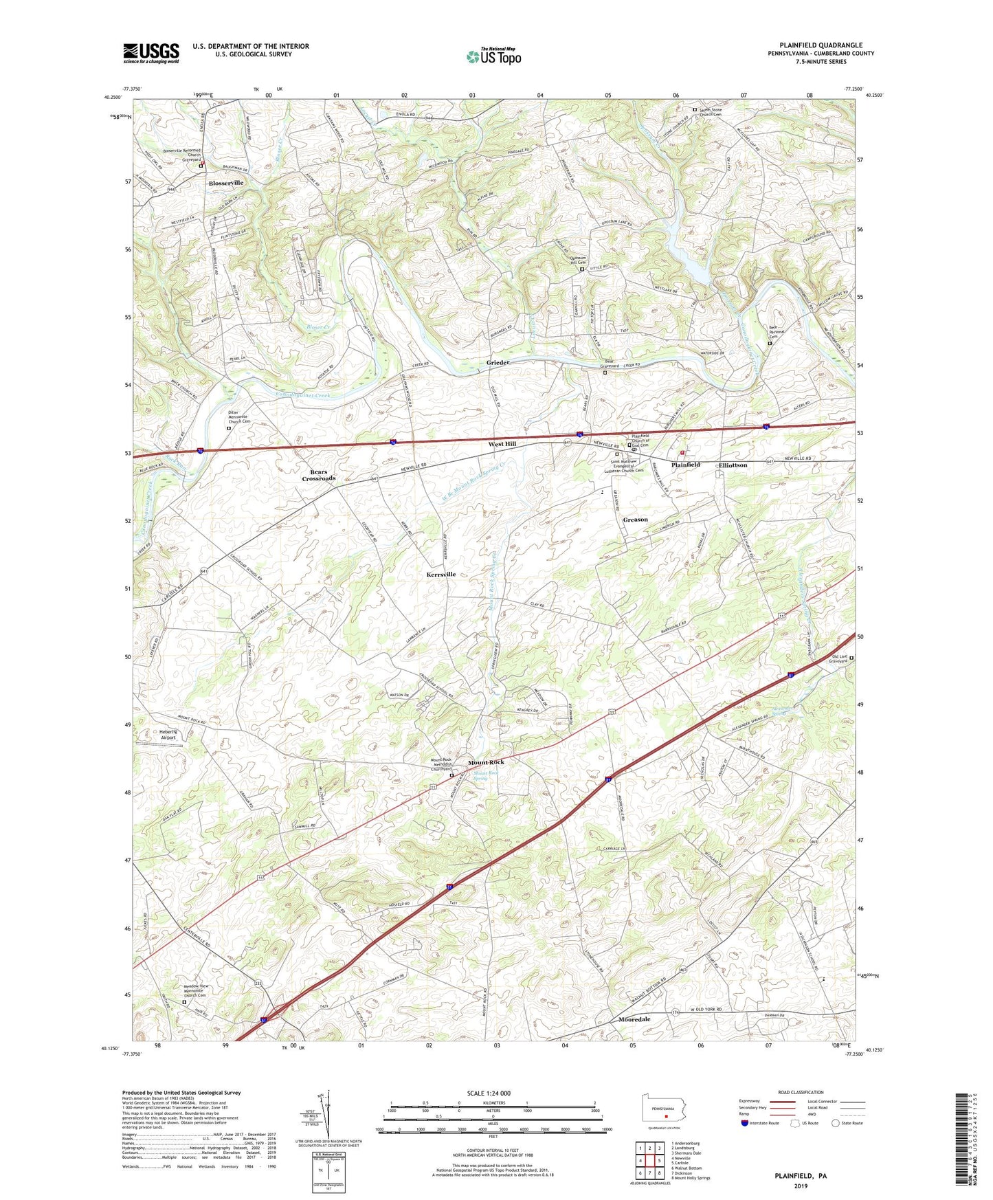
2023 topographic map quadrangle Plainfield in the state of Pennsylvania. Scale: 1:24000. Based on the newly updated USGS 7.5' US Topo map series, this map is in the following counties: Cumberland. The map contains contour data, water features, and other items you are used to seeing on USGS maps, but also has updated roads and other features. This is the next generation of topographic maps. Printed on high-quality waterproof paper with UV fade-resistant inks.
Quads adjacent to this one:
West: Newville
Northwest: Andersonburg
North: Landisburg
Northeast: Shermans Dale
East: Carlisle
Southeast: Mount Holly Springs
South: Dickinson
Southwest: Walnut Bottom
This map covers the same area as the classic USGS quad with code o40077b3.
Contains the following named places: Alexander Spring, Alterton Station, Bear Graveyard, Bear Personal Cemetery, Bears Crossroads, Bears School, Black Dam, Bloser Creek, Bloserville Reformed Church Graveyard, Blosserville, Crossroads School, Cumberland County, Cumberland Golf Course, Diller Church, Diller Mennonite Church Cemetery, Elliotts Mill, Elliottson, Frankford Elementary School, Greason, Green Hill School, Grieder, Heberlig Airport, Keiters Mill, Kerrsville, Lash Airport, Locust Creek, Locust Point School, Logan School, McAllister School and Church, Meadow View Mennonite Church Cemetery, Mooredale, Mount Pleasant School, Mount Rock, Mount Rock Methodist Churchyard, Mount Rock Spring, Mount Rock Spring Creek, Mount Zion School, Old Line Graveyard, Opossum Creek, Opossum Hill Cemetery, Opossum Hill School, Opossum Hill Union Church, Opossum Lake, Opossum Lake Dam, Palmtown School, Plainfield, Plainfield Census Designated Place, Plainfield Church of God Cemetery, Plainfield Emementary School, Plainfield Post Office, Rock Run, Saint Matthew Evangelical Lutheran Church Cemetery, Salem Stone Church Cemetery, Savannah School, Shady Grove School, Stone Church, Stone School, Township of Lower Frankford, Township of Upper Frankford, Township of West Pennsboro, Upper Frankford Township Volunteer Fire Company Station 48, West Branch Mount Rock Spring Creek, West Hill, West Pennsboro School, West Pennsboro Volunteer Fire Company Station 46, ZIP Code: 17081