MyTopo
Walnut Bottom Pennsylvania US Topo Map
Couldn't load pickup availability
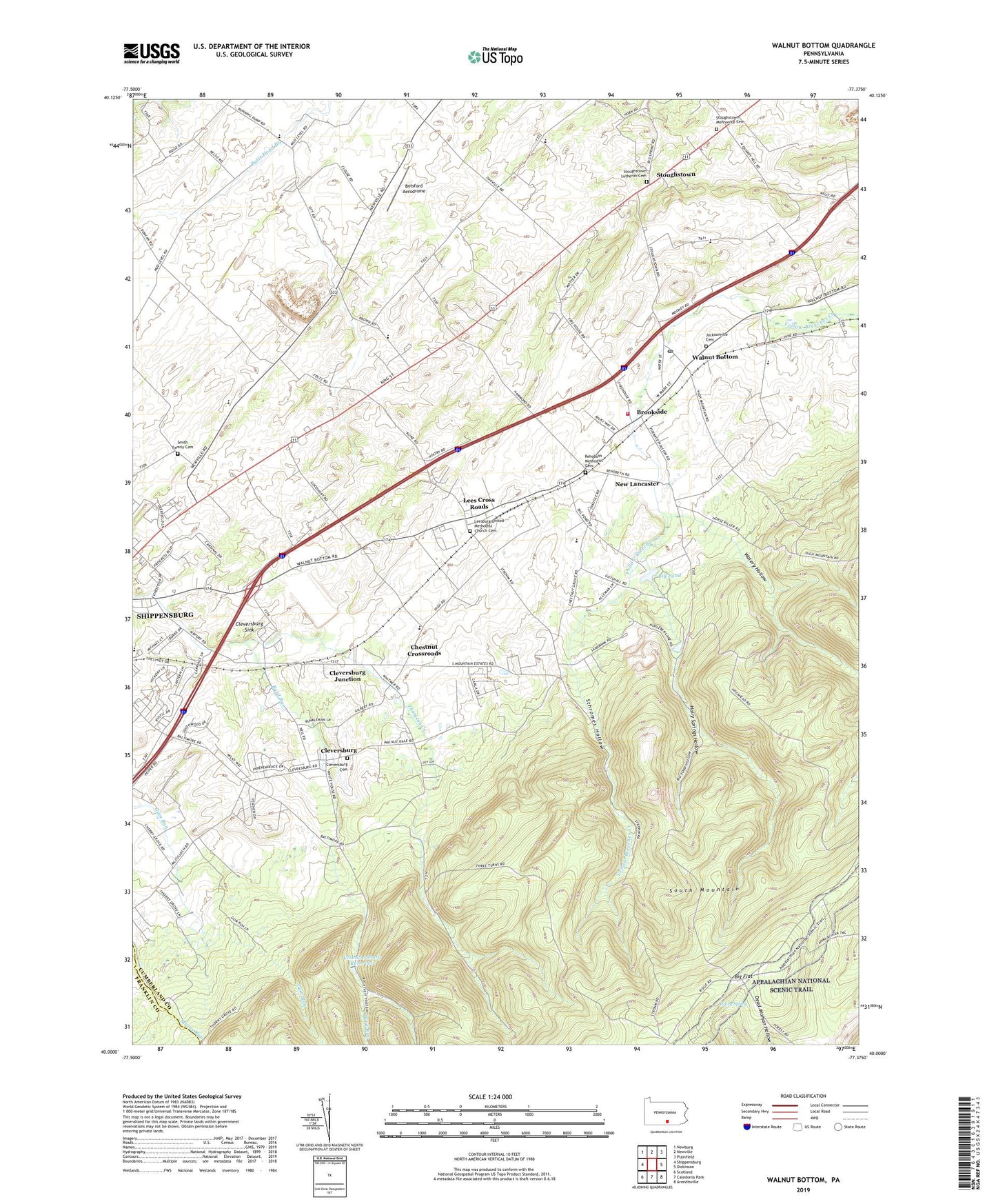
2023 topographic map quadrangle Walnut Bottom in the state of Pennsylvania. Scale: 1:24000. Based on the newly updated USGS 7.5' US Topo map series, this map is in the following counties: Cumberland, Franklin. The map contains contour data, water features, and other items you are used to seeing on USGS maps, but also has updated roads and other features. This is the next generation of topographic maps. Printed on high-quality waterproof paper with UV fade-resistant inks.
Quads adjacent to this one:
West: Shippensburg
Northwest: Newburg
North: Newville
Northeast: Plainfield
East: Dickinson
Southeast: Arendtsville
South: Caledonia Park
Southwest: Scotland
This map covers the same area as the classic USGS quad with code o40077a4.
Contains the following named places: Big Flat Tower, Big Pond, Big Pond Furnace, Botsford Aerodrome, Brookside, Buzzards Rocks Vista, Center School, Chambersburg Reservoir, Cherry Grove School, Chestnut Crossroads, Chestnut Crossroads School, Chestnut Grove School, Cleversburg, Cleversburg Cemetery, Cleversburg Junction, Cleversburg Sink, Fairview School, Greythorne Station, Hairy Spring, Hairy Springs Hollow, Jacksonville Cemetery, Lees Cross Roads, Leesburg United Methodist Church Cemetery, Long Mountain, New Lancaster, Newton Township Consolidated School, Pine Grove School, Pine Road School, Pole Bridge Trail, Rehoboth Methodist Cemetery, Reservoir Hollow, Shippensburg Airport, Sliding Rock Mountain, Smith Family Cemetery, South Mountain Chapel, South Newton Township Volunteer Fire Company Station 49, Spring Hill School, Sthromes Hollow, Stoughstown, Stoughstown Lutheran Cemetery, Stoughstown Mennonite Cemetery, Thomson Creek, Thorne Grove School, Tobacco Patch Mountain, Township of South Newton, Township of Southampton, Walnut Bottom, Walnut Bottom Post Office, Watery Hollow, ZIP Codes: 17257, 17266