MyTopo
East Butler Pennsylvania US Topo Map
Couldn't load pickup availability
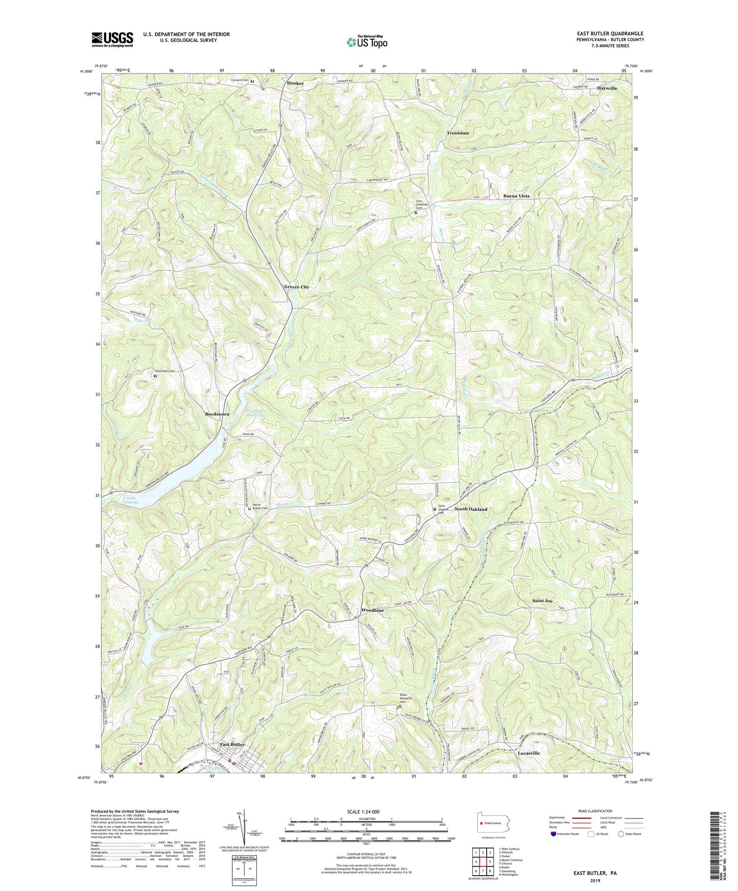
2019 topographic map quadrangle East Butler in the state of Pennsylvania. Scale: 1:24000. Based on the newly updated USGS 7.5' US Topo map series, this map is in the following counties: Butler. The map contains contour data, water features, and other items you are used to seeing on USGS maps, but also has updated roads and other features. This is the next generation of topographic maps. Printed on high-quality waterproof paper with UV fade-resistant inks.
Quads adjacent to this one:
West: Mount Chestnut
Northwest: West Sunbury
North: Hilliards
Northeast: Parker
East: Chicora
Southeast: Worthington
South: Saxonburg
Southwest: Butler
Contains the following named places: Borough of East Butler, Boydstown, Boydstown Dam, Boydstown Reservoir, Buena Vista, Byers Corner, Campbell School, Concord Cemetery, Concord Church, East Butler, East Butler Post Office, East Butler Volunteer Fire Department Station 9, Gilbert, Greece City, Haysville, Hiland Public Golf Course, Hooker, Lake Oneida, Lake Oneida Dam, Lick Hill Volunteer Fire Department Station 8, Lucasville, Lucasville Station, Millingar School, Noeline Station, North Butler Cemetery, North Butler Church, North Oakland, North Oakland Station, Oakland Township Elementary School, Pine Run, Saint Joe, Saint Joe Station, Saint Josephs Cemetery, Saint Wendelin Cemetery, Saint Wendells School, Springdale Church, Starr Crossing, State Game Lands Number 164, Thorn Reservoir, Township of Concord, Township of Oakland, Troutman, Troutman Station, Utley, Whitmire Cemetery, Whitmire School, Woodbine, Zion Church, Zion Lutheran Cemetery, ZIP Codes: 16025, 16029