MyTopo
Mount Chestnut Pennsylvania US Topo Map
Couldn't load pickup availability
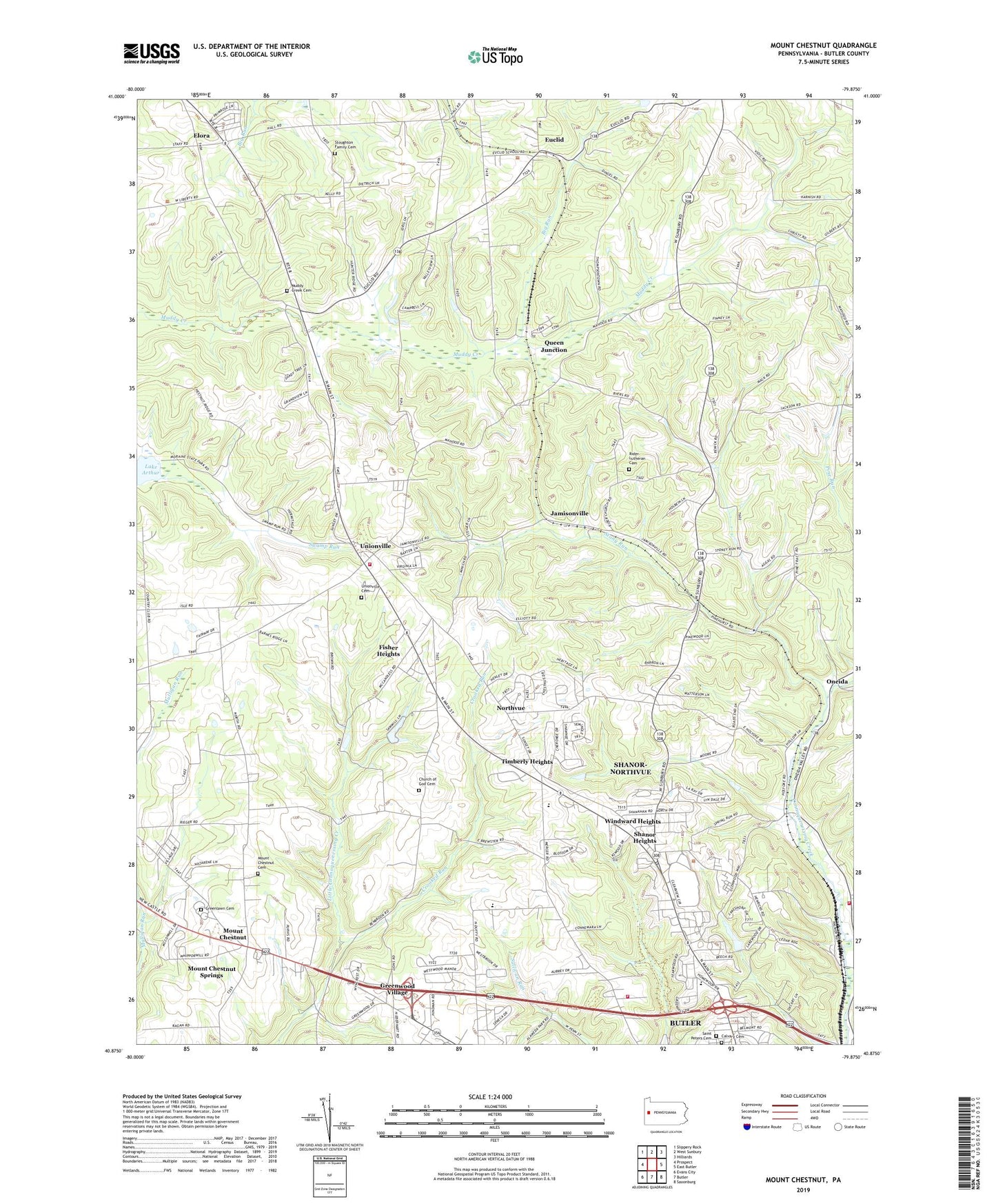
2023 topographic map quadrangle Mount Chestnut in the state of Pennsylvania. Scale: 1:24000. Based on the newly updated USGS 7.5' US Topo map series, this map is in the following counties: Butler. The map contains contour data, water features, and other items you are used to seeing on USGS maps, but also has updated roads and other features. This is the next generation of topographic maps. Printed on high-quality waterproof paper with UV fade-resistant inks.
Quads adjacent to this one:
West: Prospect
Northwest: Slippery Rock
North: West Sunbury
Northeast: Hilliards
East: East Butler
Southeast: Saxonburg
South: Butler
Southwest: Evans City
This map covers the same area as the classic USGS quad with code o40079h8.
Contains the following named places: Aubreys Golf Course, Big Run, Bon Aire School, Bon Aire Shopping Mall, Butler County, Butler County Child Center Inc, Butler Shopping Mall, Calvary Cemetery, Camp Alameda, Camp Wesley, Center School, Center Township Elementary School, Church of God Cemetery, Clearview Shopping Mall, Crooked Run, Elliott School, Elora, Euclid, Fisher Heights, Franklin Township Elementary School, Greenlawn Cemetery, Greenwood Village, Greenwood Village Volunteer Fire Department Station 5, Hickory Corner, Jamisonville, Lake Arthur Country Club, McCandless Airport, Mercer Road Volunteer Fire Department Station 6, Mercer Road Volunteer Fire Station, Miller School, Mount Chestnut, Mount Chestnut Cemetery, Mount Chestnut Springs, Muddy Creek, Muddy Creek Cemetery, North Fork, Northvue, Oakland Oneida Valley Volunteer Fire Department Station 35, Oneida, Queen Junction, Rider Church, Rider Lutheran Cemetery, Ridge School, Saint Clair School, Saint Peters Cemetery, Shanor Heights, Shanor-Northvue Census Designated Place, Smithville, Stony Run, Stoughton Acres Golf Course, Stoughton Family Cemetery, Thompson School, Thorn Creek, Thorn Crossing, Thorn Run Dam, Thorn Run Reservoir, Thorn Station, Timberly Heights, Township of Center, Township of Clay, Unionville, Unionville Cemetery, Unionville Census Designated Place, Unionville Volunteer Fire Company Station 14, WBUT-AM (Butler), Windward Heights, WISR-AM (Butler), WLER-FM (Butler), ZIP Code: 16001