MyTopo
Everett East Pennsylvania US Topo Map
Couldn't load pickup availability
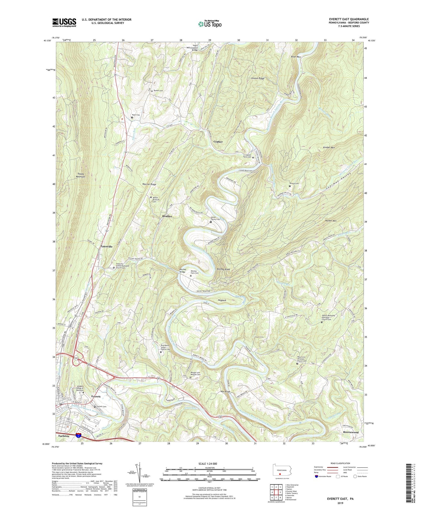
2019 topographic map quadrangle Everett East in the state of Pennsylvania. Scale: 1:24000. Based on the newly updated USGS 7.5' US Topo map series, this map is in the following counties: Bedford. The map contains contour data, water features, and other items you are used to seeing on USGS maps, but also has updated roads and other features. This is the next generation of topographic maps. Printed on high-quality waterproof paper with UV fade-resistant inks.
Quads adjacent to this one:
West: Everett West
Northwest: New Enterprise
North: Hopewell
Northeast: Saxton
East: Wells Tannery
Southeast: Breezewood
South: Mench
Southwest: Clearville
Contains the following named places: Asbury Church, Asbury Methodist Episcopal Church Cemetery, Bethel Brethren Cemetery, Bethel Church, Bloody Run, Borough of Everett, Brallier, Brush Creek, Burket Cemetery, Clear Creek, Cypher, Cypher Farm Cemetery, Cypher Station, Earlston, Earlston Census Designated Place, Everett, Everett Area Middle / High School, Everett Cemetery, Everett Post Office, French Run, Greys Run, Hall's Mill Covered Bridge, Hinish Family Cemetery, Hogback, Johns Branch, Kimber Run, Lake Groundhog Campsite, Lemnus Ridge, Morgart and Morgret Cemetery, Piper Cemetery, Pipers Run, Providence Union Church, Providence Union Church Cemetery, Rays Cove Christian Church Cemetery, Rays Cove Church, Raystown Ambulance Service - Unit 12, Rinard Cemetery, Ritchey Bridge, Ritchey Farm Cemetery, Ritchey Knob, Rivers Bend Country Club, Rivers Bend Golf Course, Sherman Valley, Sherman Valley Run, State Game Lands Number 261, State Game Lands Number 73, Tatesville, Tatesville United Methodist Church Cemetery, Township of East Providence, Township of Hopewell, Tub Mill Run, West Providence School, Woy Bridge, WSKE-AM (Everett), ZIP Codes: 15537, 16650