MyTopo
New Enterprise Pennsylvania US Topo Map
Couldn't load pickup availability
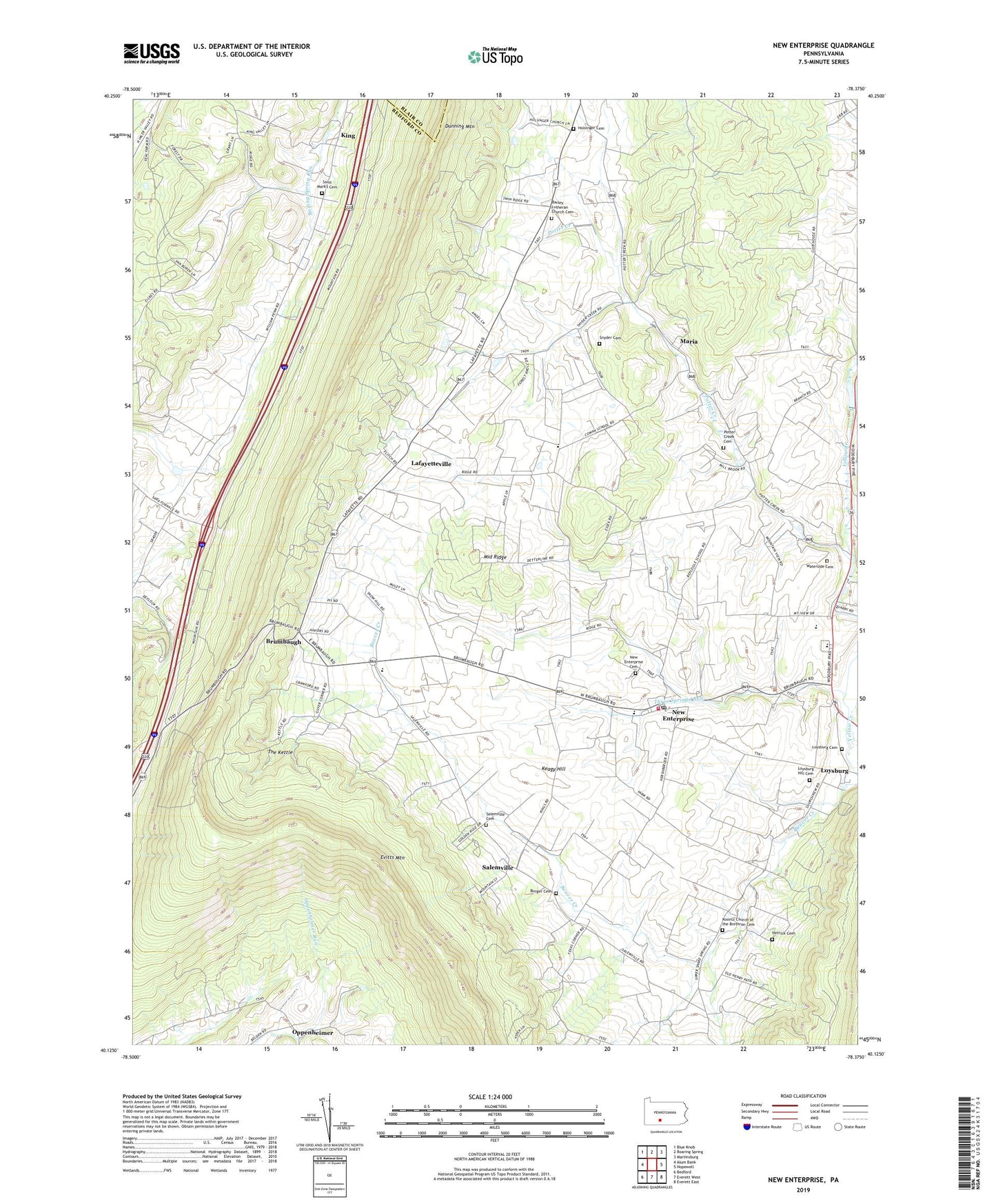
2023 topographic map quadrangle New Enterprise in the state of Pennsylvania. Scale: 1:24000. Based on the newly updated USGS 7.5' US Topo map series, this map is in the following counties: Bedford, Blair. The map contains contour data, water features, and other items you are used to seeing on USGS maps, but also has updated roads and other features. This is the next generation of topographic maps. Printed on high-quality waterproof paper with UV fade-resistant inks.
Quads adjacent to this one:
West: Alum Bank
Northwest: Blue Knob
North: Roaring Spring
Northeast: Martinsburg
East: Hopewell
Southeast: Everett East
South: Everett West
Southwest: Bedford
This map covers the same area as the classic USGS quad with code o40078b4.
Contains the following named places: Barley Church, Barley Lutheran Church Cemetery, Brumbaugh, Burger Cemetery, Coveburg, Dunning Mountain, Hetrick Cemetery, Hickory Bottom Creek, Holsinger Cemetery, Holsinger Church, Keagy Dam, Keagy Hill, King, Koontz Church, Koontz Church of the Brethren Cemetery, Lafayetteville, Loysburg, Loysburg Hill Cemetery, Maria, Middle Ridge, New Enterprise, New Enterprise Cemetery, New Enterprise Post Office, Northern Bedford County High School, Potter Creek, Potter Creek Cemetery, Saint Johns Church, Saint John's Reformed Church Cemetery, Saint Mark's Cemetery, Saint Marks Union Church, Salemville, Salemville Cemetery, Shaefer Overlook, Snyder Cemetery, Southern Cove Emergency Medical Services, Southern Cove Volunteer Fire Company - Station 41, State Game Lands Number 41, Texas Corner, The Kettle, Three Springs Run, Township of Bloomfield, Township of South Woodbury, Waterside, Waterside Cemetery, ZIP Codes: 16659, 16664