MyTopo
Fairfield Pennsylvania US Topo Map
Couldn't load pickup availability
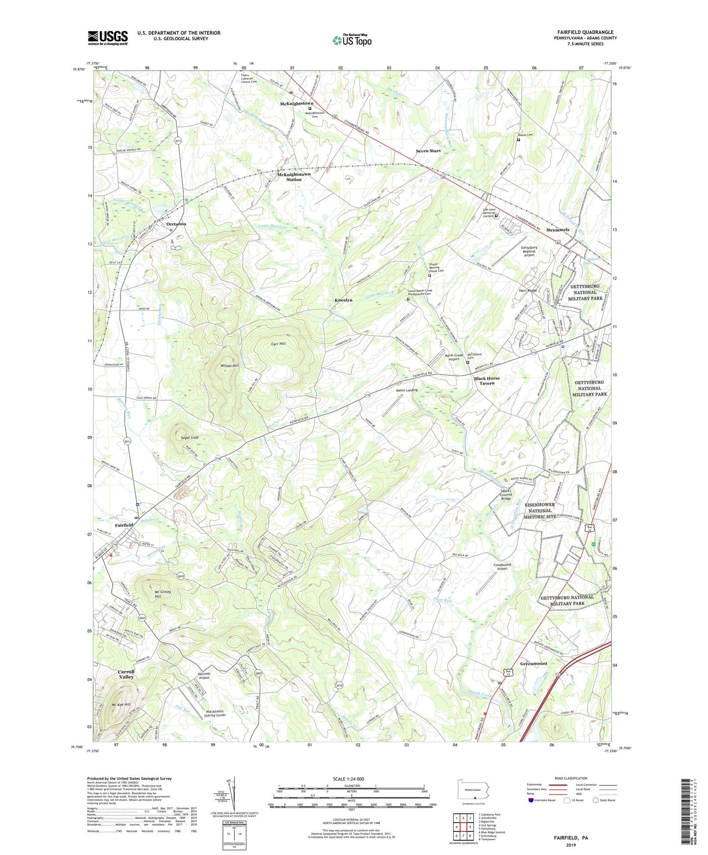
2023 topographic map quadrangle Fairfield in the state of Pennsylvania. Scale: 1:24000. Based on the newly updated USGS 7.5' US Topo map series, this map is in the following counties: Adams. The map contains contour data, water features, and other items you are used to seeing on USGS maps, but also has updated roads and other features. This is the next generation of topographic maps. Printed on high-quality waterproof paper with UV fade-resistant inks.
Quads adjacent to this one:
West: Iron Springs
Northwest: Caledonia Park
North: Arendtsville
Northeast: Biglerville
East: Gettysburg
Southeast: Taneytown
South: Emmitsburg
Southwest: Blue Ridge Summit
This map covers the same area as the classic USGS quad with code o39077g3.
Contains the following named places: Battlefield Heliport, Belmont School, Black Horse Tavern, Blacks Cemetery, Borough of Fairfield, Browns Airport, Camp George H Sharp, Caring Hearts Emergency Medical Services, Carr Hill, Cloudbound Airport, Cumberland Township Police Department, Eisenhower National Historic Site, Fairfield, Fairfield Fire and Emergency Medical Services Station 2, Fairfield Library, Fairfield Post Office, Gettysburg Heliport, Gettysburg Park, Gettysburg Regional Airport, Glenwood School, Green Mount Post Office, Greenmount, Greenmount Community Volunteer Fire Company Station 23, Hamiltonban Township Police Department, Hammer Hall, Heintzlemans, Herr Ridge, Hickory Hollow Horse Farm, Karlindo Airport, Katalysine Spring, Knoxlyn, Liberty Hall School, Little Marsh Creek, Lower Marsh Creek, Lower Marsh Creek Presbyterian Cemetery, Lower Marsh Creek School, Manor Landing, March Creek Church, Marsh Creek Airport, Marsh Creek Church, Mc Ginley Hill, Mc Kee Hill, McCleary School, McClelland Cemetery, McCurdy School, McKnightstown, McKnightstown Cemetery, McKnightstown Census Designated Place, McKnightstown Post Office, McKnightstown Station, Mid Atlantic Soaring Center, Muddy Run, Muddy Run Airport, Mummasburg Run, Muskrat Run, Oak Grove School, Oak Lawn Memorial Gardens, Orrtanna, Orrtanna Census Designated Place, Pfoutz Meeting House Cemetery, Pitzer School, Pitzers Run, Plum Run, Poplar Spring Creek, Rattling Run, Sauck's Covered Bridge, Seven Stars, Sheraton Inn-Gettysburg Heliport, Ski Liberty Ski Area, Southern Adams County Heliport, Spring Run, Stremmels, Sugar Loaf, Tifllie, Township of Cumberland, Township of Freedom, Township of Highland, Township of Liberty, Willoughby Run, Wilson Hill, ZIP Code: 17343