
MyTopo
Greenville West Pennsylvania US Topo Map
Couldn't load pickup availability
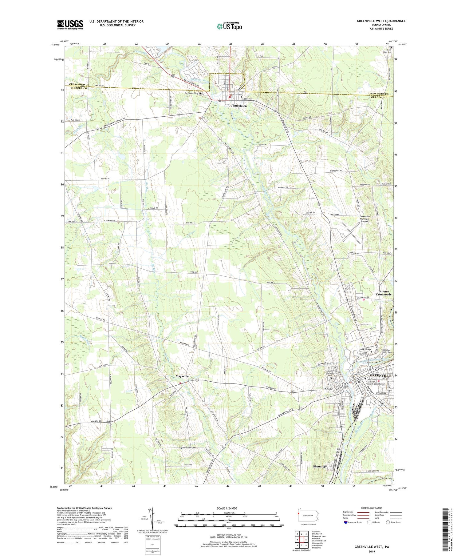
2019 topographic map quadrangle Greenville West in the state of Pennsylvania. Scale: 1:24000. Based on the newly updated USGS 7.5' US Topo map series, this map is in the following counties: Mercer, Crawford. The map contains contour data, water features, and other items you are used to seeing on USGS maps, but also has updated roads and other features. This is the next generation of topographic maps. Printed on high-quality waterproof paper with UV fade-resistant inks.
Quads adjacent to this one:
West: Kinsman
Northwest: Andover
North: Hartstown
Northeast: Conneaut Lake
East: Greenville East
Southeast: Fredonia
South: Sharpsville
Southwest: Orangeville
Contains the following named places: Artman School, Borough of Greenville, Borough of Jamestown, Columbia School, Donner Crossroads, Greenville, Greenville - West Salem Police Department, Greenville Municipal Airport, Greenville Post Office, Greenville Volunteer Fire Department Station 96, Holsing Airport, Holy Trinity Lutheran Church Columbarium, Jamestown, Jamestown Borough Police Department, Jamestown Post Office, Jamestown Volunteer Fire Department Station 89, Jerusalem Cemetery, Little Shenango River, Mathay Run, Maysville, Mud College, Park Lawn Cemetery, Penn High School, Pymatuning Reservoir, Pymatuning Reservoir Dam, Ray School, Rocky Glen Cemetery, Saint Michaels Cemetery, Saint Pauls Childrens Home, Saul Run, Shenango, Shenango Valley Cemetery, Sugar Run, Sugar Run School, Thiel College, Township of Greene, Township of West Salem, Walnut Creek Golf Course, West Salem Elementary School, West Salem Volunteer Fire Department Station 73, West Salem Volunteer Fire Department Station 73 - 2, West Side School, WGRP-AM (Greenville), WGRP-FM (Greenville), WTGP-FM (Greenville)


