
MyTopo
Hazel Hurst Pennsylvania US Topo Map
Couldn't load pickup availability
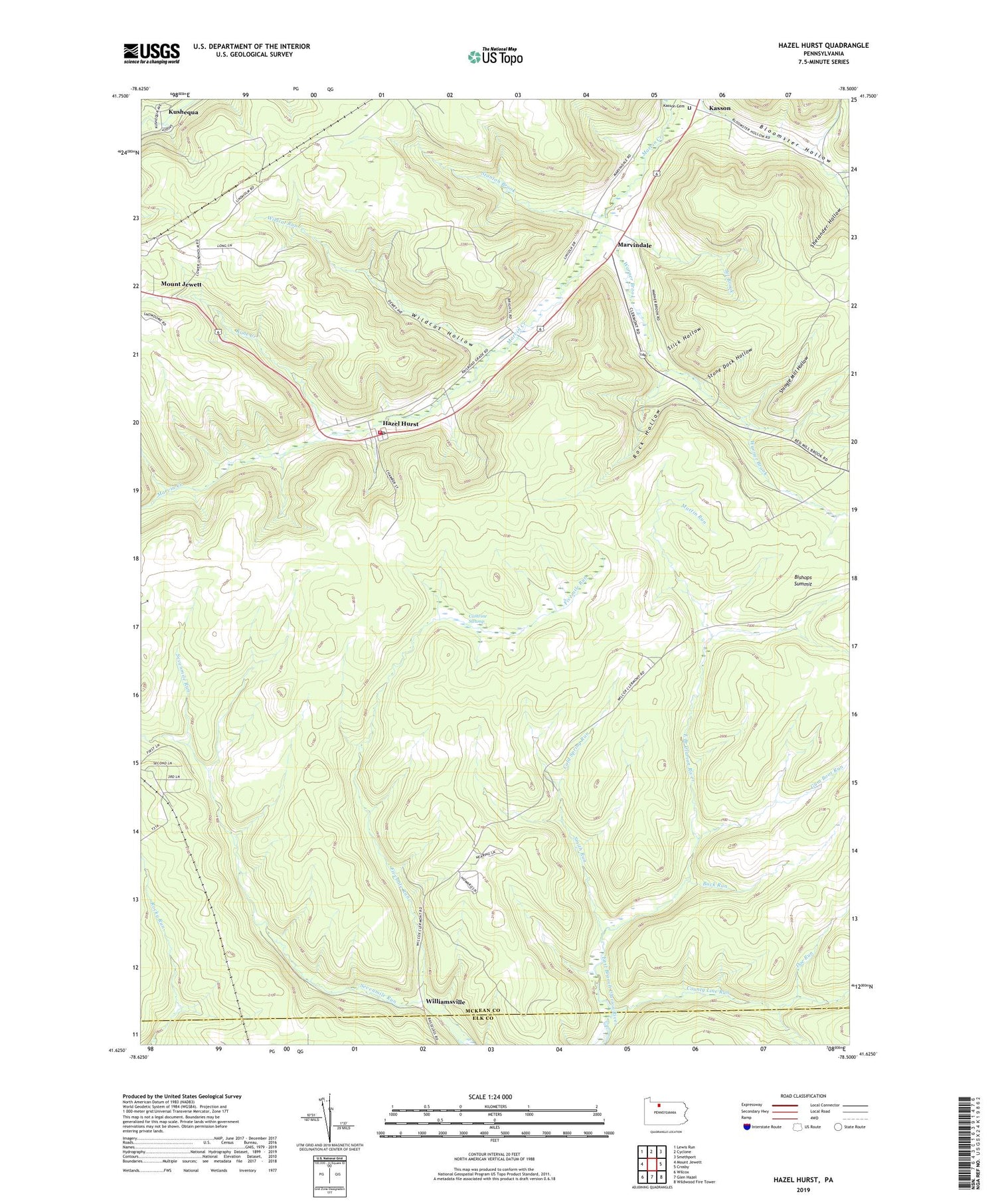
2019 topographic map quadrangle Hazel Hurst in the state of Pennsylvania. Scale: 1:24000. Based on the newly updated USGS 7.5' US Topo map series, this map is in the following counties: McKean, Elk. The map contains contour data, water features, and other items you are used to seeing on USGS maps, but also has updated roads and other features. This is the next generation of topographic maps. Printed on high-quality waterproof paper with UV fade-resistant inks.
Quads adjacent to this one:
West: Mount Jewett
Northwest: Lewis Run
North: Cyclone
Northeast: Smethport
East: Crosby
Southeast: Wildwood Fire Tower
South: Glen Hazel
Southwest: Wilcox
Contains the following named places: Bishops Summit, Bloomster Hollow, Boyer Station, Buck Run, Cathrine Swamp, Cold Spring Run, County Line Run, Doe Run, Ginalsburg, Gum Boot Run, Hamlin Township Volunteer Fire Department - Station 20, Hazel Hurst, Hazel Hurst Post Office, Jet Brook, Kane Creek, Kasson, Kasson Cemetery, Kushequa, Martin Run, Marvindale, Peep, Rock Hollow, Sevenmile Run, Shelander Hollow, Shingle Mill Hollow, Slick Hollow, Smith Run, Stanton Brook, State Game Lands Number 62, Stone Dock Hollow, Township of Sergeant, Warner Brook, Wildcat Hollow, Wildcat Run, Williamsville, ZIP Code: 16733


