MyTopo
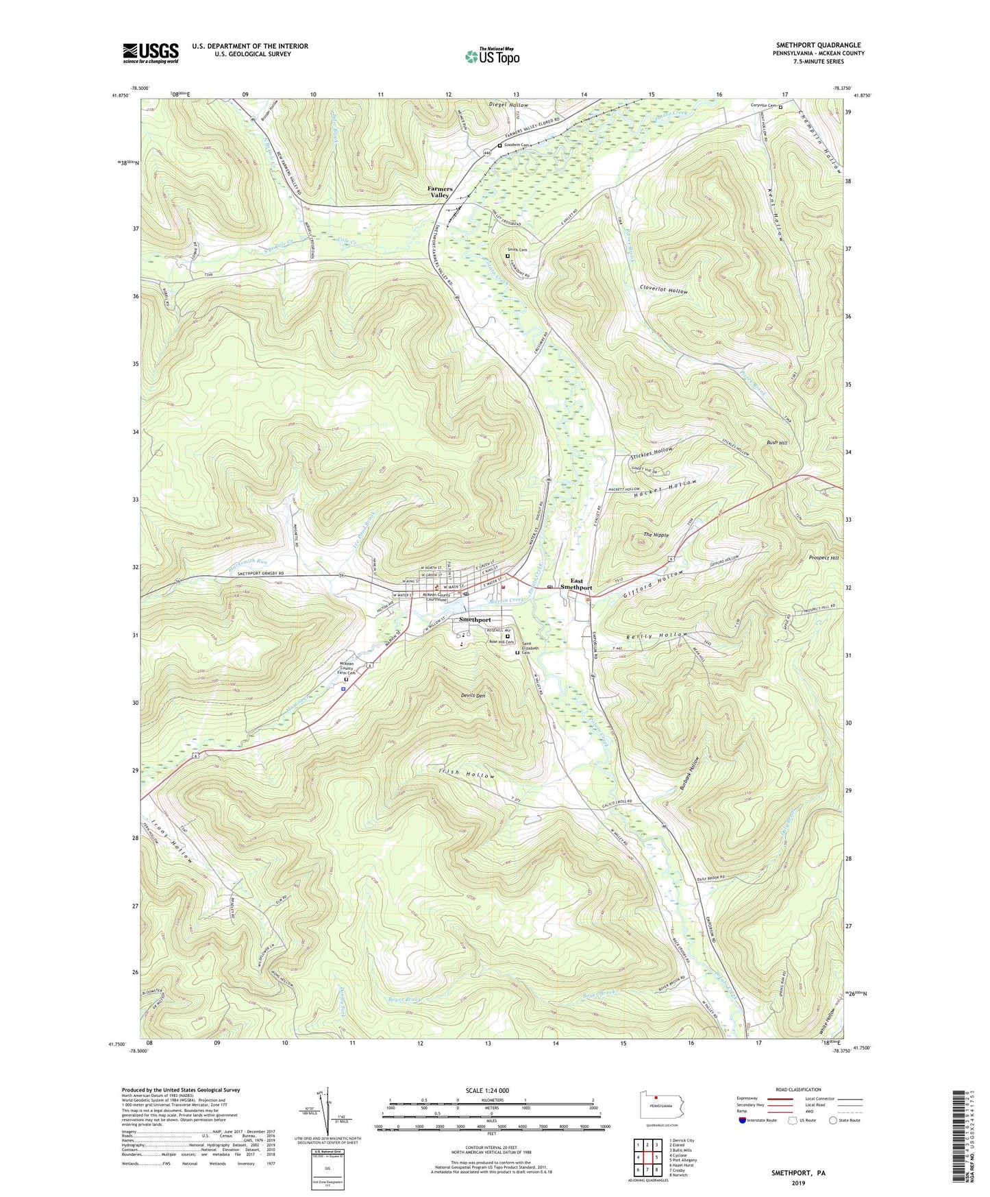
Smethport Pennsylvania US Topo Map
Couldn't load pickup availability
2023 topographic map quadrangle Smethport in the state of Pennsylvania. Scale: 1:24000. Based on the newly updated USGS 7.5' US Topo map series, this map is in the following counties: McKean. The map contains contour data, water features, and other items you are used to seeing on USGS maps, but also has updated roads and other features. This is the next generation of topographic maps. Printed on high-quality waterproof paper with UV fade-resistant inks.
Quads adjacent to this one:
West: Cyclone
Northwest: Derrick City
North: Eldred
Northeast: Bullis Mills
East: Port Allegany
Southeast: Norwich
South: Crosby
Southwest: Hazel Hurst
This map covers the same area as the classic USGS quad with code o41078g4.
Contains the following named places: Beechwood Camp, Blacksmith Run, Borough of Smethport, Boyer Brook, Brooder Hollow, Burbank Hollow, Bush Hill, Bush Hill School, Camp Comfort, Champlin Hollow, Cloverlot Hollow, Cole Creek, Coryville Cemetery, Daly Brook, Devils Den, Diegel Hollow, East Smethport, East Smethport Post Office, Farmers Valley, Gifford Hollow, Goodwin Cemetery, Hacket Hollow, Hamlin Lake, Hamlin Lake Park Dam, Ice Pond Brook, Irish Hollow, Irons Hollow, Kent Hollow, Marvin Creek, Marvin Creek Oil Field, McKean County Farm Cemetery, McKean County Sheriff's Office, North Branch Cole Creek, Olds Club, Pierce Brook, Pospect Hill Lookout Tower, Prospect Hill, Reilly Hollow, Rose Hill Cemetery, Saint Elizabeth Cemetery, Sartwell Oil Field, Smethport, Smethport Area Junior Senior High School, Smethport Elementary School, Smethport Fire Department - Station 2, Smethport Police Department, Smethport Post Office, Smith Cemetery, South Branch Cole Creek, State Game Lands Number 301, Stickles Hollow, The Nipple, Township of Keating, Tyler Brook, ZIP Codes: 16730, 16749