MyTopo
Cyclone Pennsylvania US Topo Map
Couldn't load pickup availability
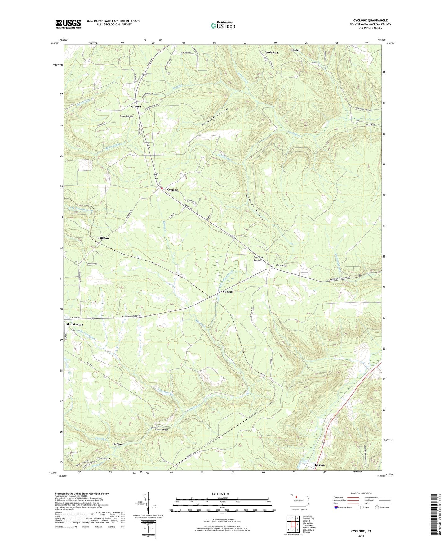
2023 topographic map quadrangle Cyclone in the state of Pennsylvania. Scale: 1:24000. Based on the newly updated USGS 7.5' US Topo map series, this map is in the following counties: McKean. The map contains contour data, water features, and other items you are used to seeing on USGS maps, but also has updated roads and other features. This is the next generation of topographic maps. Printed on high-quality waterproof paper with UV fade-resistant inks.
Quads adjacent to this one:
West: Lewis Run
Northwest: Bradford
North: Derrick City
Northeast: Eldred
East: Smethport
Southeast: Crosby
South: Hazel Hurst
Southwest: Mount Jewett
This map covers the same area as the classic USGS quad with code o41078g5.
Contains the following named places: Backus, Bingham, Bingham Pump Station, Bond Vein, Bradford Oil Field, Buttsville, Cyclone, Cyclone Post Office, Dana Heights, Davis Gifford Post Office, Gaffney, Gifford, Gifford Post Office, Hilltop Volunteer Fire Department - Station 7, Kinzua Bridge, Kinzua Bridge State Park, Kinzua Gorge, Little Black Brook, McKean, McKean County, McQuen Hollow, Newton, Ormsby, Ormsby Oil Field, Ormsbys Summit, Panther Run, Simpson, Threemile Run, Wildcat Hollow, Wolf Run, ZIP Codes: 16726, 16732, 16744