MyTopo
Holtwood Pennsylvania US Topo Map
Couldn't load pickup availability
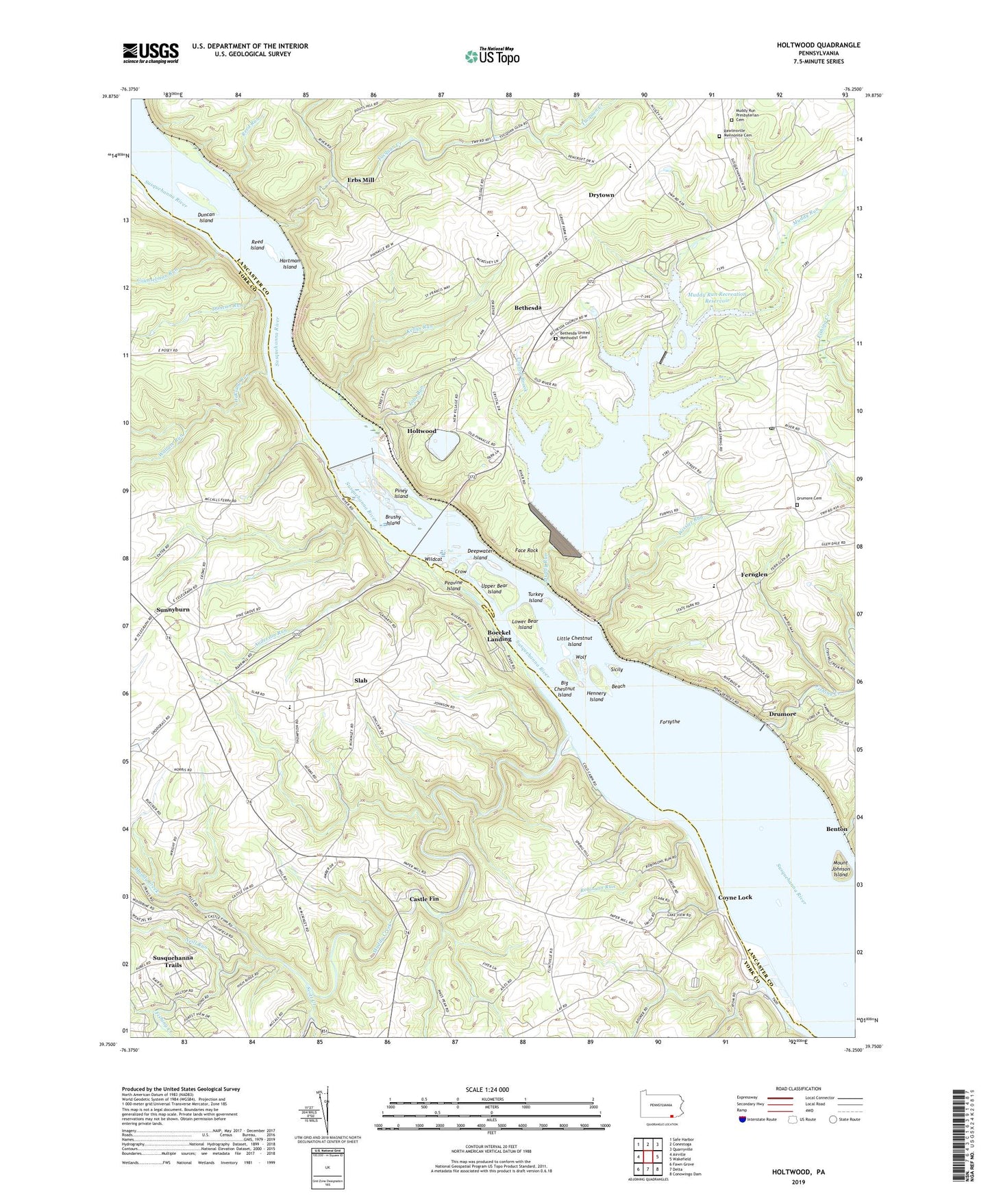
2019 topographic map quadrangle Holtwood in the state of Pennsylvania. Scale: 1:24000. Based on the newly updated USGS 7.5' US Topo map series, this map is in the following counties: Lancaster, York. The map contains contour data, water features, and other items you are used to seeing on USGS maps, but also has updated roads and other features. This is the next generation of topographic maps. Printed on high-quality waterproof paper with UV fade-resistant inks.
Quads adjacent to this one:
West: Airville
Northwest: Safe Harbor
North: Conestoga
Northeast: Quarryville
East: Wakefield
Southeast: Conowingo Dam
South: Delta
Southwest: Fawn Grove
Contains the following named places: Anderson Run, Beach, Benton, Bethesda, Bethesda Post Office, Bethesda United Methodist Cemetery, Big Chestnut Island, Boeckel Landing, Bon View, Brubaker Run, Brushy Island, Bryansville Station, Camp Andrews, Camp Minqua, Castle Fin, Castle Fin Station, Coal Cabin Beach, Counselman Run, Coyne Lock, Crow, Crystal Brook, Deepwater Island, Drumore, Drumore Cemetery, Drumore Post Office, Drytown, Duncan Island, Duncan Run, Erbs Mill, Face Rock, Face Rock Overlook, Fernglen, Fishing Creek, Forsythe, Hartman Island, Hennery Island, Holtwood, Holtwood Dam, House Rock Run, Joy L Dairy Farms, Kellys Run, Kildary Acres, Lake Aldred, Liberty Square, Liberty Square Post Office, Little Chestnut Island, Lower Bear Island, Midway Station, Mount Johnson Island, Muddy Creek, Muddy Creek Forks, Muddy Run, Muddy Run Presbyterian Cemetery, Muddy Run Recreation Dam, Muddy Run Recreation Reservoir, Neill Run, Oakland Run, Peach Bottom Power Plant, Peavine Island, Piney Island, Pinnacle Overlook, Rawlinsville Church, Rawlinsville Mennonite Cemetery, Reed Island, Reed Run, Robinson Run, Rock Run Dam, Ruff Field, Salem Church, Scott Creek, Sicily, Slab, State Game Lands Number 181, Sunnyburn, Susquehanna Trails, Susquehanna Trails Census Designated Place, Susquehannock Overlook, Susquehannock State Park, Tobe Run, Township of Martic, Tucquan Creek, Turkey Island, Union Chapel, Upper Bear Island, Wallace Run, Wildcat, Wissler Run, Wolf, ZIP Codes: 17314, 17518, 17532