MyTopo
Hopewell Pennsylvania US Topo Map
Couldn't load pickup availability
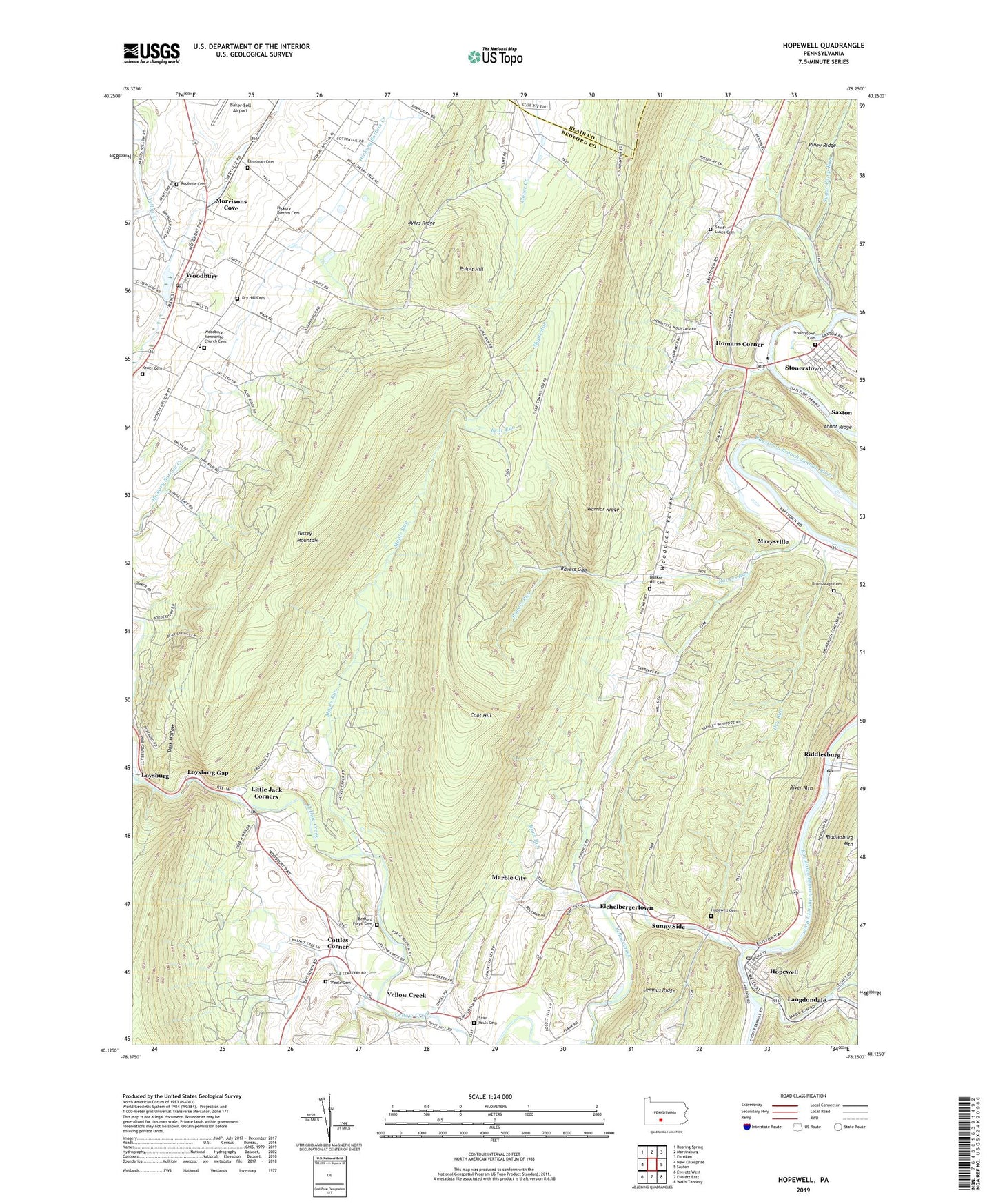
2019 topographic map quadrangle Hopewell in the state of Pennsylvania. Scale: 1:24000. Based on the newly updated USGS 7.5' US Topo map series, this map is in the following counties: Bedford, Blair. The map contains contour data, water features, and other items you are used to seeing on USGS maps, but also has updated roads and other features. This is the next generation of topographic maps. Printed on high-quality waterproof paper with UV fade-resistant inks.
Quads adjacent to this one:
West: New Enterprise
Northwest: Roaring Spring
North: Martinsburg
Northeast: Entriken
East: Saxton
Southeast: Wells Tannery
South: Everett East
Southwest: Everett West
Contains the following named places: Abbot Ridge, Bank Run, Bear Run, Beaver Creek, Bedford Church, Bedford Forge Cemetery, Borough of Hopewell, Borough of Woodbury, Brumbaugh Cemetery, Bunker Hill Cemetery, Byers Ridge, Coot Hill, Cottles Corner, Dark Hollow, Dry Hill Cemetery, Dry Run, Eichelbergertown, Eshelman Cemetery, Grace Church, Hickory Bottom Cemetery, Homans Corner, Hopewell, Hopewell Cemetery, Hopewell Post Office, Keagy Cemetery, Langdondale, Little Jack Corners, Longs Run, Loysburg Gap, Maple Run, Marble City, Marysville, Morrisons Cove, Piney Ridge, Pulpit Hill, Raven Church, Ravers Gap, Ravers Run, Raystown Church, Replogle Cemetery, Riddleburg Post Office, Riddlesburg, Riddlesburg Mountain, River Mountain, Saint Lukes Cemetery, Saint Pauls Cemetery, Saint Pauls Church, Sandy Run, Sixmile Run, Smith School, Steele Cemetery, Stonerstown, Stonerstown Cemetery, Stonerstown Census Designated Place, Sugar Camp Run, Sunny Side, Township of Liberty, Township of Woodbury, Tussey Mountain, Warriors Path State Park, Woodbury, Woodbury Mennonite Church Cemetery, Woodbury Post Office, Yellow Creek, Yellow Creek Post Office, ZIP Code: 16695