MyTopo
Entriken Pennsylvania US Topo Map
Couldn't load pickup availability
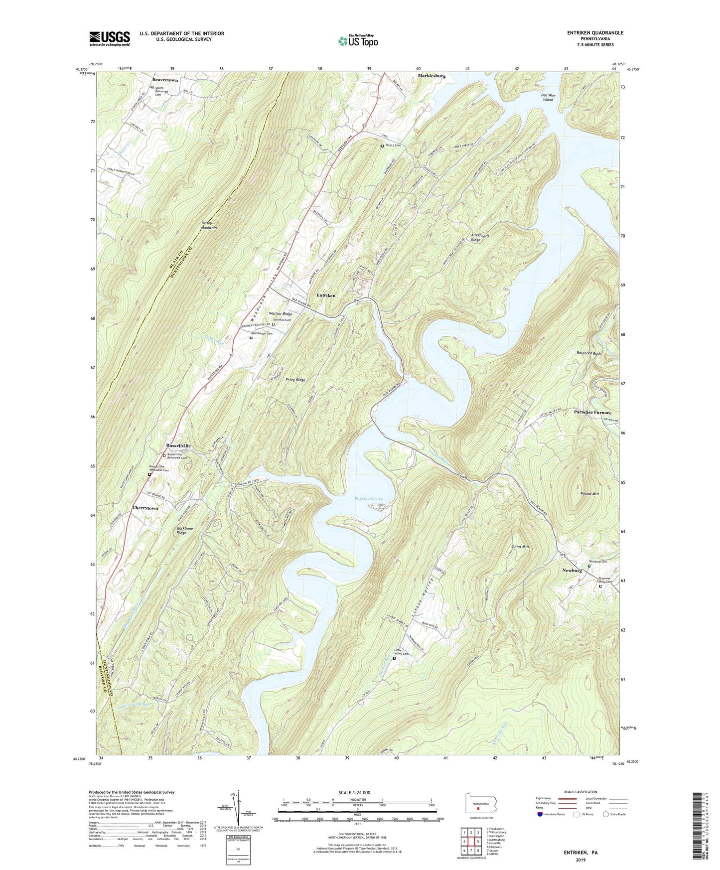
2023 topographic map quadrangle Entriken in the state of Pennsylvania. Scale: 1:24000. Based on the newly updated USGS 7.5' US Topo map series, this map is in the following counties: Huntingdon, Blair, Bedford. The map contains contour data, water features, and other items you are used to seeing on USGS maps, but also has updated roads and other features. This is the next generation of topographic maps. Printed on high-quality waterproof paper with UV fade-resistant inks.
Quads adjacent to this one:
West: Martinsburg
Northwest: Frankstown
North: Williamsburg
Northeast: Huntingdon
East: Cassville
Southeast: Saltillo
South: Saxton
Southwest: Hopewell
This map covers the same area as the classic USGS quad with code o40078c2.
Contains the following named places: Aitch, Allegrippis Ridge, Backbone Ridge, Balanced Rock, Beavertown, Beavertown Census Designated Place, Brumbaugh Cemetery, Bunns Mountain, Camp Reynolds, Cherrytown, Church Camp, Coffee Run, Coffee Run Overlook, Cove, Drab, Entriken, Entriken Bridge Overlook, Entriken Cemetery, Entriken Church, Fouses Airport, Foxton, Great Trough Creek, James Creek, James Creek Access Area, Lake Raytown Resort Rothrock Marina, Lick Run, Lincoln Grange Hall, Little Valley, Little Valley Cemetery, Nancys Campground, Newburg, Newburg Cemetery, Paradise Furnace, Pee Wee Island, Peninsula Campground, Piney Ridge, Plummer Family Cemetery, Putts Campground, Rothrock Campground, Round Mountain, Russellville, Russellville Church, Russellville Methodist Cemetery, Russellville Reformed Cemetery, Salem Reformed Cemetery, Salems Church, Salter, Shultz Cemetery, Shy Beaver Access Area, Shy Beaver Creek, Tarman Run Access Area, Tatman Run, Tatman Run Access Area, Township of Hopewell, Township of Lincoln, Trough Creek, Trough Creek State Park, Trough Creek Wild Area, YMCA Camp, ZIP Codes: 16638, 16657