MyTopo
Iron Springs Pennsylvania US Topo Map
Couldn't load pickup availability
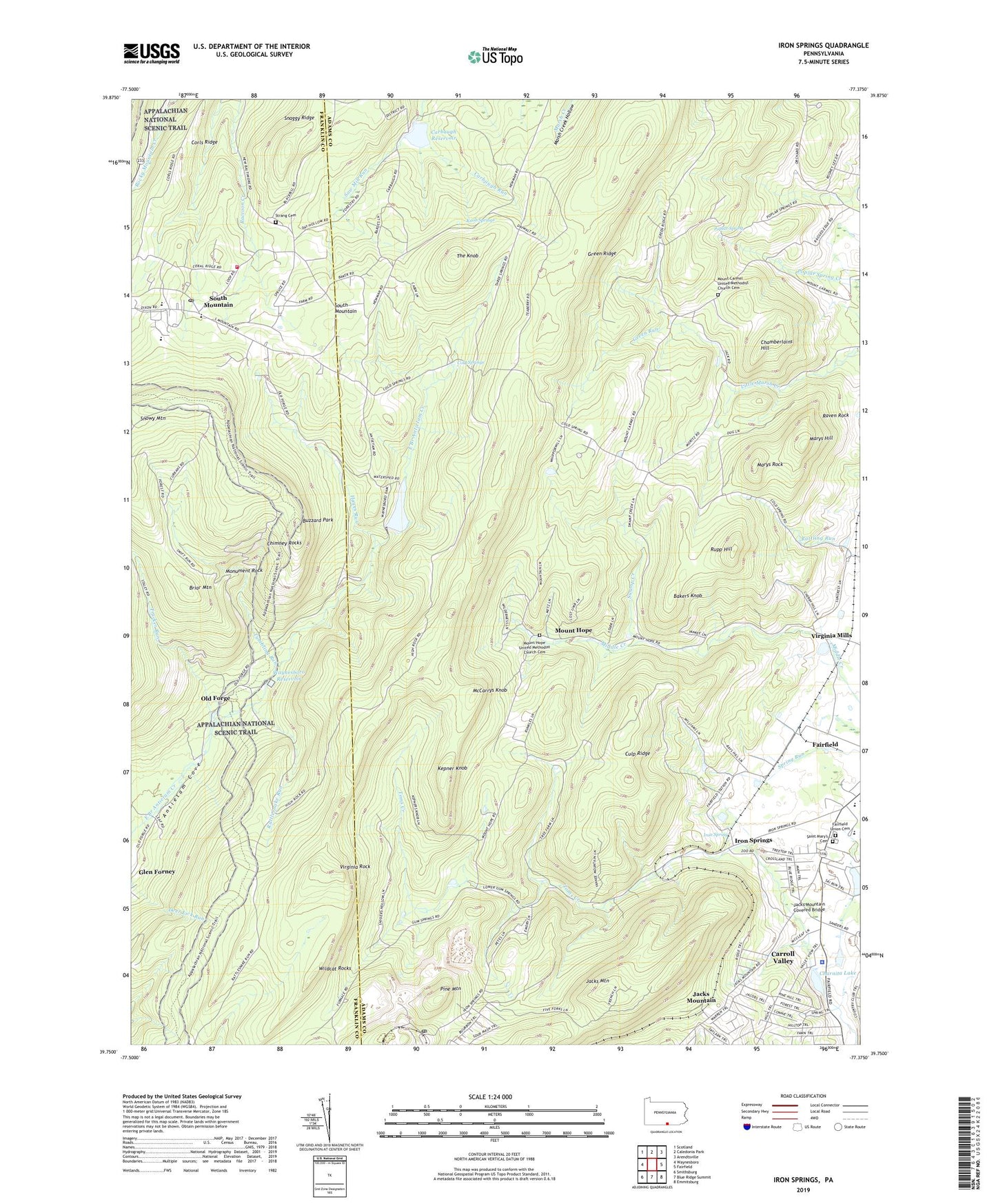
2019 topographic map quadrangle Iron Springs in the state of Pennsylvania. Scale: 1:24000. Based on the newly updated USGS 7.5' US Topo map series, this map is in the following counties: Adams, Franklin. The map contains contour data, water features, and other items you are used to seeing on USGS maps, but also has updated roads and other features. This is the next generation of topographic maps. Printed on high-quality waterproof paper with UV fade-resistant inks.
Quads adjacent to this one:
West: Waynesboro
Northwest: Scotland
North: Caledonia Park
Northeast: Arendtsville
East: Fairfield
Southeast: Emmitsburg
South: Blue Ridge Summit
Southwest: Smithsburg
Contains the following named places: Antietam Dam, Bakers Knob, Briar Mountain, Buzzard Park, Camp Penn, Carbaugh Reservoir, Carbaugh Run Dam, Carroll Valley Police Department, Carroll Valley Resort Golf Course, Chamberlains Hill, Charnita Lake, Chimney Rocks, Cold Springs, Cold Springs School, Copper Run, Corls Ridge, Culp Ridge, Devils Racecourse, Fairfield School, Fairfield Station, Fairfield Union Cemetery, Gladhill, Green Ridge, Green Ridge Trail, Green Ridge Vista, Green Run, Greenstone Post Office, Hayes Run, Iron Spring, Iron Springs, Jacks Mountain, Jacks Mountain Covered Bridge, Kepner Knob, Knob Springs, Maria Furnace, Marshall, Marys Hill, Marys Rock, McCarrys Knob, Monument Rock, Mount Carmel Church, Mount Carmel United Methodist Church Cemetery, Mount Hope, Mount Hope United Methodist Church Cemetery, Mount Pleasant School, New Baltimore School, Old Forge, Old Forge Picnic Area, Pine Mountain, Poplar Spring, Ram, Rattlesnake Run, Raven Rock, Roth Private Airstrip, Rupp Hill, Saint Mary's and Saint Rita's Catholic Cemetery, Saw Mill Run, Snowy Mountain, Snowy Mountain Fire Tower, South Mountain, South Mountain Post Office, South Mountain Restoration Center, South Mountain Volunteer Fire Department - Company 16, Strang Cemetery, Swamp Creek, Tartown, The Knob, Township of Hamiltonban, Trucker Run, Tumbling Run, Virginia Mills, Virginia Rock, Waynesboro Dam, Waynesboro Reservoir, Wildcat Rocks, ZIP Code: 17320