MyTopo
Knoxville Pennsylvania US Topo Map
Couldn't load pickup availability
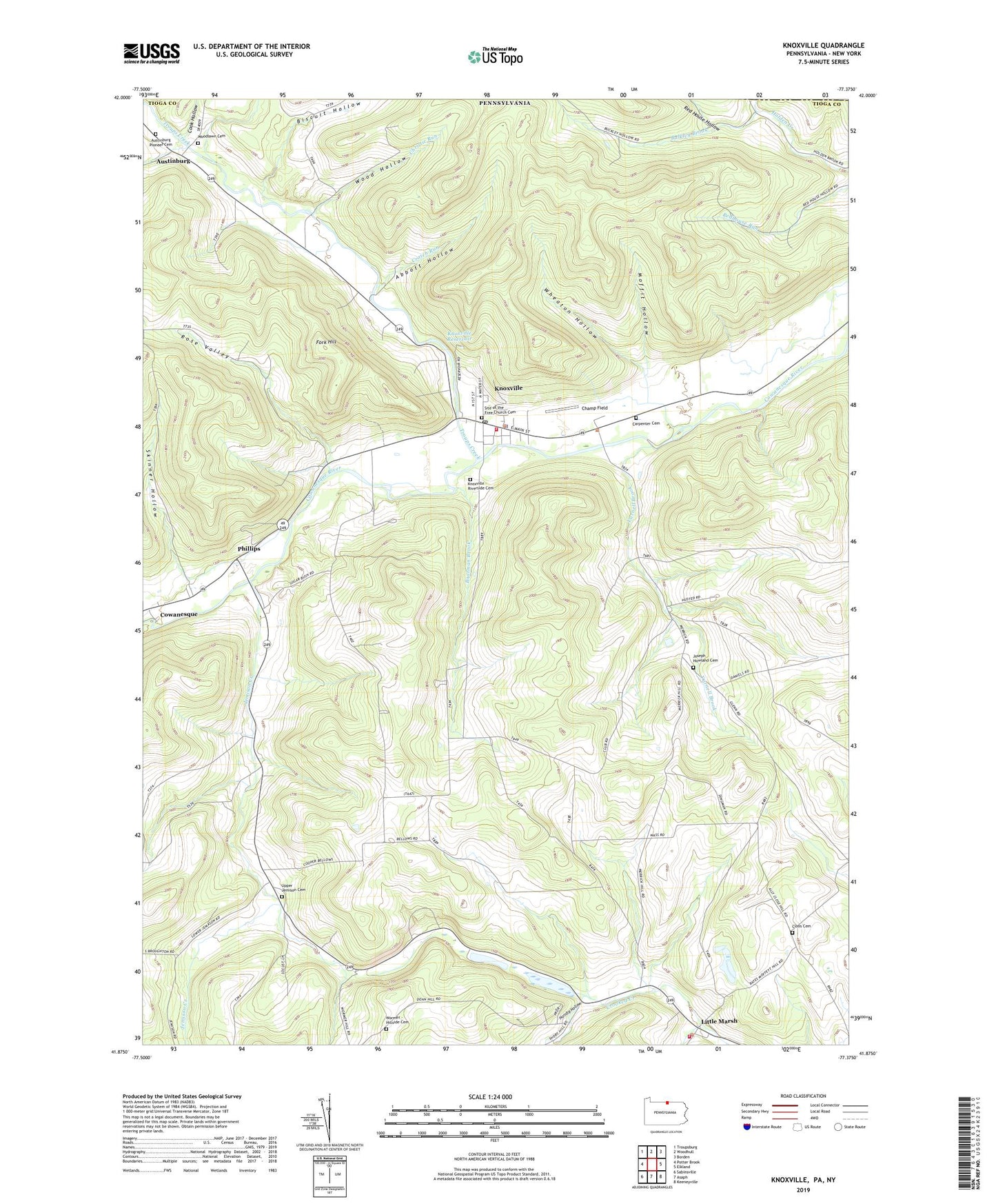
2019 topographic map quadrangle Knoxville in the states of Pennsylvania, New York. Scale: 1:24000. Based on the newly updated USGS 7.5' US Topo map series, this map is in the following counties: Tioga, Steuben. The map contains contour data, water features, and other items you are used to seeing on USGS maps, but also has updated roads and other features. This is the next generation of topographic maps. Printed on high-quality waterproof paper with UV fade-resistant inks.
Quads adjacent to this one:
West: Potter Brook
Northwest: Troupsburg
North: Woodhull
Northeast: Borden
East: Elkland
Southeast: Keeneyville
South: Asaph
Southwest: Sabinsville
Contains the following named places: Abbott Hollow, Academy Corners, Austinburg, Austinburg Pioneer Cemetery, Biscuit Hollow, Blair Creek, Boatman Brook, Borough of Knoxville, Bulkley Brook, Carpenter Cemetery, Carpenter Run, Champ Field, Chatham Volunteer Fire Company, Christie Run, Cloos Cemetery, Cook Hollow, Cowanesque, Crotch Run, Fork Hill, Free Church Cemetery, Hillside Cemetery, Hornby Hollow, Jemison Creek, Jemison Valley Church, Joseph Howland Cemetery, Knoxville, Knoxville - Deerfield Volunteer Fire Company, Knoxville Borough Police Department, Knoxville Post Office, Knoxville Reservoir, Little Marsh, Moffit Hollow, Phillips, Red House Hollow, Riverside Cemetery, Rose Valley, Skinner Hollow, South Brook Troups Creek, Township of Deerfield, Troups Creek, Upper Jemison Cemetery, Wheaton Hollow, Wood Hollow, Woodlawn Cemetery, Yarnell Brook, ZIP Code: 16928