MyTopo
Meyersdale Pennsylvania US Topo Map
Couldn't load pickup availability
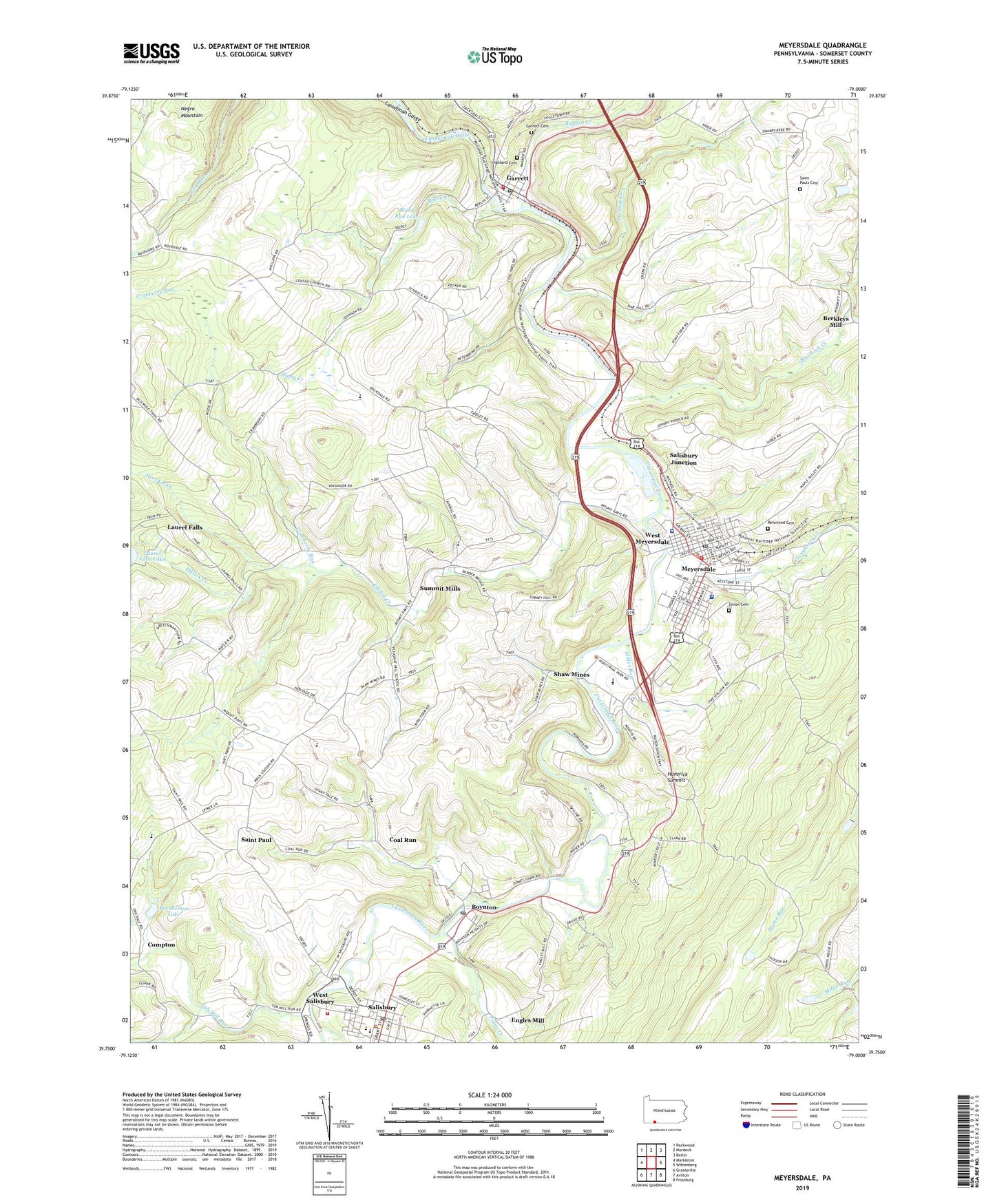
2019 topographic map quadrangle Meyersdale in the state of Pennsylvania. Scale: 1:24000. Based on the newly updated USGS 7.5' US Topo map series, this map is in the following counties: Somerset. The map contains contour data, water features, and other items you are used to seeing on USGS maps, but also has updated roads and other features. This is the next generation of topographic maps. Printed on high-quality waterproof paper with UV fade-resistant inks.
Quads adjacent to this one:
West: Markleton
Northwest: Rockwood
North: Murdock
Northeast: Berlin
East: Wittenberg
Southeast: Frostburg
South: Avilton
Southwest: Grantsville
Contains the following named places: Bigby Creek, Bigby Run Dam, Bigby Run Lake, Blue Lick Creek, Borough of Garrett, Borough of Meyersdale, Borough of Salisbury, Boynton, Boynton Post Office, Brenneman Lake, Buffalo Creek, Casselman Gorge, Center Church, Coal Run, Cold Spring School, Compton, Cranberry Run, Crossroad School, Crossroads Church, De Hay School, Elklick Creek, Engles Mill, Flaugherty Creek, Friendship Farm, Fritz Lutheran Cemetery, Gangney School, Garrett, Garrett Cemetery, Garrett Post Office, Garrett Volunteer Fire Department - Station 620, Handwork School, Highland Cemetery, Hocking, Hunsrick Summit, Laurel Falls, Laurel Falls Lake, Lichty School, Lick Run School, Meadow Run, Meyersdale, Meyersdale Airport, Meyersdale Area Ambulance Association - Station 240, Meyersdale Borough Police Department, Meyersdale Community Hospital, Meyersdale High School, Meyersdale Post Office, Meyersdale Volunteer Fire Department - Station 617, Miller Run, Miller School, Mountain View Church, Piney Creek, Piney Run, Pleasant Hill School, Reformed Cemetery, Romania, Saint Michaels Church, Saint Paul, Saint Pauls Church, Salisbury, Salisbury Junction, Salisbury Post Office, Salisbury Volunteer Fire Department - Station 618, Sandy Hollow School, Shaw Mines, South Side School, Spook Run, State Game Lands Number 231, Summit Mills, Summit Post Office, Swamp Creek, Township of Summit, Tub Mill Run, Union Cemetery, Walker School, West Meyersdale, West Salisbury, White Oak Church, ZIP Code: 15532