MyTopo
Murdock Pennsylvania US Topo Map
Couldn't load pickup availability
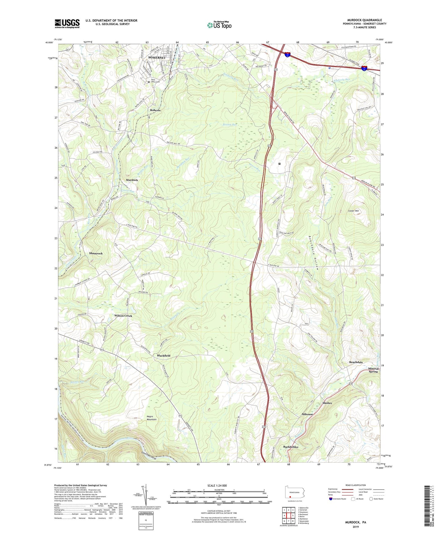
2023 topographic map quadrangle Murdock in the state of Pennsylvania. Scale: 1:24000. Based on the newly updated USGS 7.5' US Topo map series, this map is in the following counties: Somerset. The map contains contour data, water features, and other items you are used to seeing on USGS maps, but also has updated roads and other features. This is the next generation of topographic maps. Printed on high-quality waterproof paper with UV fade-resistant inks.
Quads adjacent to this one:
West: Rockwood
Northwest: Bakersville
North: Somerset
Northeast: Stoystown
East: Berlin
Southeast: Wittenberg
South: Meyersdale
Southwest: Markleton
This map covers the same area as the classic USGS quad with code o39079h1.
Contains the following named places: Allegheny Mines, Althouse, Ankeny School, Base Rock Quarry, Beachdale, Beachdale Hollow, Beachley Mine, Best Lookout, Blackfield, Bromm Run, Bromm School, Buffalo Station, Burkhelder, Coleman School, Cover Hill, Dempsey Run, Dovan Farms, East Branch Coxes Creek, Edgewood Grove Station, Fairview, Flickinger School, Garrett Slope Station, Kimberly Run, Laurel Run, Lick Run, Long School, McGregor Mines, Milford, Milford Station, Millers Run, Mount Calvary Church, Murdock, Parson Run, Pennsylvania State Police Troop T Somerset Station, Pines Church, Piney Run Golf Course, Plank Road School, Rice Run, Roberts, Saint Johns Centennial United Brethren Cemetery, Saint Johns Church, Saint Marks Church, Saint Pauls Church, Salem Church, Shafer Run, Shamrock, Shober, Somerset County, State Correctional Institution Somerset, State Game Lands Number 50, Summit School, Tubs Run, Vogel Mine, WADJ-AM (Somerset), West Branch Coxes Creek, Wills Church, Wilson Creek, Wilson Creek Mines, ZIP Codes: 15510, 15542