MyTopo
Mount Jewett Pennsylvania US Topo Map
Couldn't load pickup availability
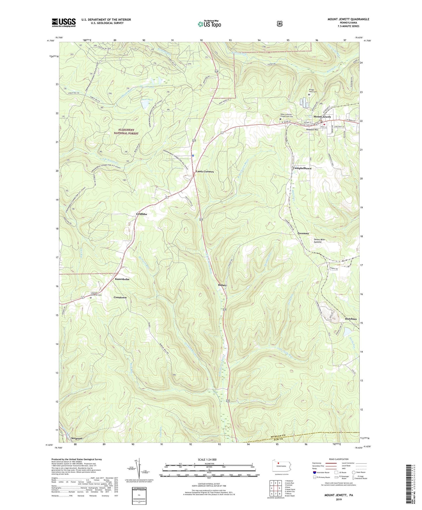
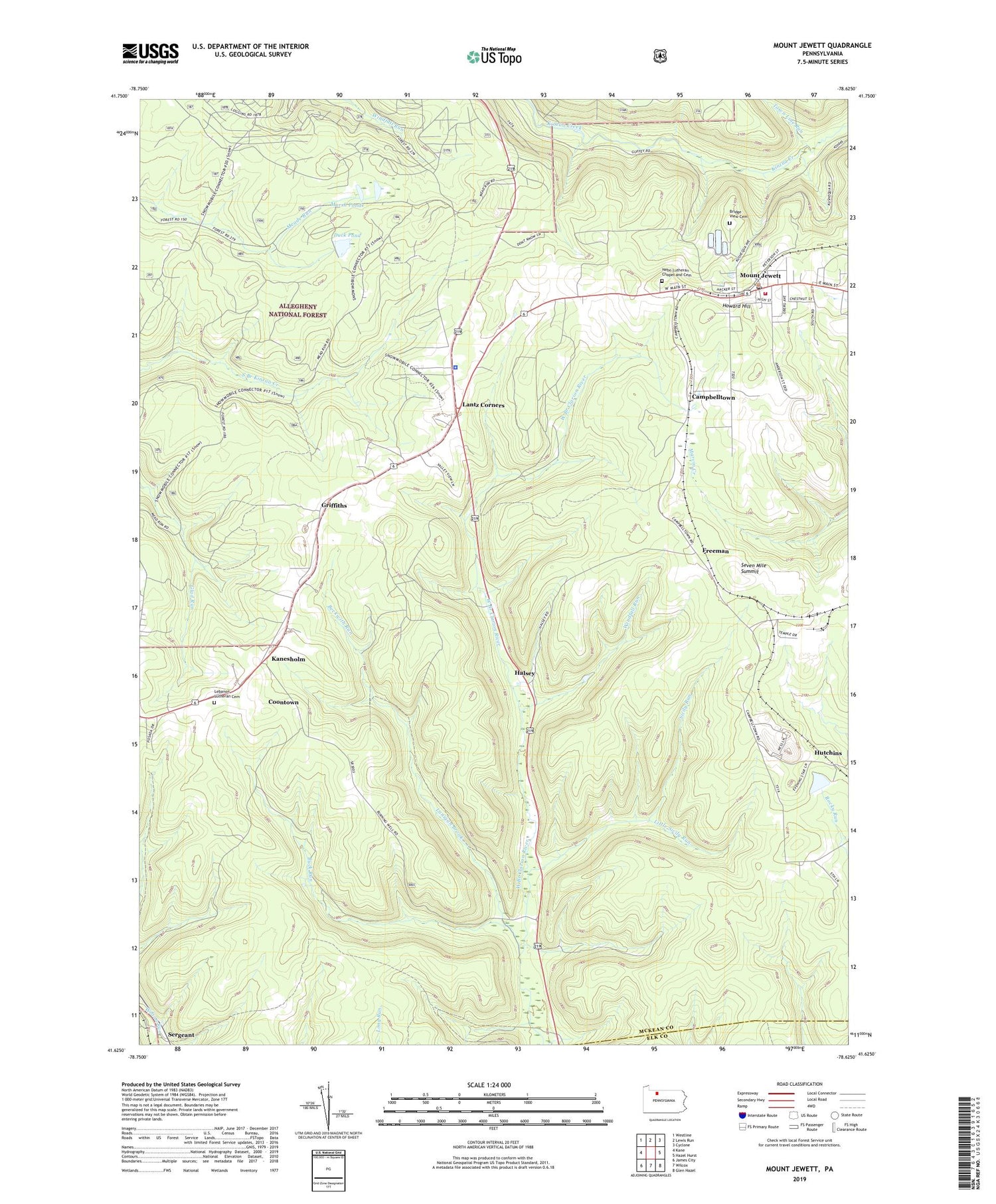
2019 topographic map quadrangle Mount Jewett in the state of Pennsylvania. Scale: 1:24000. Based on the newly updated USGS 7.5' US Topo map series, this map is in the following counties: McKean, Elk. The map contains contour data, water features, and other items you are used to seeing on USGS maps, but also has updated roads and other features. This is the next generation of topographic maps. Printed on high-quality waterproof paper with UV fade-resistant inks.
Quads adjacent to this one:
West: Kane
Northwest: Westline
North: Lewis Run
Northeast: Cyclone
East: Hazel Hurst
Southeast: Glen Hazel
South: Wilcox
Southwest: James City
Contains the following named places: Beckwith Run, Borough of Mount Jewett, Bridge View Cemetery, Buck Run, Burning Well, Burning Well Oil Field, Campbelltown, Cartwrights Crossing, Coontown, Duck Pond, Freeman, Griffiths, Guffey Oil Field, Halsey, Halsey Gas Field, Howard Hill, Hutchins, Kanesholm, Lafayette, Lafayette Station, Lanigan Brook, Lantz Corners, Lebanon Church, Lebanon Lutheran Cemetery, Little Sicily Run, Marsh Ponds, McKean Landfill, Mount Jewett, Mount Jewett Area Ambulance Association, Mount Jewett Elementary School, Mount Jewett Post Office, Mount Jewett Volunteer Fire Department - Station 10, Nebo Church, Nebo Lutheran Chapel and Cemetery, Pennsylvania State Police Troop C Kane Station, Saint Josephs Church, Seven Mile Summit, Sicily Run, Stenstrom School, Toby Springs School, Township of Hamlin, Windfall Run, ZIP Code: 16740