MyTopo
Needmore Pennsylvania US Topo Map
Couldn't load pickup availability
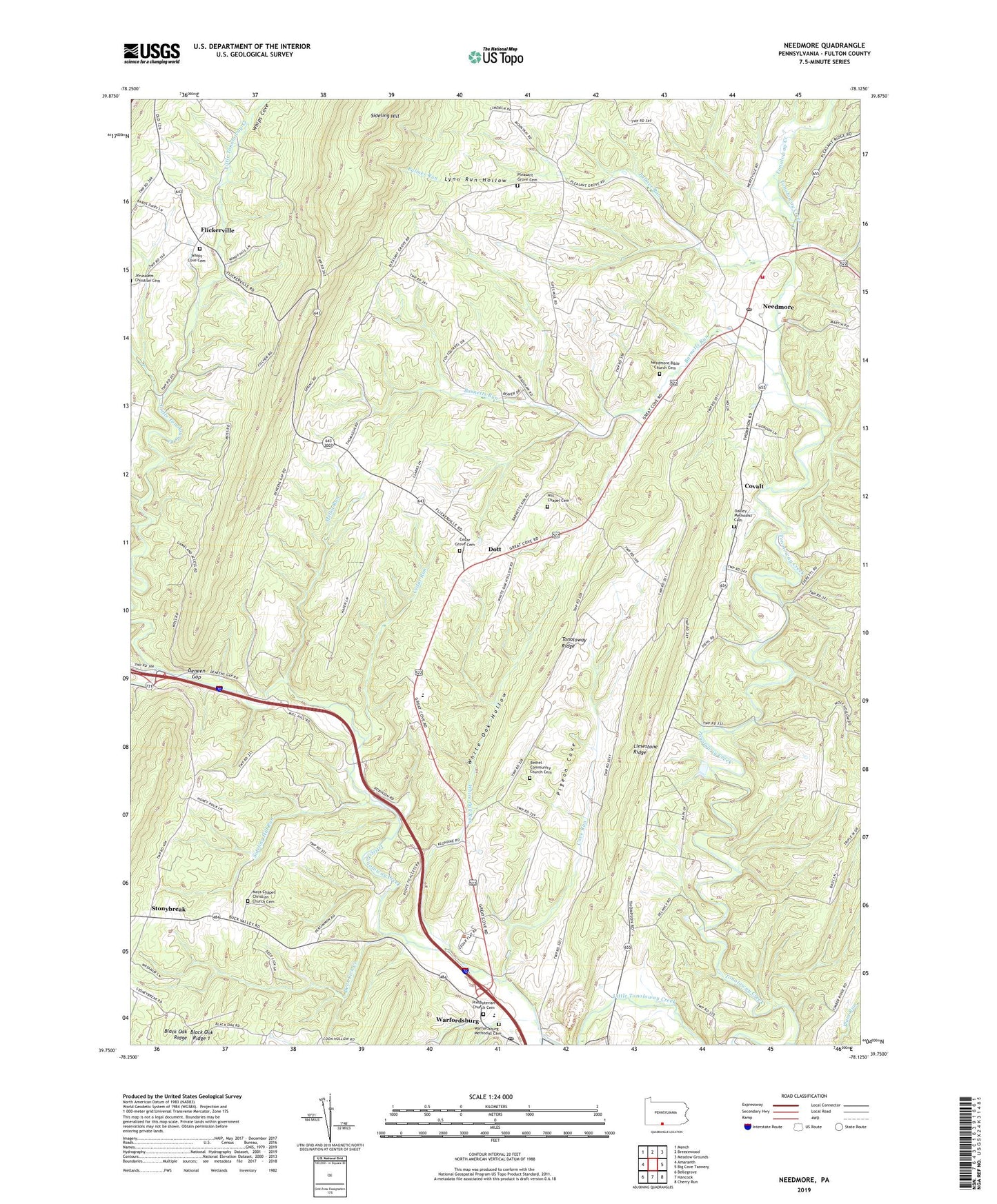
2019 topographic map quadrangle Needmore in the state of Pennsylvania. Scale: 1:24000. Based on the newly updated USGS 7.5' US Topo map series, this map is in the following counties: Fulton. The map contains contour data, water features, and other items you are used to seeing on USGS maps, but also has updated roads and other features. This is the next generation of topographic maps. Printed on high-quality waterproof paper with UV fade-resistant inks.
Quads adjacent to this one:
West: Amaranth
Northwest: Mench
North: Breezewood
Northeast: Meadow Grounds
East: Big Cove Tannery
Southeast: Cherry Run
Southwest: Bellegrove
Contains the following named places: Barnetts Run, Bedford Chapel, Bethel Church, Bethel Community Church Cemetery, Black Oak Ridge, Black Oak Ridge 1, Cedar Grove Cemetery, Cedar Grove Church, Cedar Run, Covalt, Cove Run, Deer Lick Creek, Deneen Gap, Dott, Flickerville, Hill Chapel Cemetery, Indian Grave Run, Jerusalem Church, Limestone Ridge, Lynn Run Hollow, Mays Chapel, Mays Chapel Christian Church Cemetery, McKees Run, Mellot Run, Needmore, Needmore Bible Church Cemetery, Needmore Census Designated Place, Needmore Post Office, Needmore Volunteer Fire Company - Station 55, Oakley Church, Oakley Methodist Cemetery, Palmer Run, Pigeon Cove, Pleasant Grove Cemetery, Presbyterian Church Cemetery, Sideling Hill Run, State Game Lands Number 128, State Game Lands Number 65, Stonybreak, Township of Bethel, Warfordsburg, Warfordsburg Methodist Cemetery, Warfordsburg Post Office, Warfordsburg Quarry, Whips Cove, Whips Cove Cemetery, White Oak Hollow, White Oak Run, ZIP Codes: 17238, 17267