MyTopo
Big Cove Tannery Pennsylvania US Topo Map
Couldn't load pickup availability
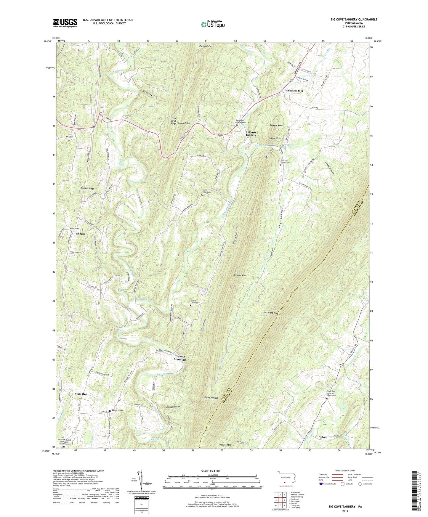
2023 topographic map quadrangle Big Cove Tannery in the state of Pennsylvania. Scale: 1:24000. Based on the newly updated USGS 7.5' US Topo map series, this map is in the following counties: Fulton, Franklin. The map contains contour data, water features, and other items you are used to seeing on USGS maps, but also has updated roads and other features. This is the next generation of topographic maps. Printed on high-quality waterproof paper with UV fade-resistant inks.
Quads adjacent to this one:
West: Needmore
Northwest: Breezewood
North: Meadow Grounds
Northeast: McConnellsburg
East: Mercersburg
Southeast: Clear Spring
South: Cherry Run
This map covers the same area as the classic USGS quad with code o39078g1.
Contains the following named places: Anthony Ford, Antioch Cemetery, Antioch Church, Bald Eagle School, Big Cove Creek, Big Cove Tannery, Big Hollow, Big Spring, Boardyard School, Brethren Church Cemetery, Cave Run, Center School, Chestnut Flat, Connor School, Damascus Cemetery, Damascus Church, Dickeys Mountain, Esther Run, Indian Chair, Keefer Mountain, Laurel Ridge Cemetery, Laurel Ridge Church, Lockings Hollow, Lowery Knob, Mount Zion Church, Mount Zion Lutheran Church Cemetery, Plum Run, Redbud Valley Nature Center, Rehobeth Church, Rehobeth United Methodist Church Cemetery, Roaring Run, Saint Pauls Church, Saint Pauls Lutheran Cemetery, Sharpe, Simpson Farm Cemetery, Sowers Hollow, Spring Run, State Game Lands Number 124, Sylvan, The Corner, The Lockings, Timber Ridge, Township of Thompson, Township of Warren, Websters Mill, ZIP Code: 17212