MyTopo
New Bethlehem Pennsylvania US Topo Map
Couldn't load pickup availability
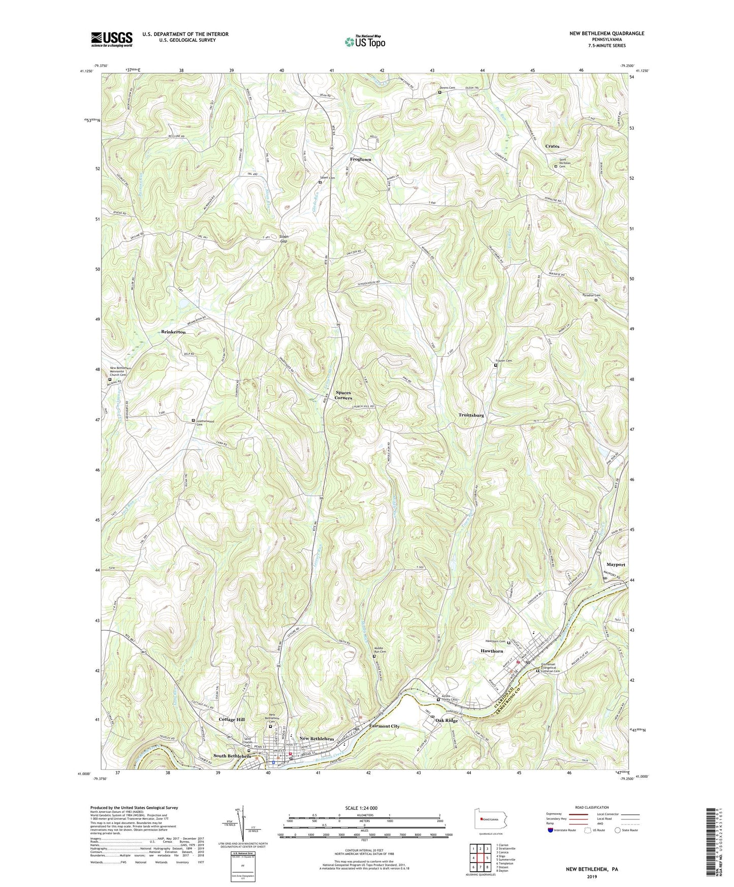
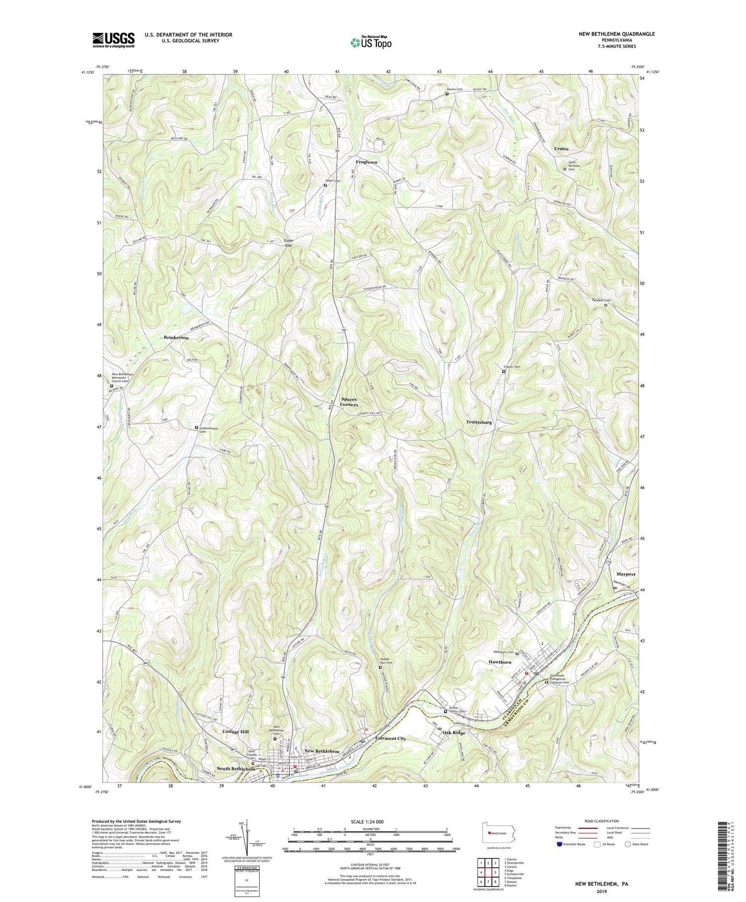
2019 topographic map quadrangle New Bethlehem in the state of Pennsylvania. Scale: 1:24000. Based on the newly updated USGS 7.5' US Topo map series, this map is in the following counties: Clarion, Armstrong. The map contains contour data, water features, and other items you are used to seeing on USGS maps, but also has updated roads and other features. This is the next generation of topographic maps. Printed on high-quality waterproof paper with UV fade-resistant inks.
Quads adjacent to this one:
West: Sligo
Northwest: Clarion
North: Strattanville
Northeast: Corsica
East: Summerville
Southeast: Dayton
South: Distant
Southwest: Templeton
Contains the following named places: Alcola, Alcola Trinity Cemetery, Borough of Hawthorn, Borough of New Bethlehem, Brinkerton, Brinkerton Post Office, Citizens Water Company Dam, Cottage Hill, Crates, Downs Cemetery, Emmanuel Evangelical Lutheran Cemetery, Fairmont City, Fairmount City Post Office, Frazier Cemetery, Frazier School, Frogtown, Hawthorn, Hawthorn Area Volunteer Fire Department Station 560, Hawthorn Cemetery, Hawthorn Post Office, Jack School, Leatherwood Cemetery, Leatherwood Church, Leisure Run, Long Run, Mayport, Mayport Airport, Mayport Post Office, Middle Run, Middle Run Cemetery, Millville, Nevin Church, New Bethlehem, New Bethlehem Cemetery, New Bethlehem Fire Company Station 600, New Bethlehem Mennonite Church Cemetery, New Bethlehem Police Department, New Bethlehem Post Office, New Mayville Post Office, Oak Hill School, Oak Ridge, Oak Ridge Post Office, Paradise Cemetery, Parsons Run, Pine Creek, Saint Charles Cemetery, Saint Nicholas Cemetery, Salem Cemetery, Sloan Gap, Spaces Corners, Town Run, Township of Redbank, Truittsburg, ZIP Codes: 16224, 16230, 16242, 16245