MyTopo
Templeton Pennsylvania US Topo Map
Couldn't load pickup availability
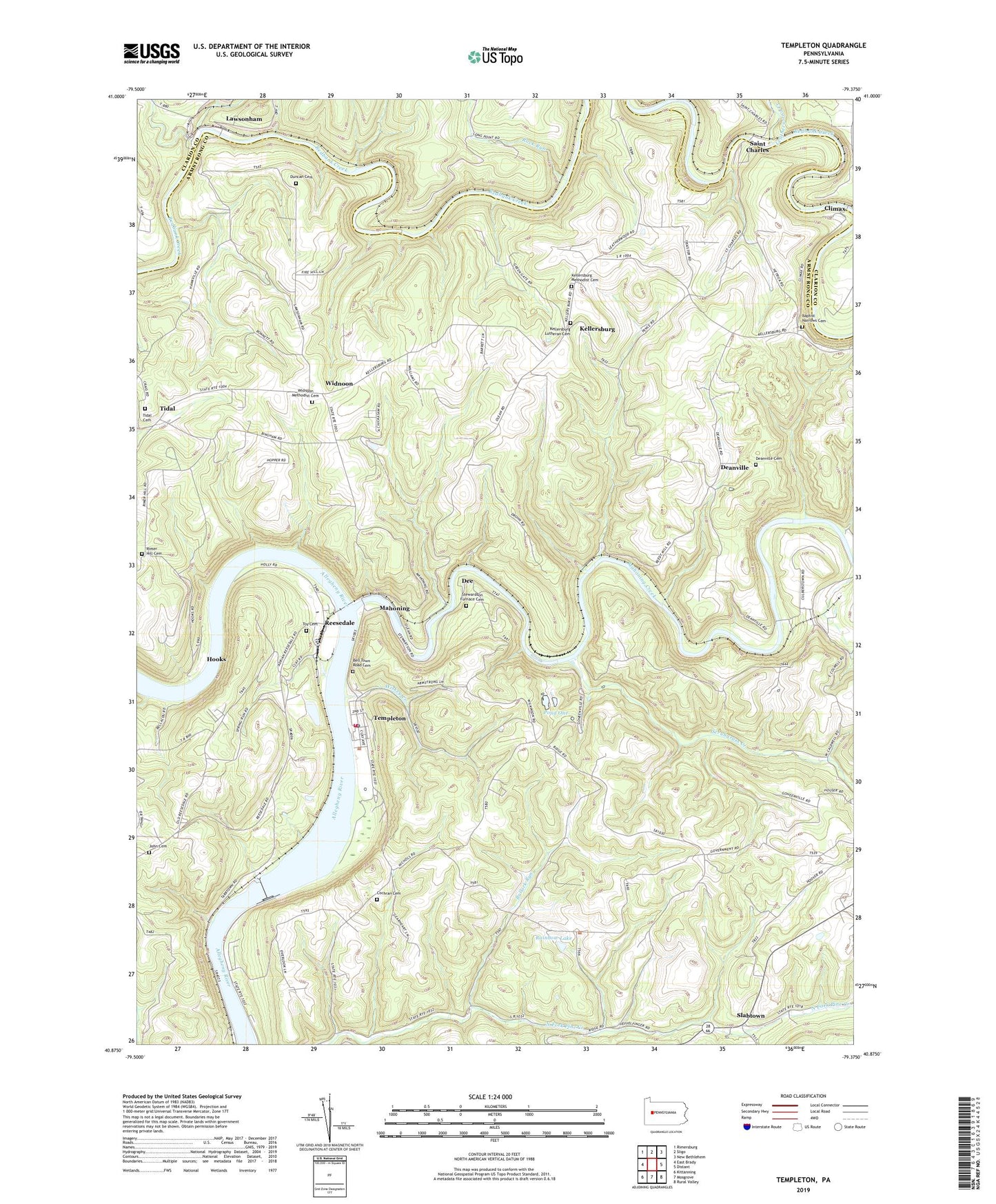
2023 topographic map quadrangle Templeton in the state of Pennsylvania. Scale: 1:24000. Based on the newly updated USGS 7.5' US Topo map series, this map is in the following counties: Armstrong, Clarion. The map contains contour data, water features, and other items you are used to seeing on USGS maps, but also has updated roads and other features. This is the next generation of topographic maps. Printed on high-quality waterproof paper with UV fade-resistant inks.
Quads adjacent to this one:
West: East Brady
Northwest: Rimersburg
North: Sligo
Northeast: New Bethlehem
East: Distant
Southeast: Rural Valley
South: Mosgrove
Southwest: Kittanning
This map covers the same area as the classic USGS quad with code o40079h4.
Contains the following named places: Allegheny River Lock and Dam Eight, Allegheny River Pool Eight, Bell Town Road Cemetery, Bullock Run, Chickasaw, Climax, Cochran Cemetery, Deanville, Deanville Cemetery, Dee, Duncan Cemetery, Grays Eddy, Henley Station, Hooks, John Cemetery, Kellersburg, Kellersburg Lutheran Cemetery, Kellersburg Methodist Cemetery, Lawsonham, Leatherwood Creek, Madison School, Mahoning, Mahoning Creek, Mahoning Creek Mines Dam One and Two, Mahoning Station, Narrows Cemetery, Pine Township Volunteer Fire Company Station 190, Pond Five, Pond One, Pond Two, Rainbow Lake, Reedy Station, Reesedale, Rimer Hill Cemetery, Rock Run, Saint Charles, Scrubgrass Creek, Slabtown, State Game Lands Number 287, Stewardson Furnace Cemetery, Tempelton Elementary School, Templeton, Templeton Census Designated Place, Templeton Post Office, Thayerton, Tidal, Tidal Cemetery, Township of Boggs, Township of Madison, Township of Pine, Toy Cemetery, Widnoon, Widnoon Methodist Cemetery, Widnoon Station, Wildcat Run, Wiskey Creek, ZIP Code: 16259