MyTopo
Pleasant View Summit Pennsylvania US Topo Map
Couldn't load pickup availability
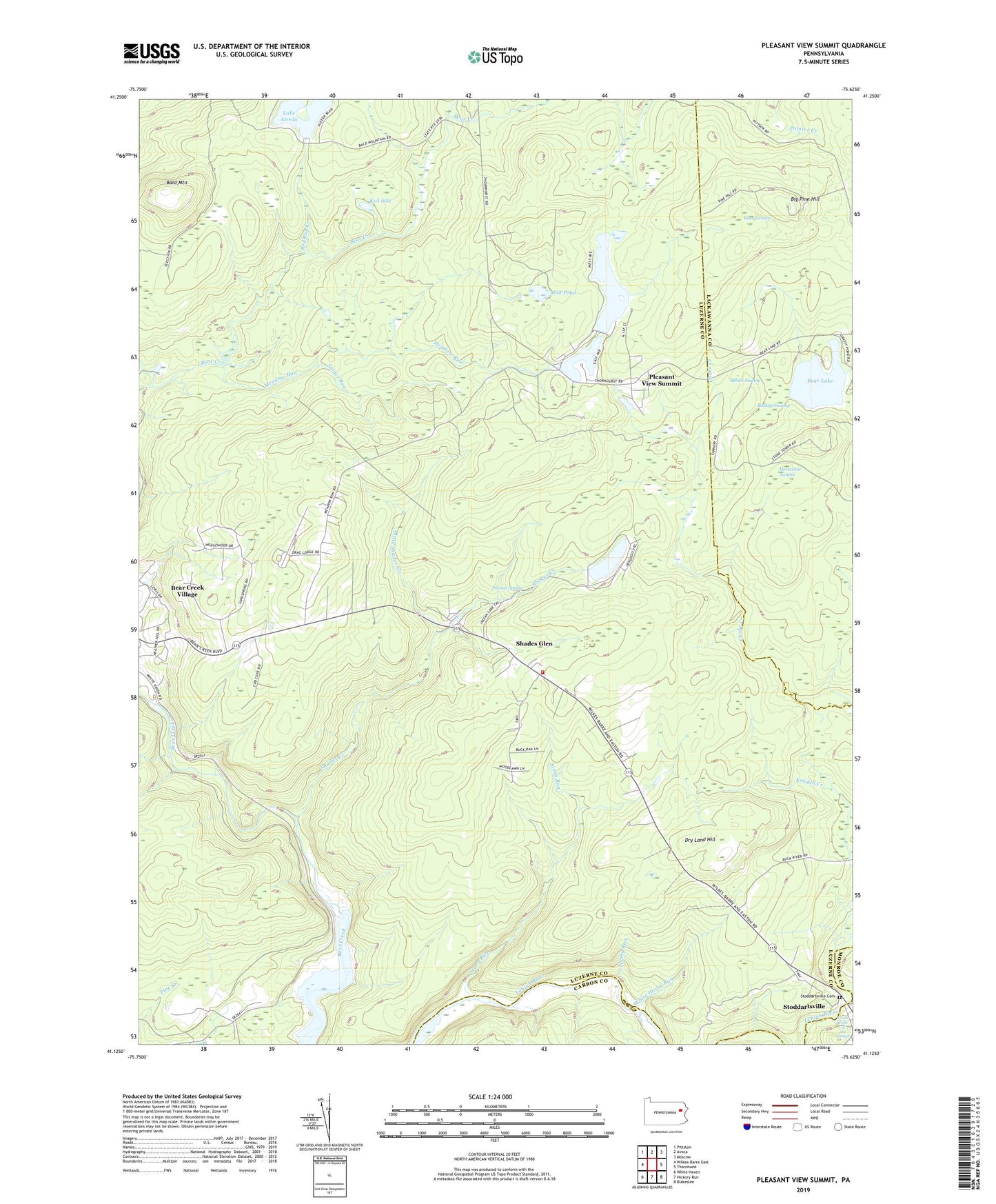
2019 topographic map quadrangle Pleasant View Summit in the state of Pennsylvania. Scale: 1:24000. Based on the newly updated USGS 7.5' US Topo map series, this map is in the following counties: Luzerne, Lackawanna, Carbon, Monroe. The map contains contour data, water features, and other items you are used to seeing on USGS maps, but also has updated roads and other features. This is the next generation of topographic maps. Printed on high-quality waterproof paper with UV fade-resistant inks.
Quads adjacent to this one:
West: Wilkes-Barre East
Northwest: Pittston
North: Avoca
Northeast: Moscow
East: Thornhurst
Southeast: Blakeslee
South: Hickory Run
Southwest: White Haven
Contains the following named places: Bald Mountain, Balsam Swamp, Bear Lake, Bear Swamp, Behler Swamp, Big Pine Hill, Big Pine Hill View, Choke Creek Trail, Dry Land Hill, Dry Land Hill Tower, Great Falls of the Lehigh, Horseshoe Swamp, Indian Lake, Indian Lake Dam, Kendall Creek, Kiel lake, Lake Aleeda, Lake Aleeda Dam, Little Bear Creek, Little Shades Creek, Meadow Lake, Meadow Lake Dam, Meadow Lake Run, Meadow Run, Meadow Run Ponds, Mountain Lake Dam, Mud Pond, Mud Run Creek, Pleasant View Summit, Pocono Spring, Red Run Creek, Refuge Trail, Shades Creek, Shades Creek Volunteer Fire Company Station 15, Shades Glen, Snider Run, Spring Run, State Game Lands Number 91, Stoddartsville, Stoddartsville Cemetery, Stoddartsville Post Office, Stony Run, Township of Buck, Walter Dike Number One, Walter Dike Number Two, White House Run, Wilkes-Barre Golf Course