
MyTopo
Wilkes-Barre East Pennsylvania US Topo Map
Couldn't load pickup availability
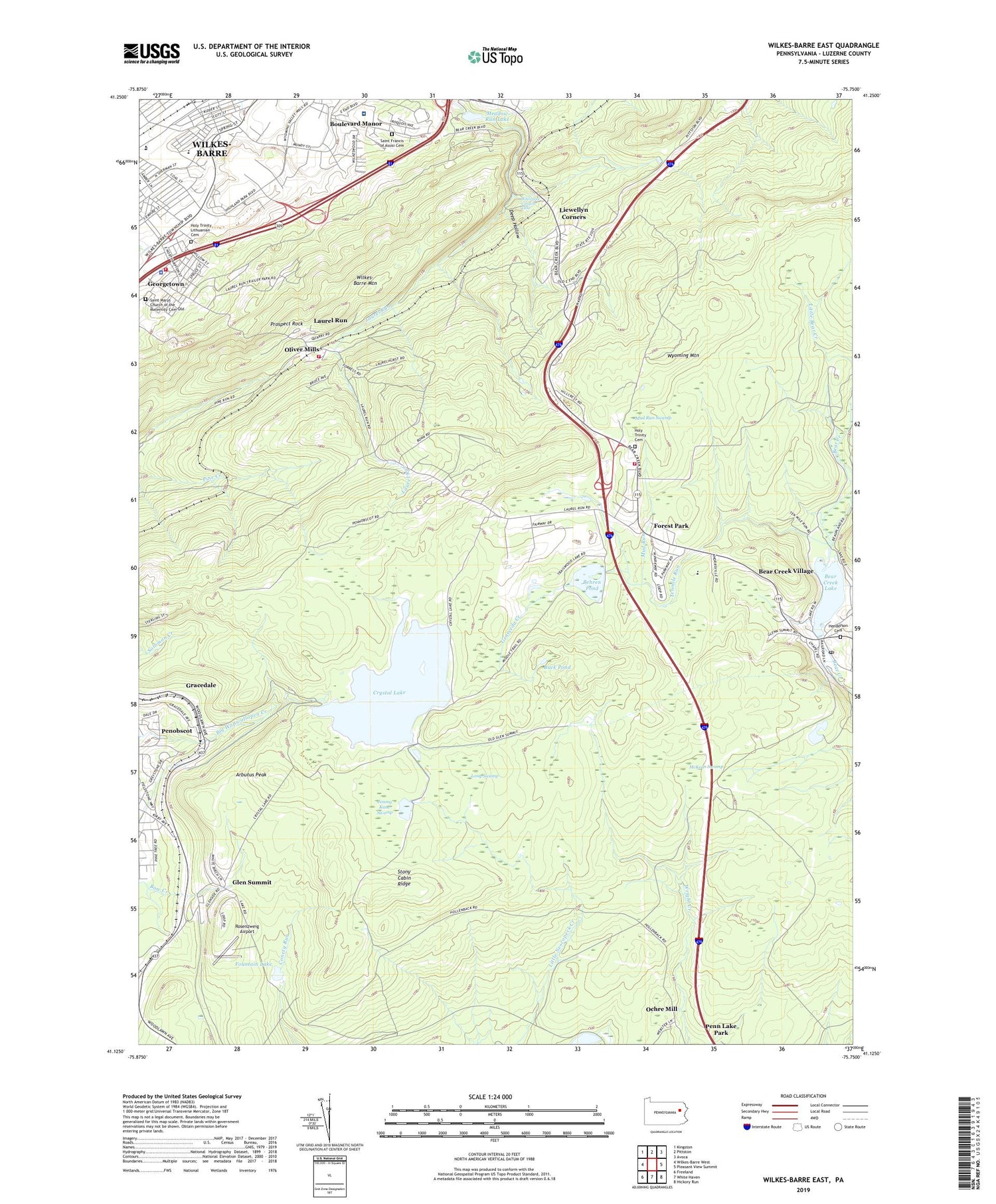
2023 topographic map quadrangle Wilkes-Barre East in the state of Pennsylvania. Scale: 1:24000. Based on the newly updated USGS 7.5' US Topo map series, this map is in the following counties: Luzerne. The map contains contour data, water features, and other items you are used to seeing on USGS maps, but also has updated roads and other features. This is the next generation of topographic maps. Printed on high-quality waterproof paper with UV fade-resistant inks.
Quads adjacent to this one:
West: Wilkes-Barre West
Northwest: Kingston
North: Pittston
Northeast: Avoca
East: Pleasant View Summit
Southeast: Hickory Run
South: White Haven
Southwest: Freeland
This map covers the same area as the classic USGS quad with code o41075b7.
Contains the following named places: Antler Lake, Arbutus Peak, Bear Creek Dam, Bear Creek Junction, Bear Creek Lake, Bear Creek Post Office, Bear Creek Township Volunteer Hose Company Station 13, Bear Creek Village, Behren Pond, Borough of Bear Creek Village, Borough of Laurel Run, Boulevard Manor, Buck Pond, Clear Brook Manor, Colebrook Dam, Crystal Lake, Crystal Lake Dam, Deep Hollow, Eikes Pond Dam, Forest Park, Fountain Lake, Geneceda Creek, Georgetown, Georgetown Census Designated Place, Glen Summit, Glen Summit Post Office, Glen Summit Springs Post Office, Glen Summit Station, Gracedale, Henderson Cemetery, Holy Trinity Cemetery, Holy Trinity Lithuanian Cemetery, Jimmy Kane Swamp, John Heinz Institute of Rehabilitation, Laurel Run, Laurel Run and Olivers Mills Stations, Laurel Run Number Two Dam, Laurel Run Volunteer Fire Department Station 155, Laurel School, Liewellyn Corners, Llewellyn Corners, Long Swamp, Macklin Elementary School, McKean Swamp, Meadow Run Lake, Mountain Park, Mud Run, Mud Run Swamp, Ochre Mill, Oliver Mills, Oliver School, Penobscot, Prospect Rock, Rosenzweig Airport, Saint Francis of Assisi Cemetery, Saint Marys Church of the Maternity Cemetery Old, State Game Lands Number 119, State Game Lands Number 292, Stony Cabin Ridge, Tenmile Run, Township of Bear Creek, Township of Fairview, Township of Wilkes-Barre, WBRE-TV (Wilkes-Barre), WCLH-FM (Wilkes-Barre), Whirlpool Canyon Falls, Wilkes - Barre Township Police Department, Wilkes - Barre Township Volunteer Fire Department Station 188, Wilkes - Barre Veterans Affairs Medical Center, Wilkes Barre Township Elementary School, Wilkes-Barre Township Census Designated Place, WKRZ-FM (Wilkes-Barre), WNEP-TV (Scranton), WRKC-FM (Wilkes-Barre), WVIA-FM (Scranton), WVIA-TV (Scranton), Wyoming Mountain, WYZZ-FM (Wilkes-Barre), ZIP Codes: 18602, 18702


