MyTopo
Riverside Pennsylvania US Topo Map
Couldn't load pickup availability
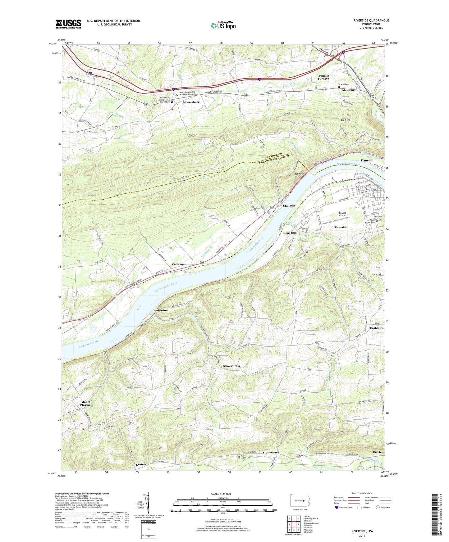
2019 topographic map quadrangle Riverside in the state of Pennsylvania. Scale: 1:24000. Based on the newly updated USGS 7.5' US Topo map series, this map is in the following counties: Northumberland, Montour. The map contains contour data, water features, and other items you are used to seeing on USGS maps, but also has updated roads and other features. This is the next generation of topographic maps. Printed on high-quality waterproof paper with UV fade-resistant inks.
Quads adjacent to this one:
West: Northumberland
Northwest: Milton
North: Washingtonville
Northeast: Millville
East: Danville
Southeast: Shamokin
South: Trevorton
Southwest: Sunbury
Contains the following named places: Bald Top, Borough of Riverside, Brights Cemetery, Cameron, Chulasky, Consolidated School, Danville Airport, Deibler, Deibler Station Church, Devils Feather Bed, Franklin Furnace, Furnace Hollow, Gaskins Run, Grace Church, Gravel Run, Indian Creek, Kase Cemetery, Keefers, Kipps Run, Klines Grove, Liberty Township Fire Company Station 100, Liberty Valley School, Mahoning Creek, Mausdale, Mauses Creek, Mooresburg, Mooresburg Presbyterian Church Cemetery, Mooresburg United Methodist Church Cemetery, Mount Pleasant, Mount Vernon Cemetery, Packers Run, Raups Run, Red Point Hill, Riverside, Riverside Borough Police Department, Riverside Elementary School, Riverside Post Office, Rush Church, Rushtown, Saint Johns Cemetery, Saint Johns Church, Saint Peters Church, Snydertown, South Danville, Southside Fire Company Station 70, State Game Lands Number 115, Township of Liberty, Township of Rush, Upper Augusta Township Fire Company Station 7 - 2, Wilson Run, Wolverton, WPGM-AM (Danville), ZIP Codes: 17821, 17868