MyTopo
Trevorton Pennsylvania US Topo Map
Couldn't load pickup availability
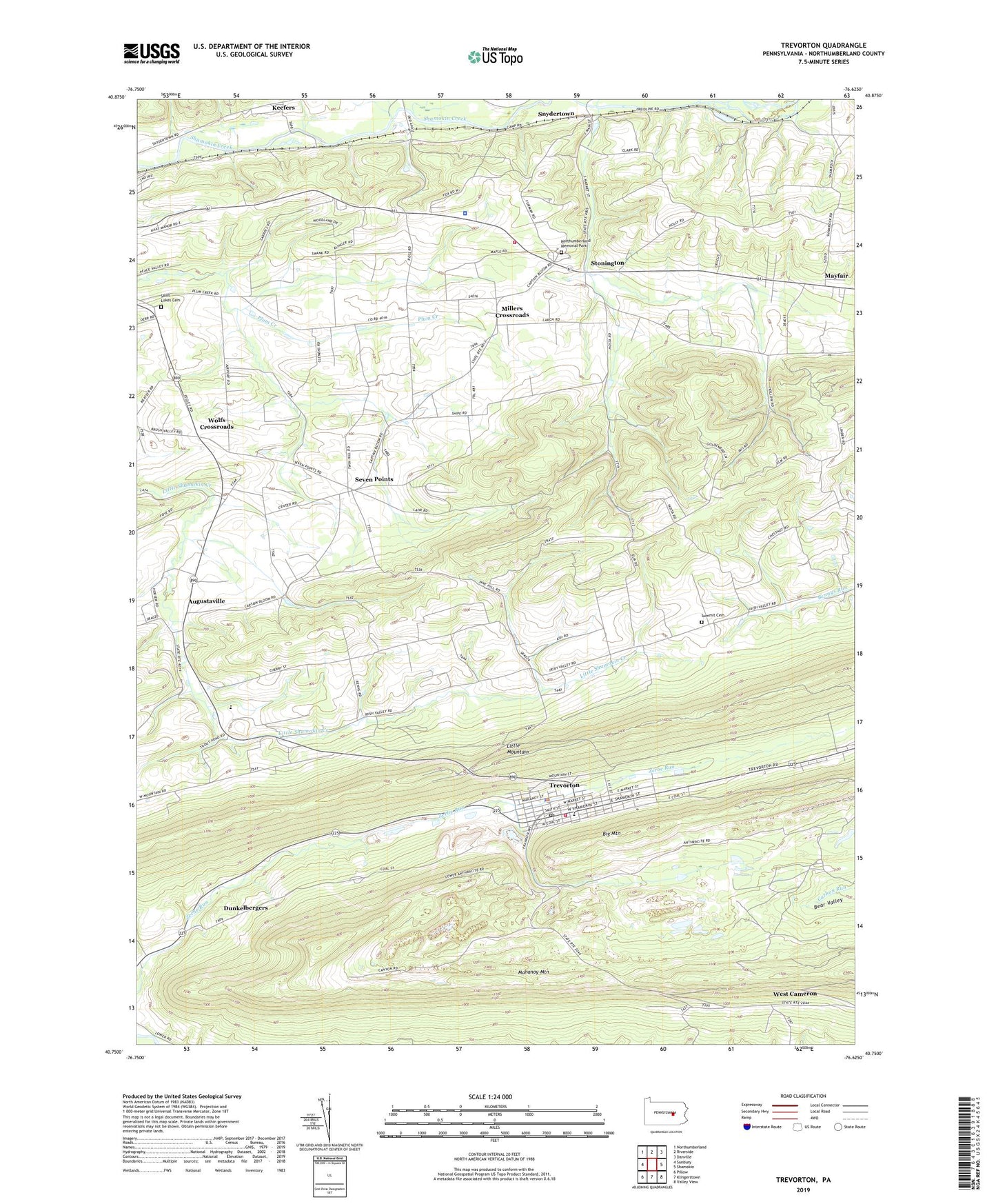
2023 topographic map quadrangle Trevorton in the state of Pennsylvania. Scale: 1:24000. Based on the newly updated USGS 7.5' US Topo map series, this map is in the following counties: Northumberland. The map contains contour data, water features, and other items you are used to seeing on USGS maps, but also has updated roads and other features. This is the next generation of topographic maps. Printed on high-quality waterproof paper with UV fade-resistant inks.
Quads adjacent to this one:
West: Sunbury
Northwest: Northumberland
North: Riverside
Northeast: Danville
East: Shamokin
Southeast: Valley View
South: Klingerstown
Southwest: Pillow
This map covers the same area as the classic USGS quad with code o40076g6.
Contains the following named places: Anthracite Bag Plant Station, Augustaville, Augustaville Church, Big Mountain, Borough of Snydertown, Corbins Airport, Dunkelbergers, Eden Church, Farnsworth, Irish Valley Church, James Path, Lower Plum Creek School, Mayfair, Millers Crossroads, Northumberland County, Northumberland Memorial Park, Odd Fellows Orphans Home, Pennsylvania State Police Troop F Stonington Station, Saint Lukes Cemetery, Seven Points, Shamokin Valley Country Club, State Game Lands Number 165, Stonington, Stonington Volunteer Fire Company Station 6 - 3, Summit Cemetery, Sunshine Coal Company Number Sixteen Dam, Sunshine Fines Pond, Township of Rockefeller, Township of Shamokin, Township of Zerbe, Trevorton, Trevorton Breaker Station, Trevorton Census Designated Place, Trevorton Fines Pond, Trevorton Fire Company Station 300, Trevorton Fire Tower, Trevorton Plant Number One Dam, Trevorton Post Office, West Cameron, Wolfs Crossroads, WQKX-FM (Sunbury), Yordy, ZIP Codes: 17872, 17881