MyTopo
Roaring Spring Pennsylvania US Topo Map
Couldn't load pickup availability
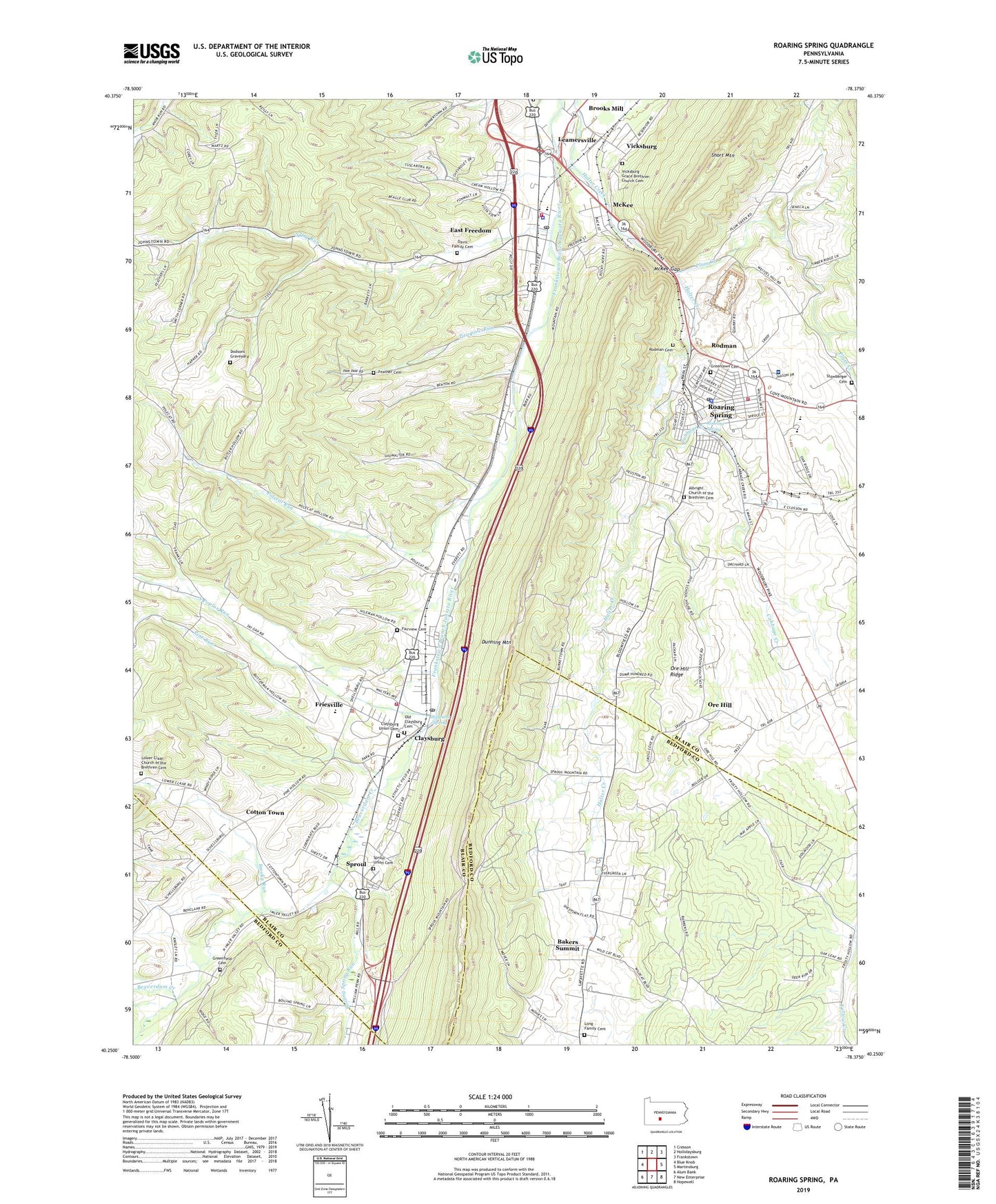
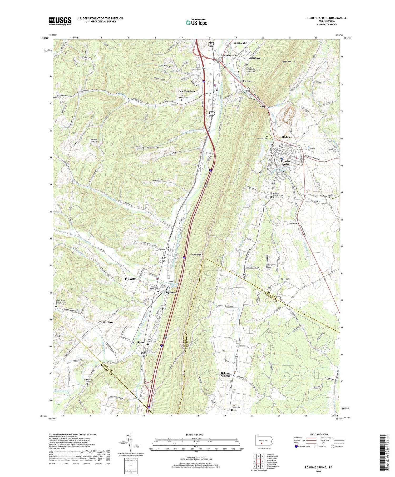
2019 topographic map quadrangle Roaring Spring in the state of Pennsylvania. Scale: 1:24000. Based on the newly updated USGS 7.5' US Topo map series, this map is in the following counties: Blair, Bedford. The map contains contour data, water features, and other items you are used to seeing on USGS maps, but also has updated roads and other features. This is the next generation of topographic maps. Printed on high-quality waterproof paper with UV fade-resistant inks.
Quads adjacent to this one:
West: Blue Knob
Northwest: Cresson
North: Hollidaysburg
Northeast: Frankstown
East: Martinsburg
Southeast: Hopewell
South: New Enterprise
Southwest: Alum Bank
Contains the following named places: Albright Church, Albright Church of the Brethren Cemetery, Bakers Summit, Beaverdam Creek, Boiling Spring Run, Borough of Roaring Spring, Brooks Mill, Brooks Mill Census Designated Place, Cabbage Creek, Chimney Rock Beagle Club, Claysburg, Claysburg - Kimmel High School, Claysburg Census Designated Place, Claysburg Post Office, Claysburg Union Cemetery, Claysburg Volunteer Fire Department Station 70, Cotton Town, Cotton Town Census Designated Place, Davis Family Cemetery, Dodsons Graveyard, Dumb Hundred, Dumb Hundred Census Designated Place, East Freedom, East Freedom Census Designated Place, East Freedom Post Office, Ebeneza Church, Fairview Cemetery, Feather Cemetery, Franklin D Roosevelt Elementary School, Freedom Township Volunteer Fire Company Station 40, Friendship Fire Company Station 60, Friesville, Friesville Census Designated Place, Greenfield Cemetery, Greenfield Church, Greenlawn Cemetery, Iron Masters Country Club, Leamersville, Leamersville Census Designated Place, Long Family Cemetery, Lower Claar Church, Lower Claar Church of the Brethren Cemetery, McKee, McKee Census Designated Place, McKee Gap, Nason Hospital, Old Claysburg Cemetery, Ore Hill, Ore Hill Census Designated Place, Ore Hill Ridge, Pawpaw Run, Pine Run, Plum Creek, Polecat Run, Queen Station, Rhodes Graveyard, Riverview Cemetery, Roaring Spring, Roaring Spring Post Office, Roaring Spring Quarry, Rodman, Rodman Cemetery, Saint Annes Church, Shawnee Park, Smith Corner, Smith Corner Census Designated Place, Smoky Run, South Dry Run, South Poplar Run, Sproul, Sproul Census Designated Place, Sproul Union Cemetery, Steam Pump Dam, Township of Freedom, Township of Taylor, Vicksburg, Vicksburg Census Designated Place, Vicksburg Grace Brethren Church Cemetery, Weynant Spring, WKMC-AM (Roaring Spring), ZIP Codes: 16637, 16673, 16682