MyTopo
Saint Thomas Pennsylvania US Topo Map
Couldn't load pickup availability
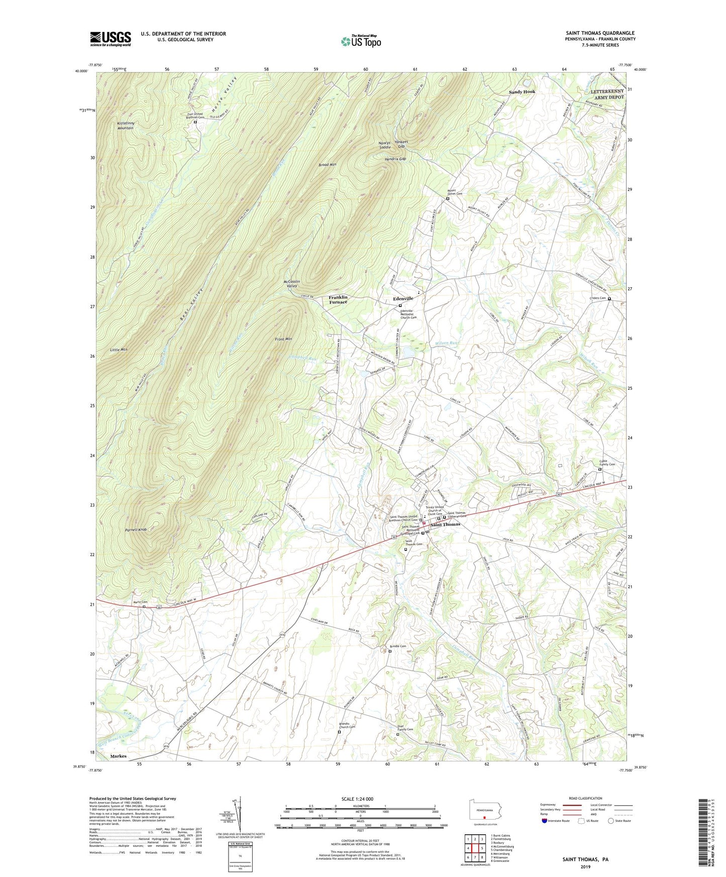
2019 topographic map quadrangle Saint Thomas in the state of Pennsylvania. Scale: 1:24000. Based on the newly updated USGS 7.5' US Topo map series, this map is in the following counties: Franklin. The map contains contour data, water features, and other items you are used to seeing on USGS maps, but also has updated roads and other features. This is the next generation of topographic maps. Printed on high-quality waterproof paper with UV fade-resistant inks.
Quads adjacent to this one:
West: McConnellsburg
Northwest: Burnt Cabins
North: Fannettsburg
Northeast: Roxbury
East: Chambersburg
Southeast: Greencastle
South: Williamson
Southwest: Mercersburg
Contains the following named places: Bear Valley Dam, Brandts Church Cemetery, Brindle Cemetery, Broad Mountain, Carlton Heights, Coble Family Cemetery, Criders Cemetery, Edenville, Edenville Methodist Church Cemetery, Franklin Furnace, Front Mountain, Hendrix Gap, Hendrix Gap Trail, Horn Trail, Little Mountain, Martz Cemetery, McCasslin Valley, Millers Mill, Mount Olivet Cemetery, Nancys Saddle, Over Family Cemetery, Parnell Knob, Saint Thomas, Saint Thomas Cemetery, Saint Thomas Lutheran Cemetery, Saint Thomas Methodist Episcopal Cemetery, Saint Thomas Post Office, Saint Thomas Township Volunteer Fire and Rescue Department - Company 18, Saint Thomas United Brethren Church Cemetery, Sandy Hook, State Game Lands Number 235, Township of Saint Thomas, Trinity United Church of Christ Cemetery, Yankees Gap, Zion United Brethren Cemetery, ZIP Code: 17252