MyTopo
Scandia Pennsylvania US Topo Map
Couldn't load pickup availability
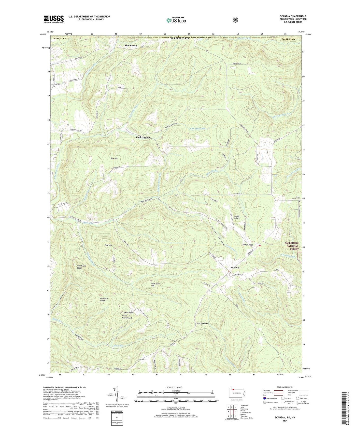
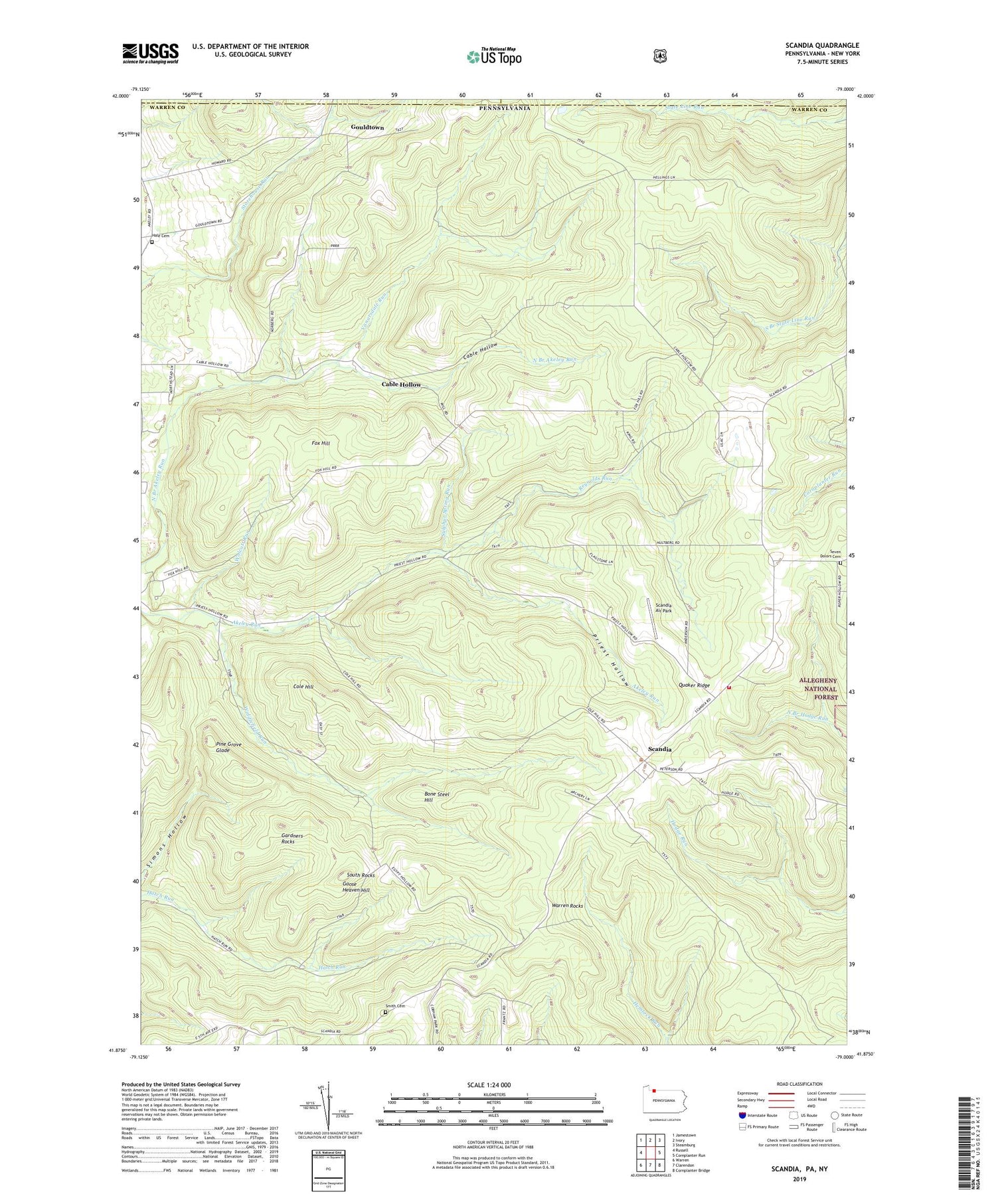
2019 topographic map quadrangle Scandia in the state of Pennsylvania. Scale: 1:24000. Based on the newly updated USGS 7.5' US Topo map series, this map is in the following counties: Warren, Cattaraugus, Chautauqua. The map contains contour data, water features, and other items you are used to seeing on USGS maps, but also has updated roads and other features. This is the next generation of topographic maps. Printed on high-quality waterproof paper with UV fade-resistant inks.
Quads adjacent to this one:
West: Russell
Northwest: Jamestown
North: Ivory
Northeast: Steamburg
East: Cornplanter Run
Southeast: Cornplanter Bridge
South: Clarendon
Southwest: Warren
Contains the following named places: Blueberry Hill Golf Course, Bone Steel Hill, Cable Hollow, Cable Hollow Golf Course, Clendening Corners, Clendenning School, Cole Hill, Fox Hill, Gardners Rocks, Goose Heaven Hill, Gouldtown, Hale Cemetery, Hale School, Lounsbury Corners, Macks Corners, Pine Grove Glade, Priest Hollow, Priest Hollow School, Quaker Ridge, Reynolds Run, Reynolds School, Scandia, Scandia Air Park, Scandia Volunteer Fire Department, Seven Dolors Cemetery, Smith Cemetery, Smith Corners, Smith School, South Rocks, Sulphur Spring Run, Township of Pine Grove, Vanarsdale Run, Warren Rocks, Widdlefield Run, Wolcott Run, ZIP Code: 16345