MyTopo
Titusville South Pennsylvania US Topo Map
Couldn't load pickup availability
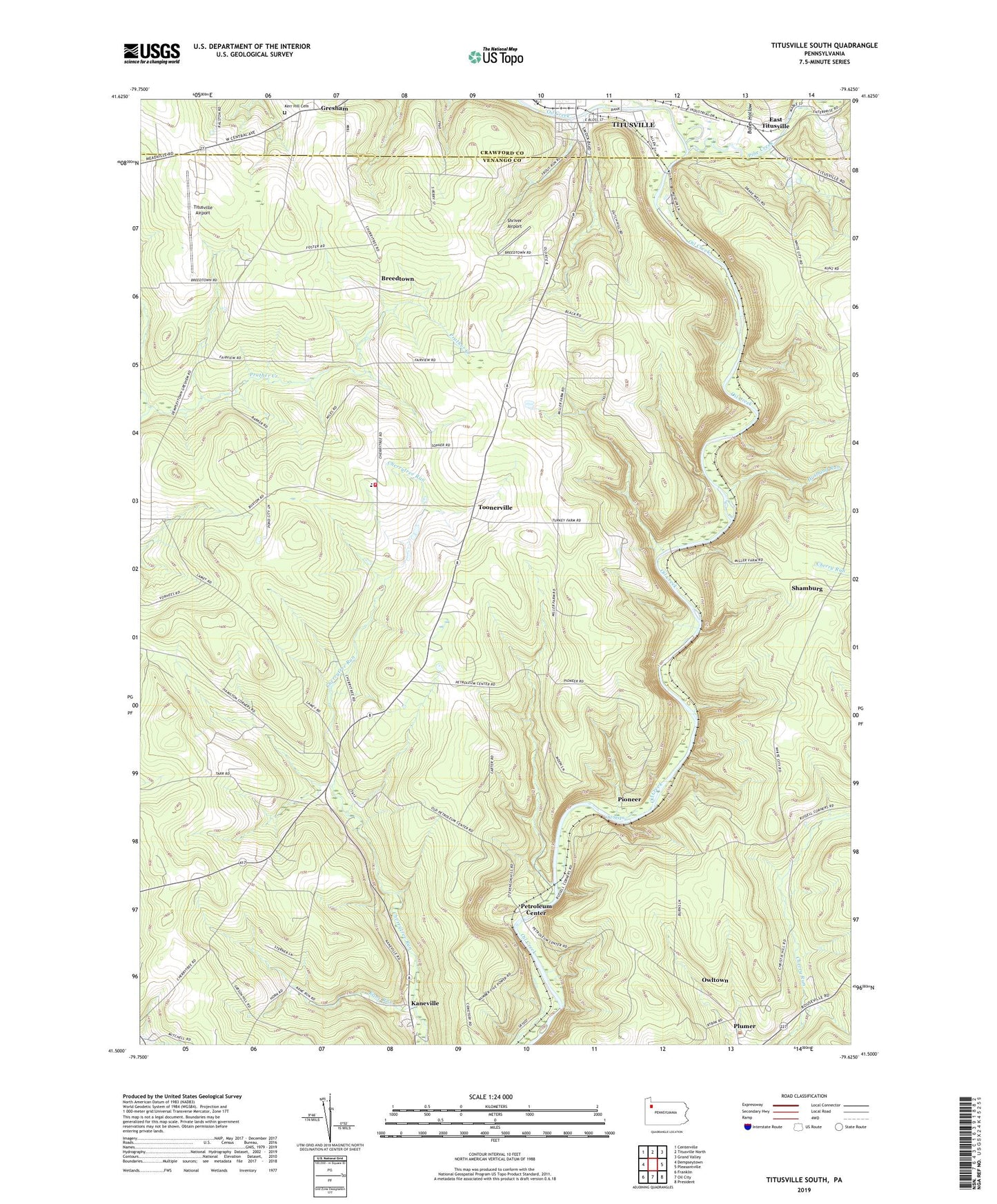
2019 topographic map quadrangle Titusville South in the state of Pennsylvania. Scale: 1:24000. Based on the newly updated USGS 7.5' US Topo map series, this map is in the following counties: Venango, Crawford. The map contains contour data, water features, and other items you are used to seeing on USGS maps, but also has updated roads and other features. This is the next generation of topographic maps. Printed on high-quality waterproof paper with UV fade-resistant inks.
Quads adjacent to this one:
West: Dempseytown
Northwest: Centerville
North: Titusville North
Northeast: Grand Valley
East: Pleasantville
Southeast: President
South: Oil City
Southwest: Franklin
Contains the following named places: Bates Hollow, Benninghof Run, Boughton, Breedtown, Cherrytree, Cherrytree School, Cherrytree Township Volunteer Fire Department, Church Run, Columbia Farm, Cross Creek Resort Golf Course, Drake Oil Well, Drake Well State Park, Dutch Hill School, East Titusville, EmergyCare Titusville Department 34, Gresham, Husband Run, Jameson Corners, Kane Run, Kaneville, Kerr Hill Cemetery, Kerr Hill Church, Mason Farm Corners, Miller Farm, Oakland Church, Oil Creek State Park, Oil Seeps, Owltown, Petroleum Center, Pine Creek, Pioneer, Prather Corners, Prather School, Redfield School, Rose School, Russell Corners, Shamburg, Shreve School, Shriver Airport, Titusville Airport, Toonerville, Township of Cherrytree, WTIV-AM (Titusville), Zerrer School, ZIP Code: 16354