MyTopo
Pleasantville Pennsylvania US Topo Map
Couldn't load pickup availability
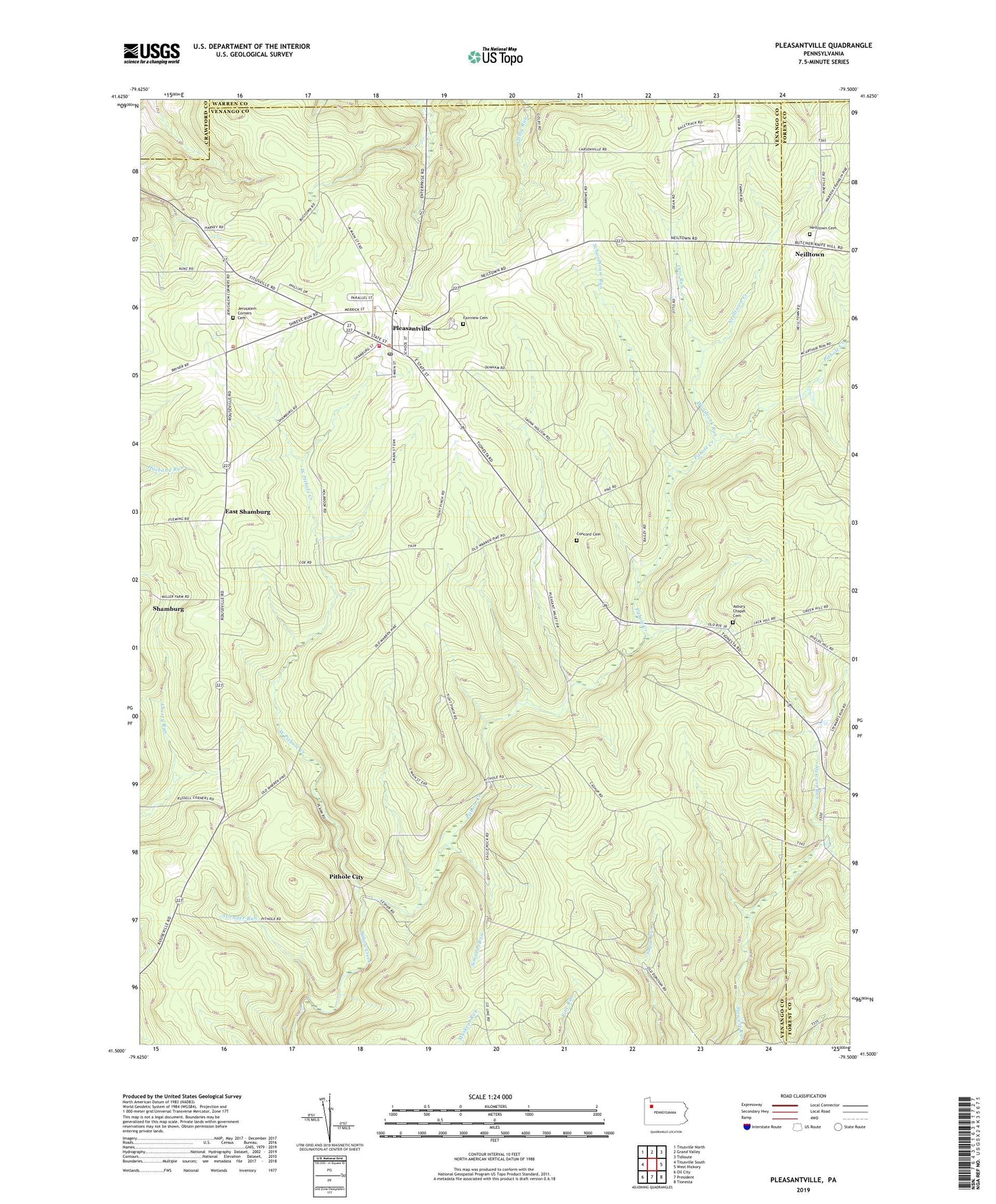
2023 topographic map quadrangle Pleasantville in the state of Pennsylvania. Scale: 1:24000. Based on the newly updated USGS 7.5' US Topo map series, this map is in the following counties: Venango, Forest, Crawford, Warren. The map contains contour data, water features, and other items you are used to seeing on USGS maps, but also has updated roads and other features. This is the next generation of topographic maps. Printed on high-quality waterproof paper with UV fade-resistant inks.
Quads adjacent to this one:
West: Titusville South
Northwest: Titusville North
North: Grand Valley
Northeast: Tidioute
East: West Hickory
Southeast: Tionesta
South: President
Southwest: Oil City
This map covers the same area as the classic USGS quad with code o41079e5.
Contains the following named places: Allender Run, Asbury Chapel Cemetery, Borough of Pleasantville, Cashup, Concord Cemetery, Concord Church, East Shamburg, Fairview Cemetery, Jerusalem Corners, Jerusalem Corners Cemetery, Lovell Corners, Morrison Corners, Neilltown, Neilltown Cemetery, Neilltown Creek, Otto Run, Pithole City, Pithole City Historical Site, Pleasantville, Pleasantville Oil Field, Pleasantville Post Office, Pleasantville Volunteer Fire Department 36, Rumbaugh Corners, Schoolhouse Run, Shamburg Oil Field, Simonds Run, The Full Gospel Church, Township of Allegheny, Township of Oil Creek, Tyrrel Farm Corners, West Pithole Creek, Woodcock Run, ZIP Code: 16341