MyTopo
Union City Pennsylvania US Topo Map
Couldn't load pickup availability
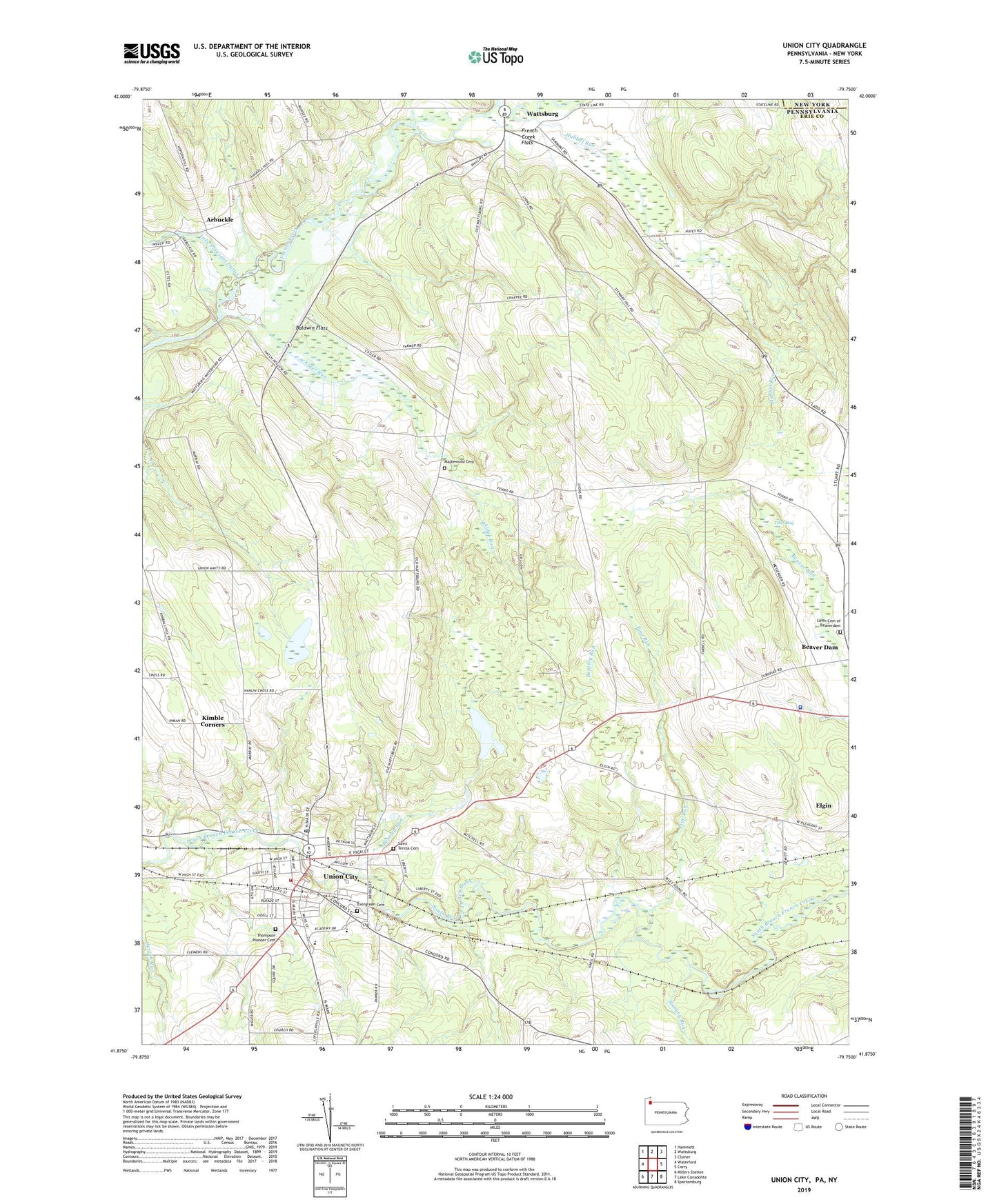
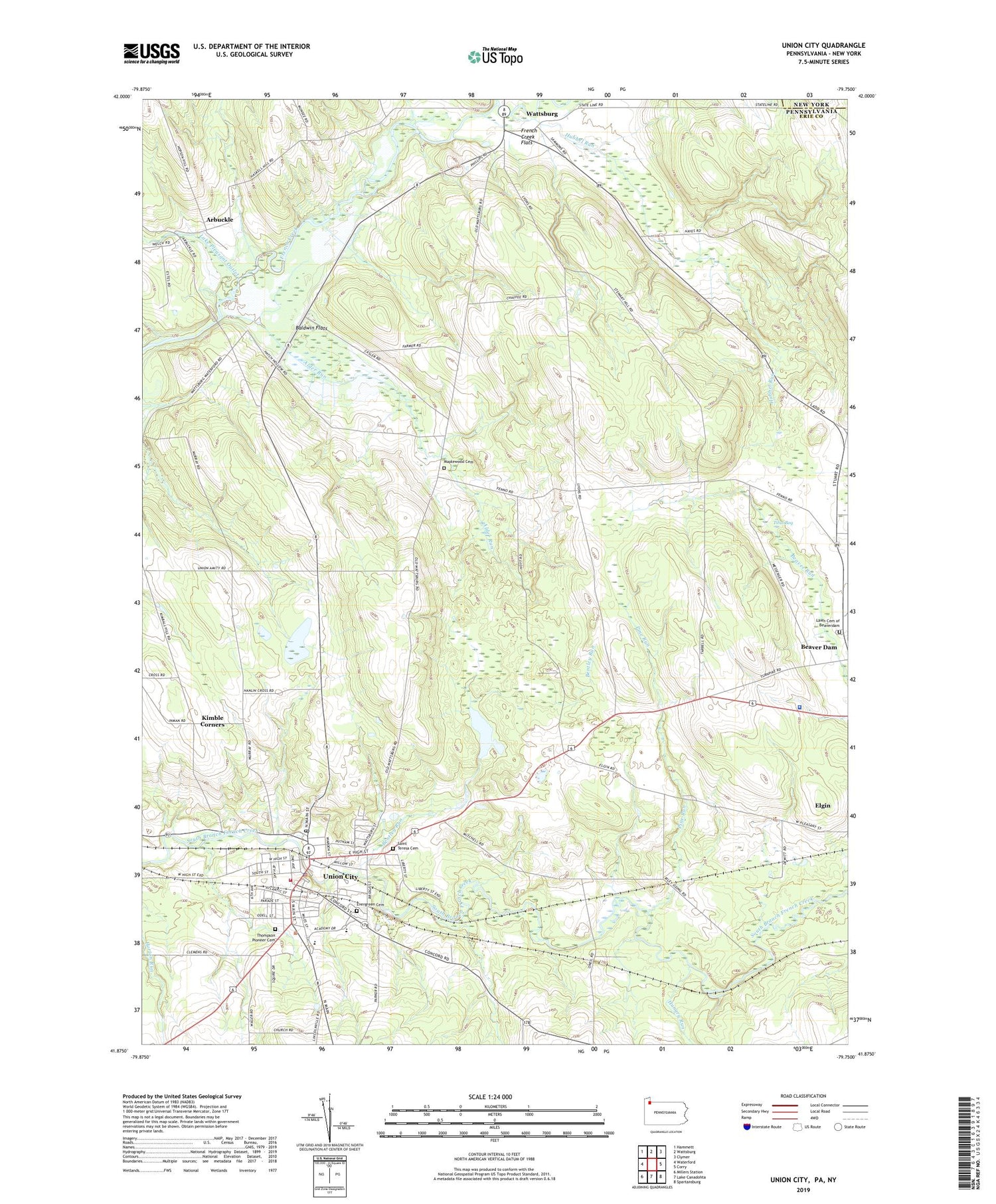
2019 topographic map quadrangle Union City in the state of Pennsylvania. Scale: 1:24000. Based on the newly updated USGS 7.5' US Topo map series, this map is in the following counties: Erie, Chautauqua. The map contains contour data, water features, and other items you are used to seeing on USGS maps, but also has updated roads and other features. This is the next generation of topographic maps. Printed on high-quality waterproof paper with UV fade-resistant inks.
Quads adjacent to this one:
West: Waterford
Northwest: Hammett
North: Wattsburg
Northeast: Clymer
East: Corry
Southeast: Spartansburg
South: Lake Canadohta
Southwest: Millers Station
Contains the following named places: Alder Run, Arbuckle, Baldwin Flats, Baldwin School, Beaver Dam, Bentley Run, Bisbee Farms, Blossom Farm, Borough of Union City, Carters Corners, Chaffee School, Emerson School, Evergreen Cemetery, Fenno School, French Creek Flats, Hatch Hollow Church, Hatch Hollow School, Horizon Hill Ranch, Howard School, Hubbel Run, Hungry Run, Kimble Corners, Lake Pleasant Outlet, Lawn Cemetery of Beaverdam, Maplewood Cemetery, Memorial Hospital, Pennsylvania State Police Troop E Corry Station, Pine Run, Saint Teresa Cemetery, Sherwood School, Shreve Farms, Sills School, Smith School, Smith's Dairy Farm, State Game Lands Number 102, State Game Lands Number 162, State Game Lands Number 167, Thompson Pioneer Cemetery, Titus Bog, Township of Amity, Township of Union, Union City, Union City Ambulance Service, Union City Fish Hatchery, Union City Junior-Senior High School, Union City Police Department, Union City Post Office, Union City Public Library, Union City Reservoir, Union City Reservoir Dam, Union City Volunteer Fire Department 113, Union-Amity Church, Wayne Valley Church, West Branch French Creek, ZIP Code: 16438