MyTopo
Wakefield Pennsylvania US Topo Map
Couldn't load pickup availability
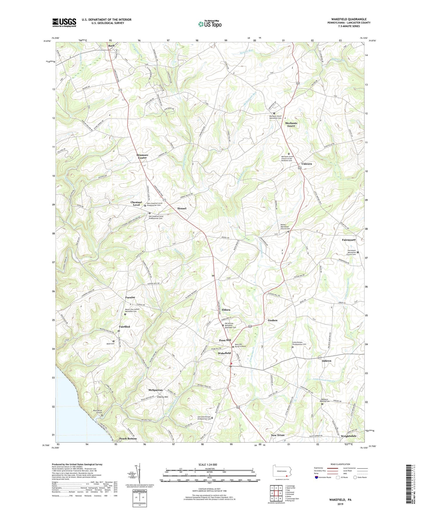
2019 topographic map quadrangle Wakefield in the state of Pennsylvania. Scale: 1:24000. Based on the newly updated USGS 7.5' US Topo map series, this map is in the following counties: Lancaster. The map contains contour data, water features, and other items you are used to seeing on USGS maps, but also has updated roads and other features. This is the next generation of topographic maps. Printed on high-quality waterproof paper with UV fade-resistant inks.
Quads adjacent to this one:
West: Holtwood
Northwest: Conestoga
North: Quarryville
Northeast: Gap
East: Kirkwood
Southeast: Rising Sun
South: Conowingo Dam
Southwest: Delta
Contains the following named places: Ballance Meeting Cemetery, Bethel, Bethel Church, Bethel Mennonite Church Cemetery, Boyd Burial Ground, Boyd Cemetery, Brick Hill School, Buck, Buck Post Office, Cherry Hill, Chestnut Level, Chestnut Level Post Office, Clark Crest Farm, Country Meadows Farms, Drumore Center, East Drumore Central School, Eldora, Fairfiled, Fairmount, Fairmount Mennonite Church Cemetery, Fulton House, Fulton House Post Office, Fulton Township School, Furniss, Goshen, Goshen Post Office, Greene Post Office, Hensel, Hershberger Farm, Hopkins Mill, Jackson Run, Krantz Valley Acres, Little Britain Airport, Little Britain Church, Little Britain Presbyterian Cemetery, Little Conowingo Creek, McFarlands Run, McSparran, Mechanic Grove, Mechanic Grove Church, Mechanic Grove Church of the Brethren Cemetery, Mechanic Grove Mennonite Cemetery, Mechanics Grove Post Office, Mount Zion Church, Mount Zion United Methodist Cemetery, New Chestnut Level Presbyterian Cemetery, Oakryn, Old African Methodist Episcopal Cemetery, Old Chestnut Level Presbyterian Cemetery, Old Little Britain Presbyterian Cemetery, Osceola School, Peach Bottom, Peach Bottom Post Office, Peach Botton Post Office, Penn Hill, Penn Hill Burial Ground, Peters Creek, Puddle Duck Creek, Robert Fulton Fire Company Station 89, Rohrer Airport, Solanco High School, Tanglewood Airport, Tanglewood Manor Golf Course, Township of Drumore, Township of East Drumore, Township of Fulton, Ulrich's Poultry Farm, Unicorn, Valley M Pork Farm, Wakefield, Wakefield Ambulance Station 88, Wakefield Census Designated Place, Wakefield Post Office, Wrightsdale, Wrightsdale Post Office, ZIP Codes: 17563, 17566