MyTopo
Kirkwood Pennsylvania US Topo Map
Couldn't load pickup availability
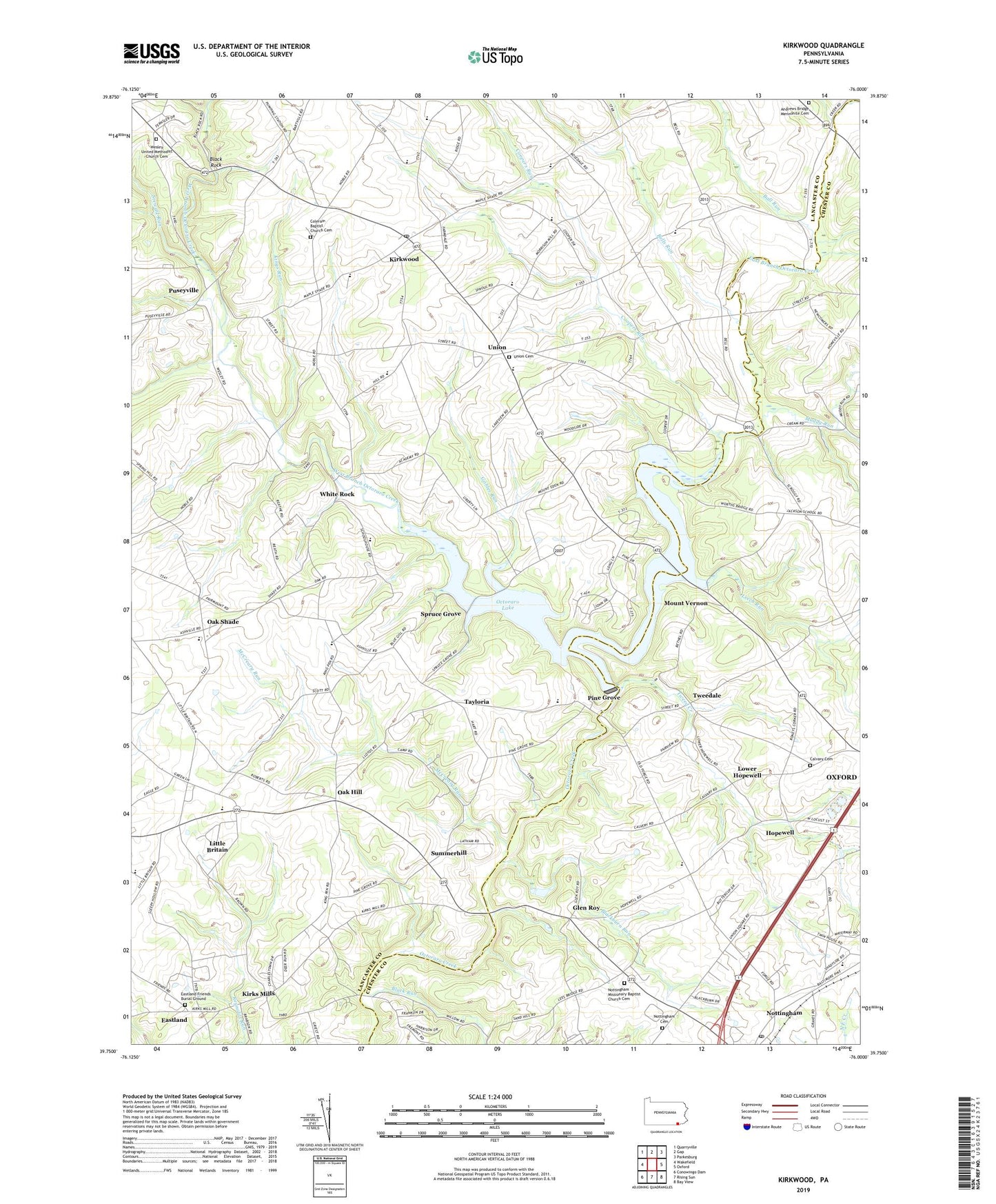
2023 topographic map quadrangle Kirkwood in the state of Pennsylvania. Scale: 1:24000. Based on the newly updated USGS 7.5' US Topo map series, this map is in the following counties: Lancaster, Chester. The map contains contour data, water features, and other items you are used to seeing on USGS maps, but also has updated roads and other features. This is the next generation of topographic maps. Printed on high-quality waterproof paper with UV fade-resistant inks.
Quads adjacent to this one:
West: Wakefield
Northwest: Quarryville
North: Gap
Northeast: Parkesburg
East: Oxford
Southeast: Bay View
South: Rising Sun
Southwest: Conowingo Dam
This map covers the same area as the classic USGS quad with code o39076g1.
Contains the following named places: Andrews Bridge, Andrews Bridge Mennonite Cemetery, Ball Run, Bells Run, Black Rock, Black Run, Blackburn Run, Breakaway Farm, Calvary Cemetery, Camp Tweedale, Colerain Baptist Church Cemetery, Colerain Church, Colerain Post Office, Coopers Run, Cream, East Branch Octoraro Creek, Eastland, Eastland Friends Burial Ground, Elim, Gables Run, Glen Roy, Groffs Plant Farm, Hope School, Hopewell, Kings Bridge, Kings Run, Kirks Bridge, Kirks Mills, Kirks Mills Post Office, Kirkwood, Kirkwood Census Designated Place, Kirkwood Post Office, Lakeview Farm, Leech Run, Lindenhof Farm, Little Britain, Little Britain Census Designated Place, Little Britain Post Office, Little Britan Elementary School, Lower Hopewell, McCreary Run, Mount Vernon, Muddy Run, Nottingham Cemetery, Nottingham Census Designated Place, Nottingham Missionary Baptist Church Cemetery, Nottingham Post Office, Oak Hill, Oak Hill Post Office, Oak Shade, Oak Shade Post Office, Octoraro Lake, Octoraro Pines, Octoraro Post Office, Pei Valley Farm, Pine Grove, Pine Grove Dam, Puseyville, Puseyville Post Office, Rob Roy Farm, Roney Corners, Salem School, Spring Hill, Spruce Grove, State Game Lands Number 136, Stewart Run, Summerhill, Tayloria, Township Central School, Township of Colerain, Township of Little Britain, Tweed Creek, Tweedale, Union, Union Cemetery, Union Square, Wabank Farm, We - Land Farm, Wesley Church, Wesley United Methodist Church Cemetery, West Branch Octoraro Creek, White Rock, White Rock Farm, ZIP Codes: 17536, 19362