
MyTopo
Weikert Pennsylvania US Topo Map
Couldn't load pickup availability
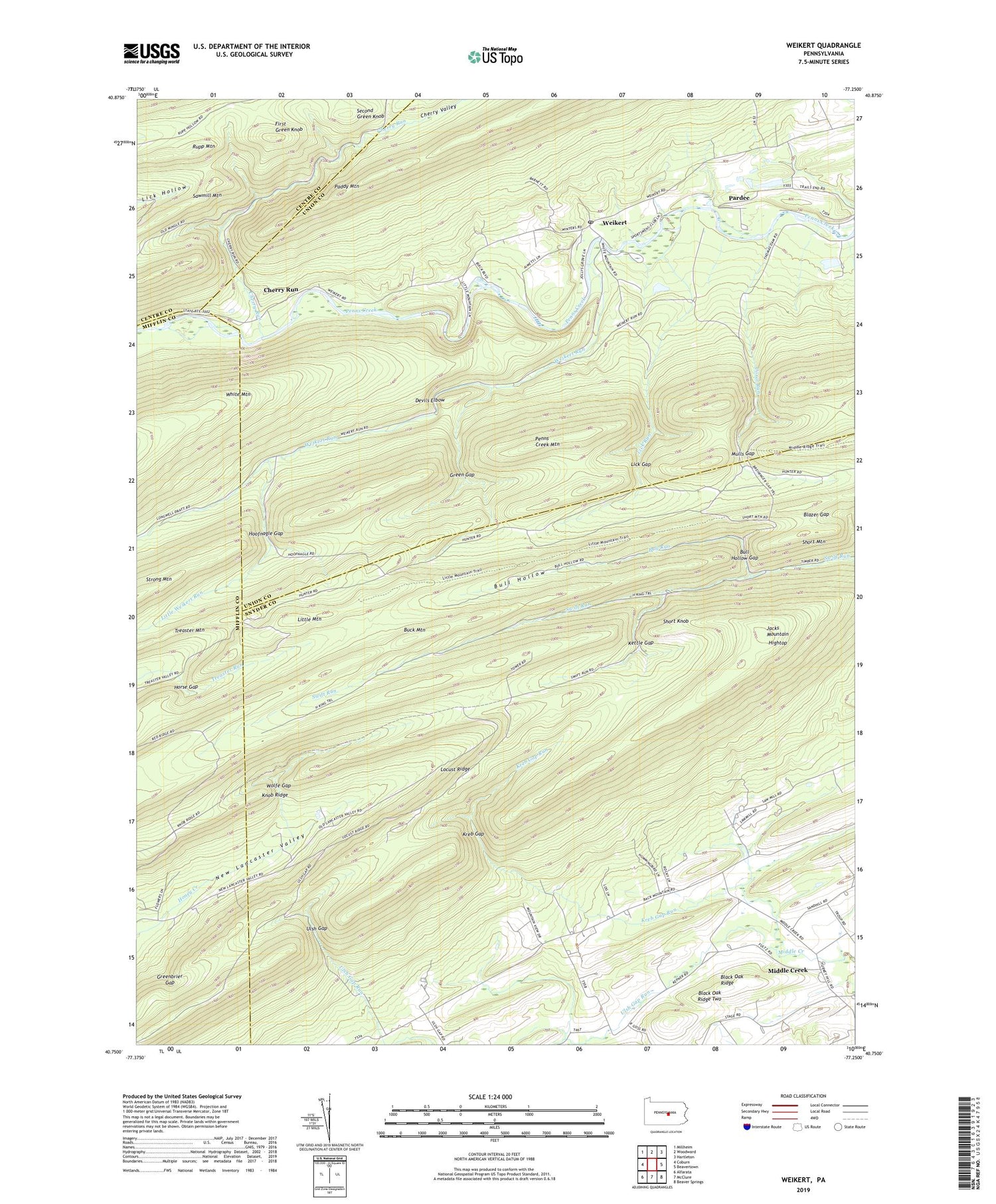
2019 topographic map quadrangle Weikert in the state of Pennsylvania. Scale: 1:24000. Based on the newly updated USGS 7.5' US Topo map series, this map is in the following counties: Snyder, Union, Mifflin, Centre. The map contains contour data, water features, and other items you are used to seeing on USGS maps, but also has updated roads and other features. This is the next generation of topographic maps. Printed on high-quality waterproof paper with UV fade-resistant inks.
Quads adjacent to this one:
West: Coburn
Northwest: Millheim
North: Woodward
Northeast: Hartleton
East: Beavertown
Southeast: Beaver Springs
South: McClure
Southwest: Alfarata
Contains the following named places: Blazer Gap, Booney Hollow Trail, Buck Mountain, Buck Mountain Trail, Bull Hollow, Bull Hollow Gap, Bull Hollow Trail, Bull Run, Camp Hironimus, Cherry Run, Cherry Valley, Cold Spring Trail, Coral Run, Devils Elbow, First Green Knob, Green Gap, Green Gap Trail, Greenbrier Gap, Henstep Valley Trail, Hightop, Hightop Trail, Hironimus Church, Hoofnagle Gap, Horse Gap, Horse Gap Trail, Karoondinha Camp, Kettle Gap, Kreb Gap, Kreb Gap Run, Kreb Gap Trail, Libby Trail, Lick Gap, Lick Gap Trail, Lick Hollow Trail, Lick Run, Little Mountain, Little Mountain Trail, Little Weikert Run, Locust Ridge, Long Path Trail, Middle Creek, Middle Ridge Trail, Mountain Dale School, Mulls Gap, Nik-O-Mahs Camp, Pardee, Penns Creek Mountain, Round Trail, Rupp Mountain, Second Green Knob, Short Knob, Short Mountain, Snyder Middleswarth Natural Area, Snyder-Middleswarth State Park, Swift Run Trail, Tall Timber Natural Area, Thick Mountain Trail, Ulsh Gap, Ulsh Gap Run, Ulsh Gap Trail, Weikert, Weikert Post Office, Weikert Run, Wesley Forest Camp, White Mountain Wild Area, Wolfe Gap, Wolfe Gap Trail, ZIP Code: 17885


