MyTopo
Beavertown Pennsylvania US Topo Map
Couldn't load pickup availability
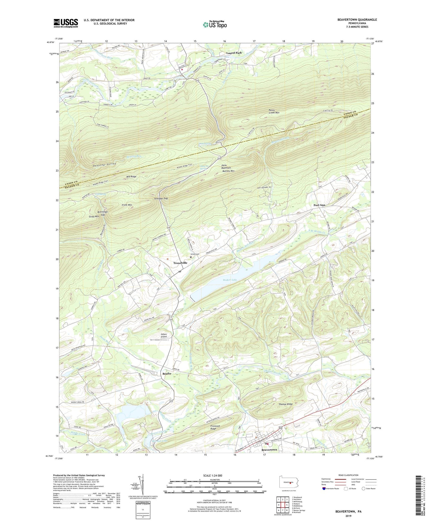
2023 topographic map quadrangle Beavertown in the state of Pennsylvania. Scale: 1:24000. Based on the newly updated USGS 7.5' US Topo map series, this map is in the following counties: Snyder, Union. The map contains contour data, water features, and other items you are used to seeing on USGS maps, but also has updated roads and other features. This is the next generation of topographic maps. Printed on high-quality waterproof paper with UV fade-resistant inks.
Quads adjacent to this one:
West: Weikert
Northwest: Woodward
North: Hartleton
Northeast: Mifflinburg
East: Middleburg
Southeast: Richfield
South: Beaver Springs
Southwest: McClure
This map covers the same area as the classic USGS quad with code o40077g2.
Contains the following named places: Beaver Creek, Beaver Springs Airport, Beavertown, Beavertown Post Office, Beavertown Rescue Hose Company 20, Benfer, Booney Mountain, Borough of Beavertown, Breininger Gap, Camp Loka, Cold Spring, Firestone Ridge, Fiss School, Front Mountain, Furnace Run, Garard Trail, Gilfert Airport, Glen Iron, Gods Missionary Church, Grace Church, Grass Mountain, Henstep Run, Henstep Trail, Henstep Valley, Horseshoe Bend Trail, Kern Run, Laurel Park, Laurel Run, Lincoln Church, Luphers Run, Manbeck Church, Messiah Church, Middle Creek Dam, Middle Ridge, Middleswarth, Mill Run Lake, Moyers Mill Run, North Branch Middle Creek, Port Ann, Potpie Spring, Saint Peters Church, Schrader Gap, Sheep Pen Spring, South Branch Middle Creek, State Game Lands Number 188, Stony Run, Summit Trail, Swift Run, Thomas Ridge, Township of Adams, Township of Beaver, Township of Spring, Troxelville, Troxelville Census Designated Place, Troxelville Post Office, Union Cemetery, Union County West End Fire Company, Walker Lake, Wetzel Run, Whitethorn Run, ZIP Code: 17813