MyTopo
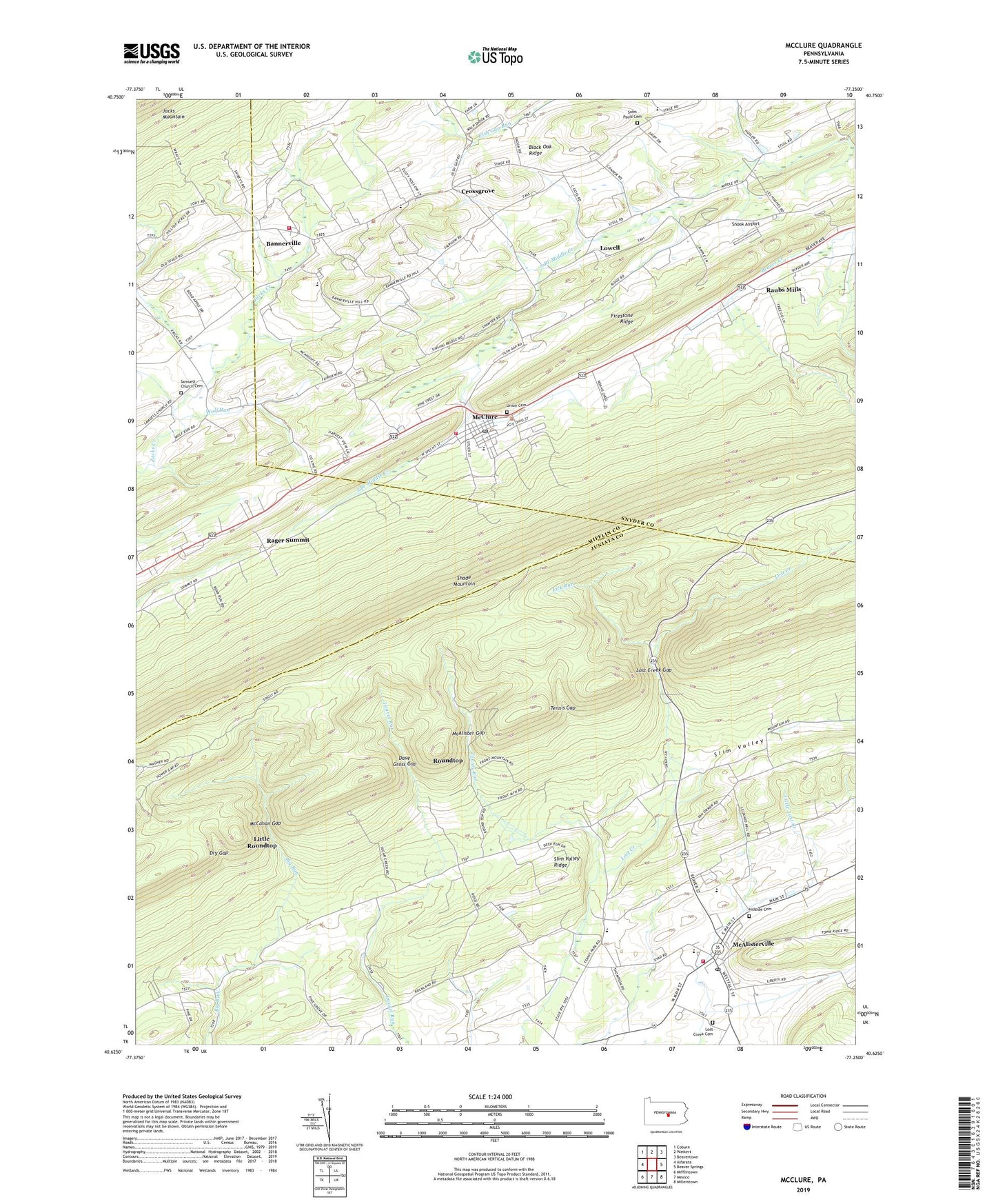
McClure Pennsylvania US Topo Map
Couldn't load pickup availability
2023 topographic map quadrangle McClure in the state of Pennsylvania. Scale: 1:24000. Based on the newly updated USGS 7.5' US Topo map series, this map is in the following counties: Juniata, Snyder, Mifflin. The map contains contour data, water features, and other items you are used to seeing on USGS maps, but also has updated roads and other features. This is the next generation of topographic maps. Printed on high-quality waterproof paper with UV fade-resistant inks.
Quads adjacent to this one:
West: Alfarata
Northwest: Coburn
North: Weikert
Northeast: Beavertown
East: Beaver Springs
Southeast: Millerstown
South: Mexico
Southwest: Mifflintown
This map covers the same area as the classic USGS quad with code o40077f3.
Contains the following named places: Bakers Church, Bannerville, Bannerville Fire Company Station 140, Black Oak Ridge, Black Oak Ridge Cemetery II, Black Oak Ridge Two, Borough of McClure, Bowersox School, Crossgrove, Dave Gross Gap, Dry Gap, Fayette Fire Company Station 4, Fayette Township Emergency Medical Services Station 4, Hillside Cemetery, Krick School, Lick Run, Little Roundtop, Lost Creek Cemetery, Lost Creek Gap, Lowell, McAlister Gap, McAlisterville, McAlisterville Census Designated Place, McAlisterville Post Office, McCahan Gap, McClure, McClure Fire Department, McClure Post Office, McClure Volunteer Fire Company - Station 40, Rager Summit, Raubs Mills, Roundtop, Saint Johns Ridge Church, Samuels Church, Samuels Church Cemetery, Slim Valley Ridge, Snook Airport, Tennis Gap, Tennis Run, Township of Fayette, Township of West Beaver, Union Cemetery, Wolf Run, ZIP Codes: 17049, 17841