MyTopo
Wilcox Pennsylvania US Topo Map
Couldn't load pickup availability
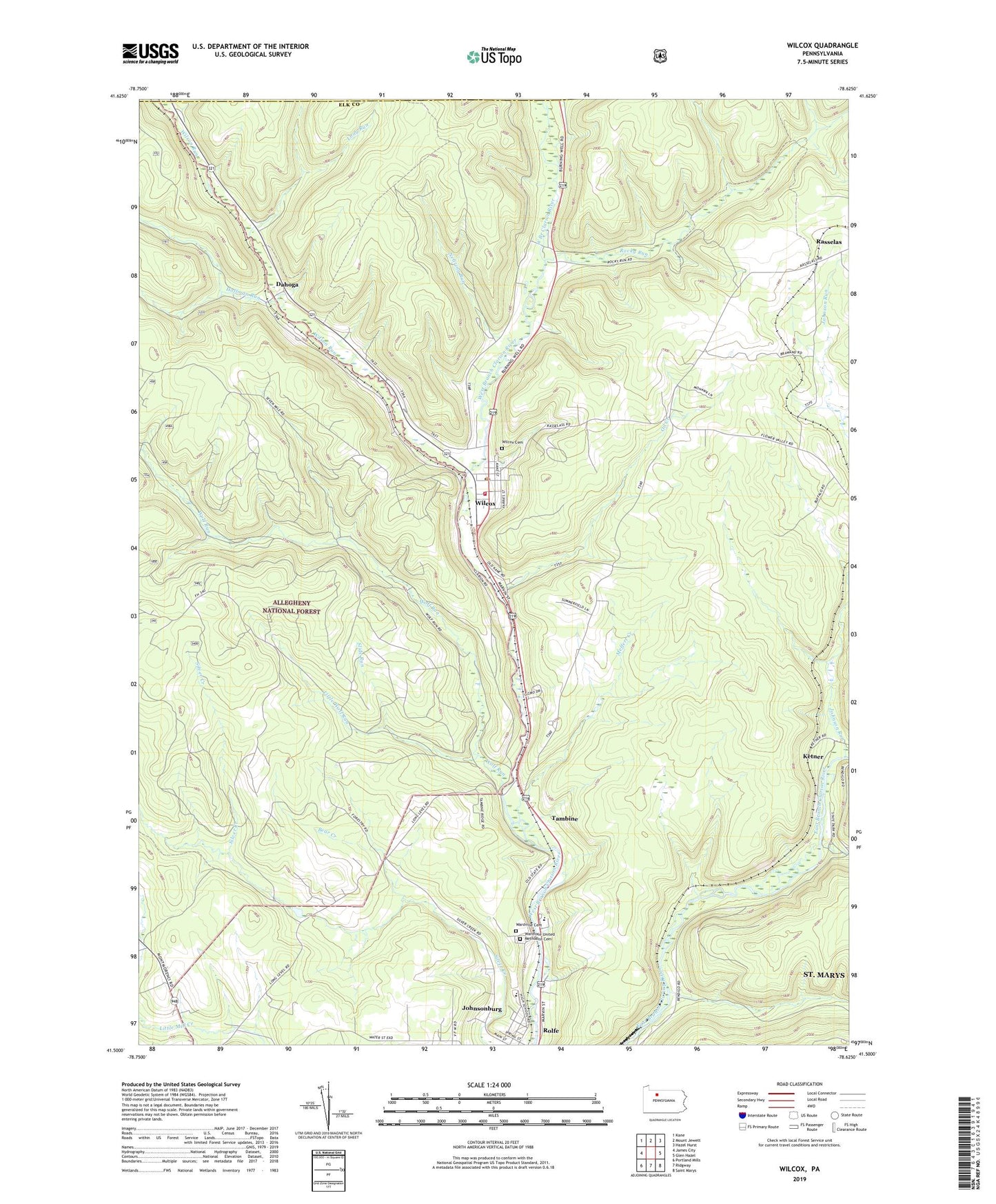
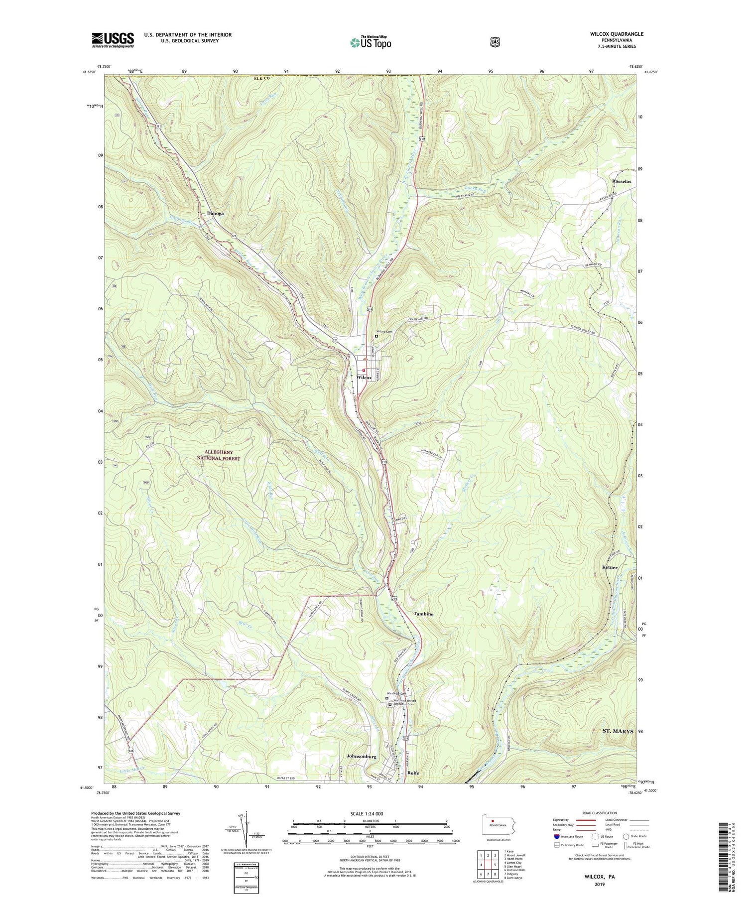
2019 topographic map quadrangle Wilcox in the state of Pennsylvania. Scale: 1:24000. Based on the newly updated USGS 7.5' US Topo map series, this map is in the following counties: Elk, McKean. The map contains contour data, water features, and other items you are used to seeing on USGS maps, but also has updated roads and other features. This is the next generation of topographic maps. Printed on high-quality waterproof paper with UV fade-resistant inks.
Quads adjacent to this one:
West: James City
Northwest: Kane
North: Mount Jewett
Northeast: Hazel Hurst
East: Glen Hazel
Southeast: Saint Marys
South: Ridgway
Southwest: Portland Mills
Contains the following named places: Bear Creek, Bendigo Run, Bendigo State Park, Bridgetown, Clarion Junction Station, Dahoga, Hoffman Run, Indian Run, Johnson Run, Johnsonburg Area Elementary School, Johnsonburg Area Junior Senior High School, Ketner, Little Wolf Run, Long Run, Meffert Creek, Mill Creek Oil and Gas Field, Nansen Oil and Gas Field, Nearing Run, Oil Creek, Rocky Run, Slide Run, Tambine, Wardvale United Methodist Cemetery, Wardville Cemetery, Wilcox, Wilcox Cemetery, Wilcox Census Designated Place, Wilcox Post Office, Wilcox Volunteer Fire Department Company 6, Wilson Run, Wolf Run