MyTopo
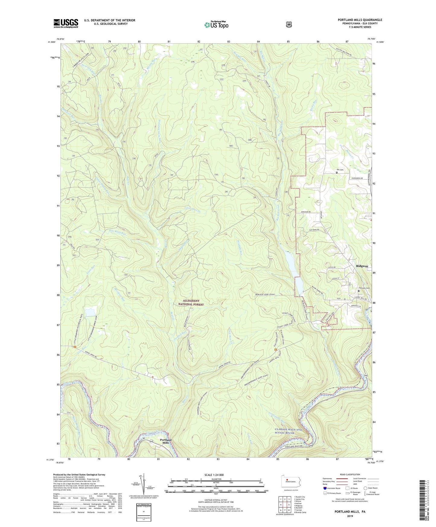
Portland Mills Pennsylvania US Topo Map
Couldn't load pickup availability
Also explore the Portland Mills Forest Service Topo of this same quad for updated USFS data
2023 topographic map quadrangle Portland Mills in the state of Pennsylvania. Scale: 1:24000. Based on the newly updated USGS 7.5' US Topo map series, this map is in the following counties: Elk. The map contains contour data, water features, and other items you are used to seeing on USGS maps, but also has updated roads and other features. This is the next generation of topographic maps. Printed on high-quality waterproof paper with UV fade-resistant inks.
Quads adjacent to this one:
West: Hallton
Northwest: Russell City
North: James City
Northeast: Wilcox
East: Ridgway
Southeast: Brandy Camp
South: Carman
Southwest: Munderf
This map covers the same area as the classic USGS quad with code o41078d7.
Contains the following named places: Bear Creek, Bear Creek Gas Field, Bear Creek Picnic Area, Big Mill Creek, Bloody Run, Central Trail, Connerville Run, Crooked Run, Davidson Run, Fairview Cemetery, Island Run, Italian Shanty Run, Kings Airfield, Little Bear Creek, Little Otter Creek, Mill Creek, North Branch Island Run, Norton Dam, Ott Cemetery, Ott School, Otter Run, Pole Road Run, Portland Mills, Red Lick Run, Red Mill Run, Ridgeway Forest Service Station, Ridgway Reservoir, Rocky Run, Round Top Fire Tower, Shanty Run, South Branch Island Run, Standing Stone Run, Twin Lick Run, Windfall Run, ZIP Code: 15853