MyTopo
Williamson Pennsylvania US Topo Map
Couldn't load pickup availability
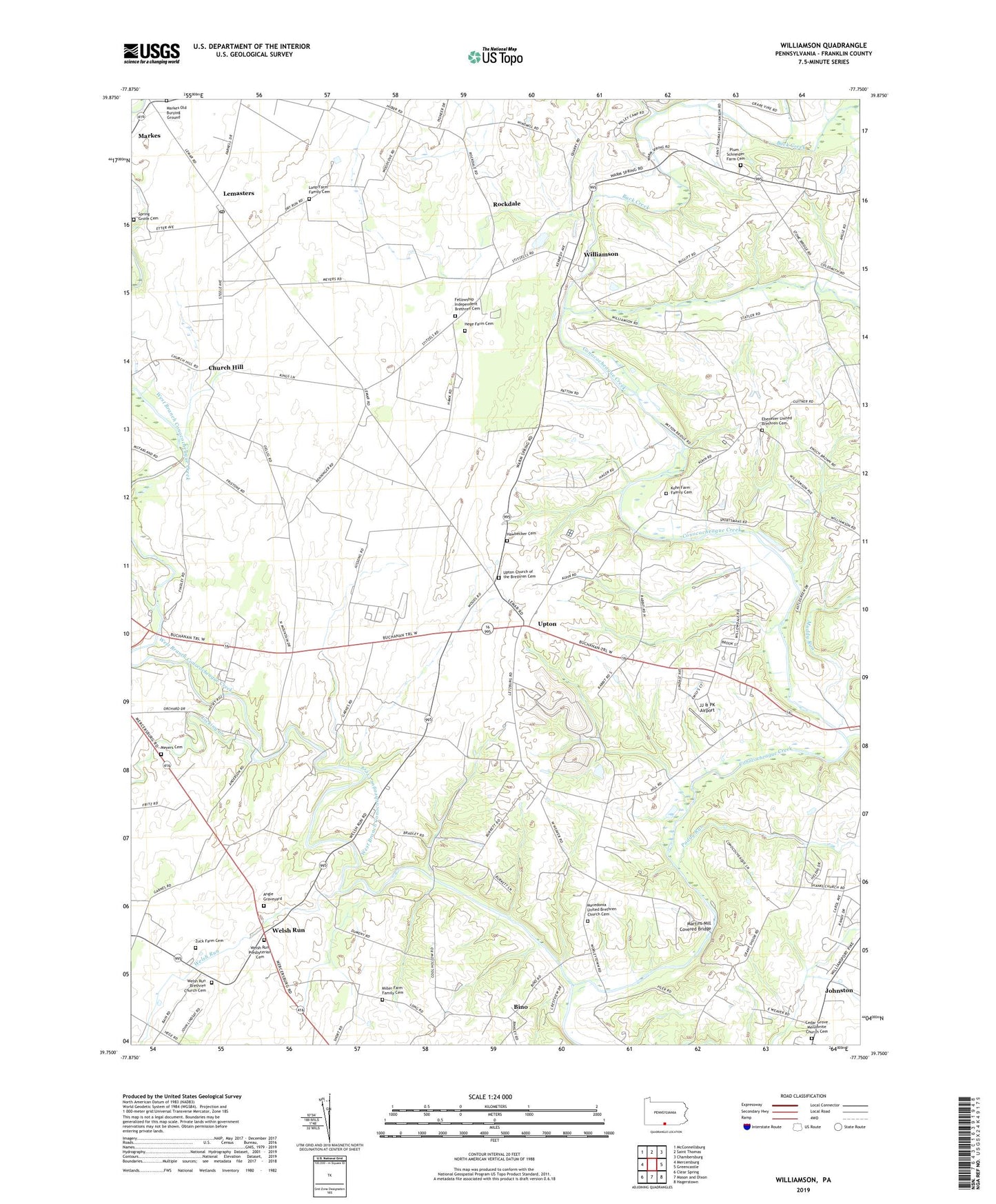
2019 topographic map quadrangle Williamson in the state of Pennsylvania. Scale: 1:24000. Based on the newly updated USGS 7.5' US Topo map series, this map is in the following counties: Franklin. The map contains contour data, water features, and other items you are used to seeing on USGS maps, but also has updated roads and other features. This is the next generation of topographic maps. Printed on high-quality waterproof paper with UV fade-resistant inks.
Quads adjacent to this one:
West: Mercersburg
Northwest: McConnellsburg
North: Saint Thomas
Northeast: Chambersburg
East: Greencastle
Southeast: Hagerstown
South: Mason and Dixon
Southwest: Clear Spring
Contains the following named places: Angle Graveyard, Back Creek, Bino, California School, Campbell Run, Cedar Grove Mennonite Church Cemetery, Church Hill, Ebenezer United Brethren Cemetery, Enoch Brown Memorial Park, Fellowship Independent Brethren Cemetery, Fort Steel, Franklin School, Hawbecker Cemetery, Hege Farm Cemetery, Highland School, JJ & PK Airport, Johnston, Kuhn Farm Family Cemetery, Lehmasters Station, Lemasters, Lemasters Post Office, Licking Creek, Loop Farm Family Cemetery, Macedonia United Brethren Church Cemetery, Markes, Markes Old Burying Ground, Martins Mill Covered Bridge, Meyers Cemetery, Miller Farm Family Cemetery, Muddy Run, Paddy Run, Paradise School, Pinefield School, Plum - Schneider Farm Cemetery, Rising Sun School, Rock Hill School, Rockdale, Saint Thomas Elementary School, Spring Grove Cemetery, Stone Bridge, Upton, Upton Church of the Brethren Cemetery, Vanilla, Welsh Run, Welsh Run Brethren Church Cemetery, Welsh Run Presbyterian Cemetery, West Branch Conococheague Creek, Williamson, WRCV-FM (Mercersburg), Zuck Farm Cemetery, ZIP Codes: 17225, 17270