MyTopo
Central Aguirre Puerto Rico US Topo Map
Couldn't load pickup availability
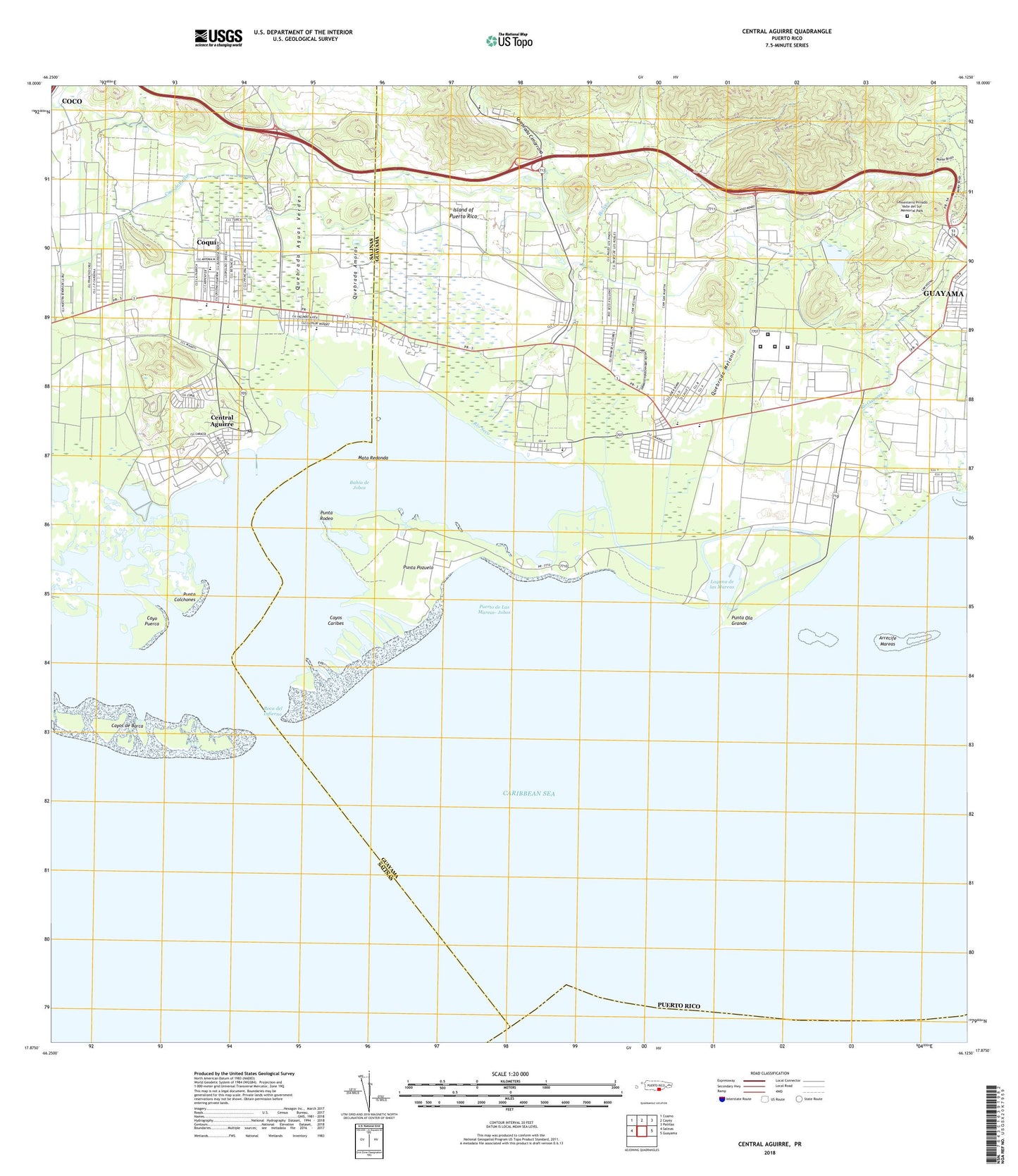
2024 topographic map quadrangle Central Aguirre in the state of Puerto Rico. Scale: 1:20000. Based on the newly updated USGS 7.5' US Topo map series, this map is in the following counties: Salinas, Guayama. The map contains contour data, water features, and other items you are used to seeing on USGS maps, but also has updated roads and other features. This is the next generation of topographic maps. Printed on high-quality waterproof paper with UV fade-resistant inks.
Quads adjacent to this one:
West: Salinas
Northwest: Coamo
North: Cayey
Northeast: Patillas
East: Guayama
Contains the following named places: Aguirre Golf Club, Aguirre Post Office, Aguirre Private School, Arrecife Mareas, Bahia de Jobos, Barrancas, Besosa, Boca del Infierno, Bosque Estatal de Aguirre, Canal de Guamani oeste, Canal de Patillas, Cayo Puerca, Cayos Caribes, Cayos de Barca, Cementerio Privado Valle del Sur Memorial Park, Central Aguirre, Central Aguirre Comunidad, Central Aguirre Subbarrio, Central Guamani, Chun Chin, Cimarrona, Colegio del Perpetuo Socorro, Coqui, Coqui Comunidad, Coqui Subbarrio, Escuela Luce, Escuela Pozuelo, Estuanna Nacional Bahia Jobos Hunting Reserve, Guayama Municipio, Jobos, Jobos Barrio, Jobos Comunidad, Josefa, Lago Melania, Laguna de las Mareas, Las Mareas, Mata Redonda, Pozo Hondo Barrio, Puerto de Jobos, Puerto de Las Mareas-Jobos, Punta Colchones, Punta Ola Grande, Punta Pozuelo, Punta Rodeo, Quebrada Aguas Verdes, Quebrada Amoros, Quebrada Cimarrona, Quebrada Melania, Reunion, Rio Guamani, Rio Seco, San Felipe, San Felipe Subbarrio, Villodas, WXRF-AM (Guayama), ZIP Code: 00704