MyTopo
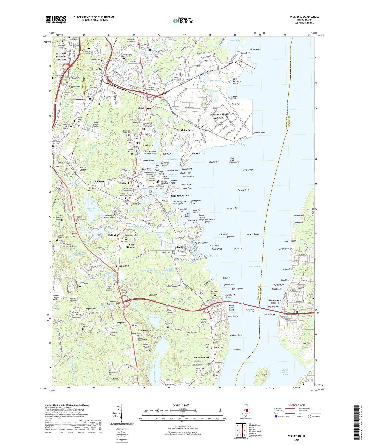
Wickford Rhode Island US Topo Map
Couldn't load pickup availability
2024 topographic map quadrangle Wickford in the state of Rhode Island. Scale: 1:24000. Based on the newly updated USGS 7.5' US Topo map series, this map is in the following counties: Washington, Newport, Kent. The map contains contour data, water features, and other items you are used to seeing on USGS maps, but also has updated roads and other features. This is the next generation of topographic maps. Printed on high-quality waterproof paper with UV fade-resistant inks.
Quads adjacent to this one:
West: Slocum
Northwest: Crompton
North: East Greenwich
Northeast: Bristol
East: Prudence Island
Southeast: Newport
South: Narragansett Pier
Southwest: Kingston
This map covers the same area as the classic USGS quad with code o41071e4.
Contains the following named places: Academy Cove, Allen - Pierce Farm Cemetery, Allen Harbor, Allenton, America Ledge, Annaquatucket, Annaquatucket Reservoir, Annaquatucket River, Barber Heights, Belleville, Belleville Pond, Bellville Pond Dam, Big Rock Point, Bissel Cove, Black Swamp, Brig Ledge, Briggs Corner, Caleb Allen Cemetery, Calf Neck, Camp Endicott, Camp Thomas, Captain Nathan Brown Lot Cemetery, Carr Cemetery, Carr Pond, Carr Pond Dam, Casey Cemetery, Casey Point, Cedar Cemetery, Cedar Swamp Ledge, Cedar Tree Point, Charles Rock, Chase Cemetery, Clark Point, Cocumcussoc, Cocumcussoc Brook, Cocumscussoc, Cocumscussoc State Park, Cold Spring Beach, Cold Spring Rock, Conanicut Island, Congdon - Gardiner Cemetery, Congdon Hill, Coon Ledge, Cornelius Island, David Green Lot Cemetery, David Greene Cemetery, Davis Memorial Wildlife Refuge, Davis Mill, Davisville, Davisville Construction Battalion Center, Davisville Depot, Davisville Historic District, Davisville Naval Construction Battalion Center, Davol Pond, Devils Foot, Dick Rock, Duck Cove, Dutch Island, Dutch Island Management Area, Eldridge Creek, Elm Grove Cemetery, Feurer Park, Fiddlesticks Recreational Sports Facility, Fishing Cove, Flagg Lane Cemetery, Flat Rock, Fones - Hazard Cemetery, Fort Greble, Fowler Rock, Fox Island, Friends Cemetery, Frys Pond, General Rock, George Thomas Plot, Gilbert Stuart Birthplace and Snuff Mill, Great Creek, Great Ledge, Greene Point, Halfway Ledge, Hall Creek, Halls Creek, Hamilton, Hamilton Mill Village Historic District, Hammond Hill, Hannah Robinson Rock, Hazard Farm, Henry Burlingame Lot, Hiscox Cemetery, Hornbeam Chapel, Hulings Corner, Hull Ledge, Hunt - Hall Cemetery, James Ledge, Jamestown Brook, Jamestown Shores, Jamestown-Saunderstown Ferry, Jenkins Pond, John Cashman Lot Cemetery, John Congdon Plot, John Eldred Plot, John Gardiner Cemetery, Joseph Hammond Lot, Judge Ezekiel Gardiner Lot Cemetery, Kettle Hole Pond, Kiefer Park, Kingstown Plaza Shopping Center, Lafayette, Little Tree Point, Lone Tree Point, Long Point, Major Joshua Davis Lot Cemetery, Major Samuel Phillips Lot Cemetery, Manney Rock, Mattatuxet River, Mill Cove, Mill Creek, Mill Pond, Mill Rock, Narragansett Terrace, Nathaniel C Carpenter Lot Cemetery, Naval Air Station Quonset Point, North Kingstown, North Kingstown Beach, North Kingstown Emergency Operations Pad, North Kingstown Golf Course, North Kingstown Town Beach, Oak Hill Pond, Old Baptist Church Yard Cemetery, Old Burlingame Cemetery, Old Episcopal Church Yard Cemetery, Old Gay Rock, Old Meetinghouse, Old Sergeant, Old Sow Rock, Oliver Gardiner Cemetery, Packard Rocks, Pearce - Watson Cemetery, Peleg Card Cemetery, Pettaquamscutt Cove National Wildlife Refuge, Phillips Cemetery, Pine River, Platform Cemetery, Plum Beach, Plum Beach Lighthouse, Plum Beach Point, Plum Point, Plum Point Beach, Point Wharf, Poplar Point, Poplar Point Lighthouse, Pork Hill, Potowomut Pond, Potowomut Pond Dam, Quidnessett Memorial Cemetery, Quonset Air Guard Base, Quonset Point, Quonset Point State Airport, Quonset State Airport, Quonset State Ang Helipad, Rabbit Island, Ray Huling Lot Cemetery, Red Rock, Reynolds Cemetery, Richard Smiths Grove, Ridge Hill, Rodman Mill, Rodman Mill Pond, Rome Point, Rowland Chadsey Lot Cemetery, Rufus Hunt Cemetery, Ryan Park, Samuel Boone Yard Cemetery, Sand Point, Sandhill Brook, Sandhill Pond, Sassamore Rock, Sauga Point, Saunderstown, Saunderstown Historic District, Saunderstown Yacht Club, Saw Mill Pond, Scrabbletown, Scrabbletown Brook, Seal Rock, Secret Lake, Sedgefield Road Cemetery, Shady Lea, Shady Lea Historic District, Sherman Cemetery, Shewatuck Brook, Shore Acres, Silas Casey Farm, Silver Spring Lake, Silver Spring Lake Dam, Silver Spring Lake Public Fishing Area, Sinker Rock, Slocum Ledge, Slocum Point, Spink Neck, Stook Hill, Sunset Beach, Sweet And Austin Lot Cemetery, Sylvester Himes Lot Cemetery, Sylvester Pierce Lot, The Brothers, The Clump, The Hummocks, The Narrows, Three Sisters, Town of North Kingstown, Viall Creek, Wannuchecomecut Brook, Wanton Himes Lot Cemetery, Wertz and Viall Pond, Wertz and Viall Pond Dam, West Passage, Wickford, Wickford Commons Mall, Wickford Cove, Wickford Harbor, Wickford Historic District, Wickford Junction, Wickford Lighthouse, Wickford Yacht Club, Wild Goose Ledge, Wild Goose Point, William Hall Plot, William Sherman Lot Cemetery, William Smith Cemetery, Woodland Golf and Country Club, Yorktown Shopping Center, Zebulon Northup Cemetery, ZIP Codes: 02835, 02852, 02874


