MyTopo
Carlisle SE South Carolina US Topo Map
Couldn't load pickup availability
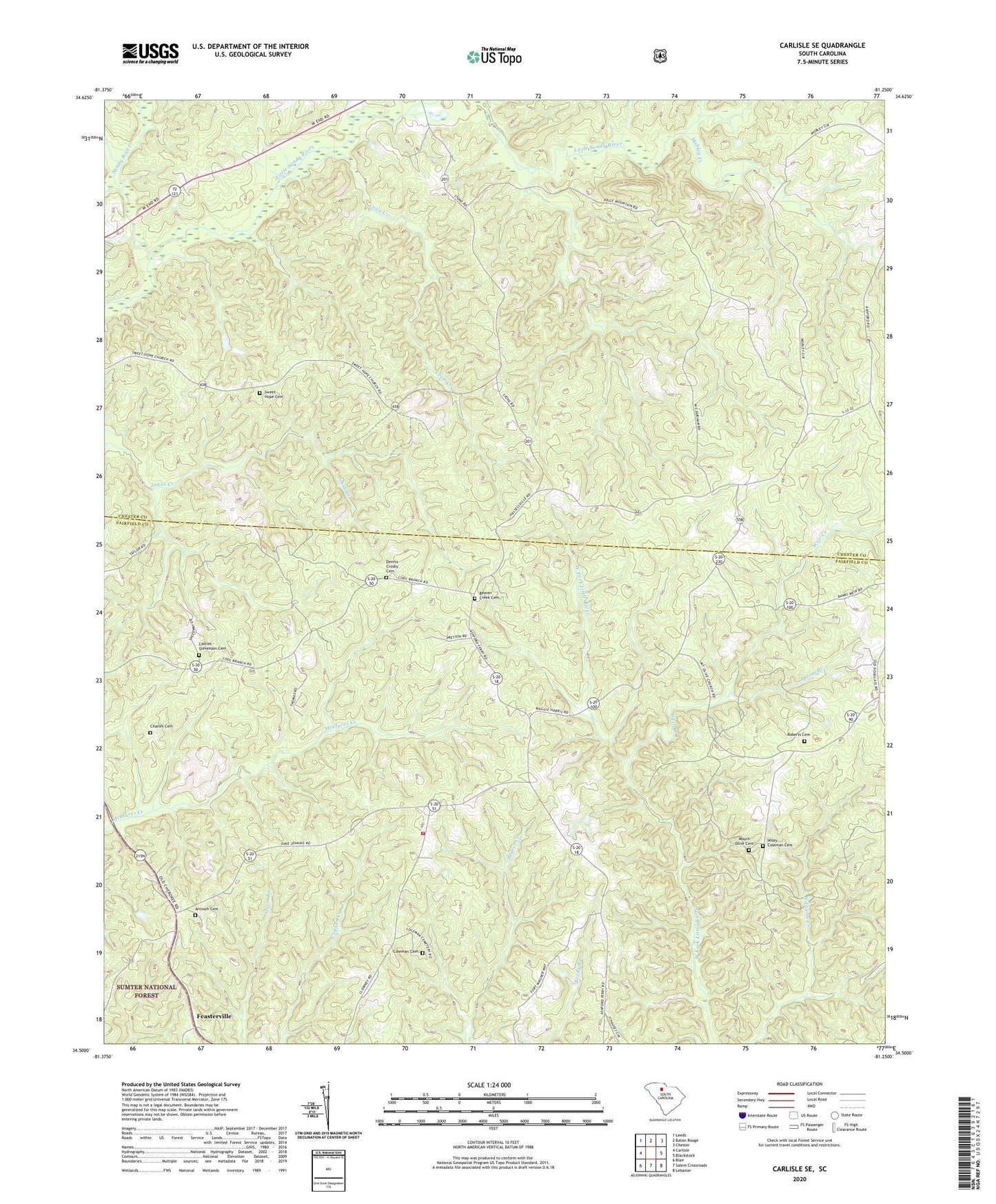
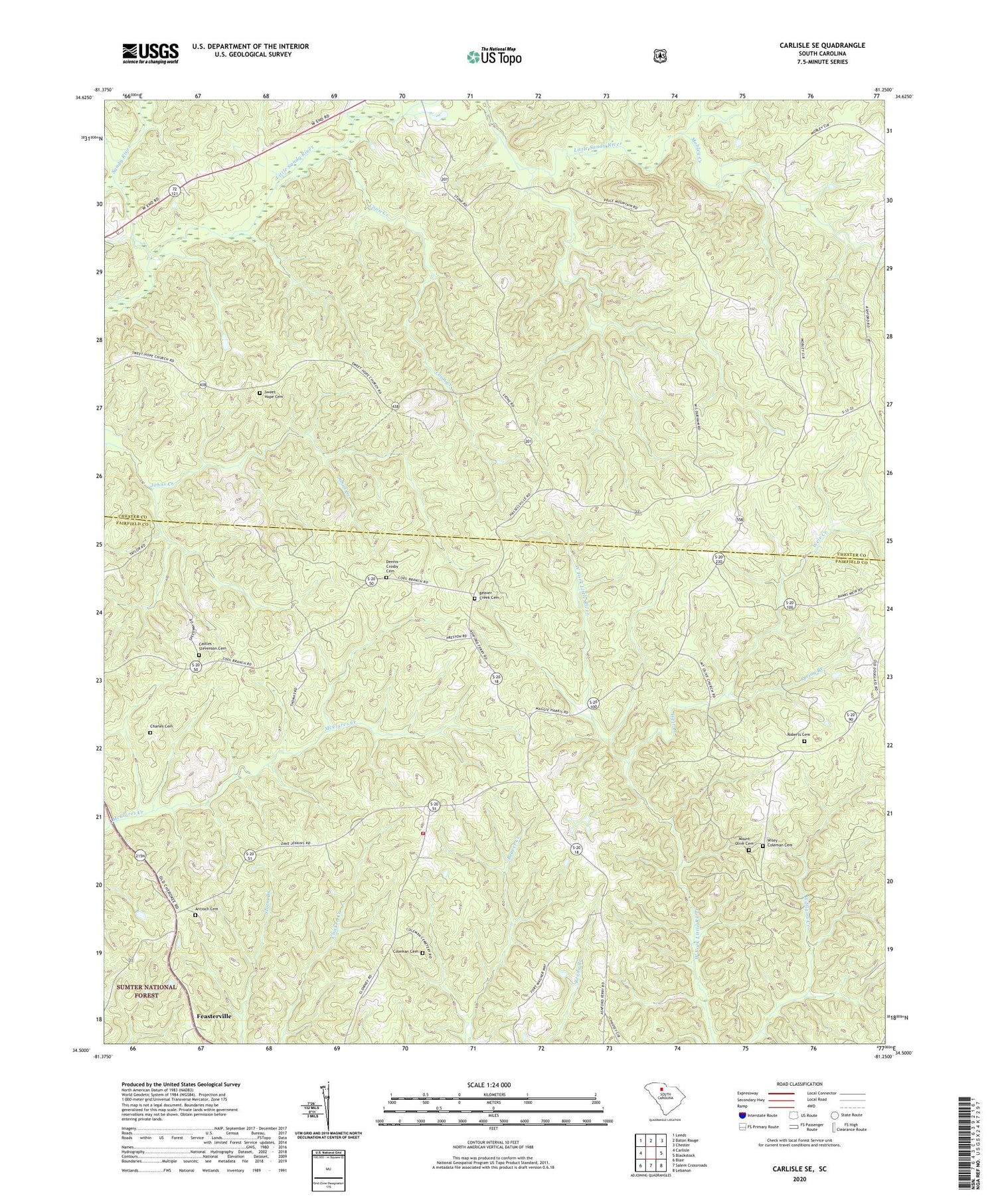
2020 topographic map quadrangle Carlisle SE in the state of South Carolina. Scale: 1:24000. Based on the newly updated USGS 7.5' US Topo map series, this map is in the following counties: Chester, Fairfield. The map contains contour data, water features, and other items you are used to seeing on USGS maps, but also has updated roads and other features. This is the next generation of topographic maps. Printed on high-quality waterproof paper with UV fade-resistant inks.
Quads adjacent to this one:
West: Carlisle
Northwest: Leeds
North: Baton Rouge
Northeast: Chester
East: Blackstock
Southeast: Lebanon
South: Salem Crossroads
Southwest: Blair
Contains the following named places: Antioch Cemetery, Antioch Church, Beaver Creek Cemetery, Beaver Creek Church, Castles - Stevenson Cemetery, Charles Cemetery, Coleman Cemetery, Coon Creek, Dennis Crosby Cemetery, Fairfield County Fire Department Feasterville, Feasterville, Featerville Academy Historic District, Featerville Community Center, Featerville Male and Female Academy, Hope Station School, Liberty Universal Church, Little Sandy River, Mizpah Presbyterian Church, Mobley Creek, Momans Mill, Mount Olive Cemetery, Mount Olive Church, Mount Olive School, Mount Pilgrim Church, Mount Pilgrim School, New Hope Church, Old Hope Station Church, Piney Grove Church, Purity Church, Purity School, Roberts Cemetery, Spring Branch, Sweet Hope Cemetery, Sweet Hope Church, Upper Hope Station Church, Weir Creek, Wiley Coleman Cemetery