MyTopo
Cassatt South Carolina US Topo Map
Couldn't load pickup availability
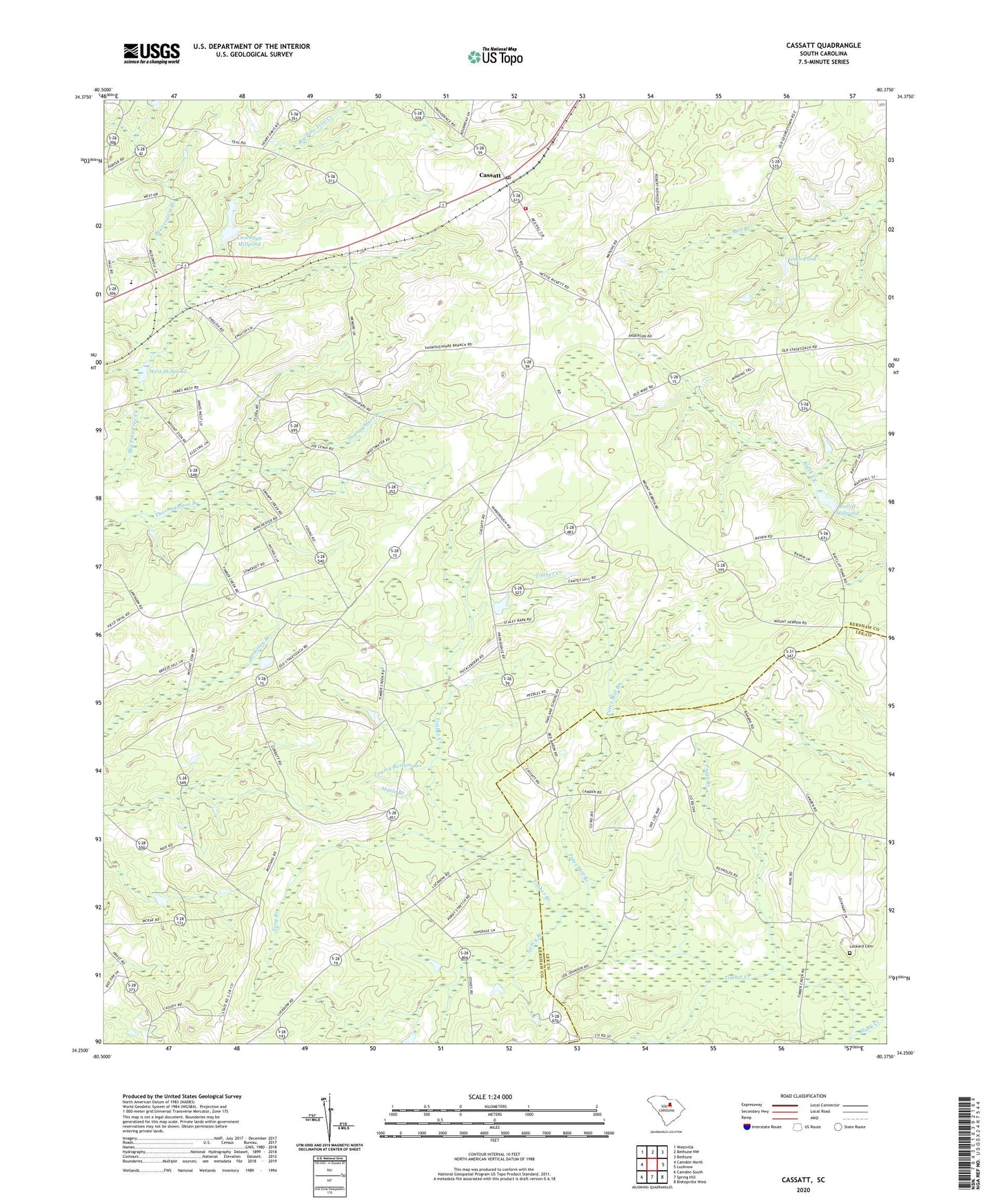
2020 topographic map quadrangle Cassatt in the state of South Carolina. Scale: 1:24000. Based on the newly updated USGS 7.5' US Topo map series, this map is in the following counties: Kershaw, Lee. The map contains contour data, water features, and other items you are used to seeing on USGS maps, but also has updated roads and other features. This is the next generation of topographic maps. Printed on high-quality waterproof paper with UV fade-resistant inks.
Quads adjacent to this one:
West: Camden North
Northwest: Westville
North: Bethune NW
Northeast: Bethune
East: Lucknow
Southeast: Bishopville West
South: Spring Hill
Southwest: Camden South
Contains the following named places: Beaverdam Branch, Black River School, Cantey Hill Church, Cantey Hill School, Cassatt, Cassatt Baptist Church, Cassatt Church, Cassatt Post Office, Cassatt School, Central School, Deliverance Tabernacle, Fuzzy Branch, Gogo Pond, Gogo Pond Dam D-2507, Grassy Bottom Branch, Greenwood School, Hickman School, Hudson Pond, Hyatts Millpond, Kershaw County Fire Department Cassatt Station, Lewellem Millpond, Llewellyn Millpond, Lockard Cemetery, Long Branch, Manhaven Church, Maple Branch, Marshalls Church, Midway School, Mount Pisgah Church, Mount Zion Church, Mount Zion School, Nancy Branch, Pates Mill Branch, Pine Tree Presbyterian Church, Ratliff Millpond, Red Hill Church, Sandy Grove Church, Shrocks Mill, Shrocks Mill School, Shrocks Plantation, South Carolina Noname 28010 D-1064 Dam, South Carolina Noname 28039 D-1147 Dam, South Carolina Noname 28049 D-2508 Dam, Timber Creek, West Millpond, ZIP Code: 29032