MyTopo
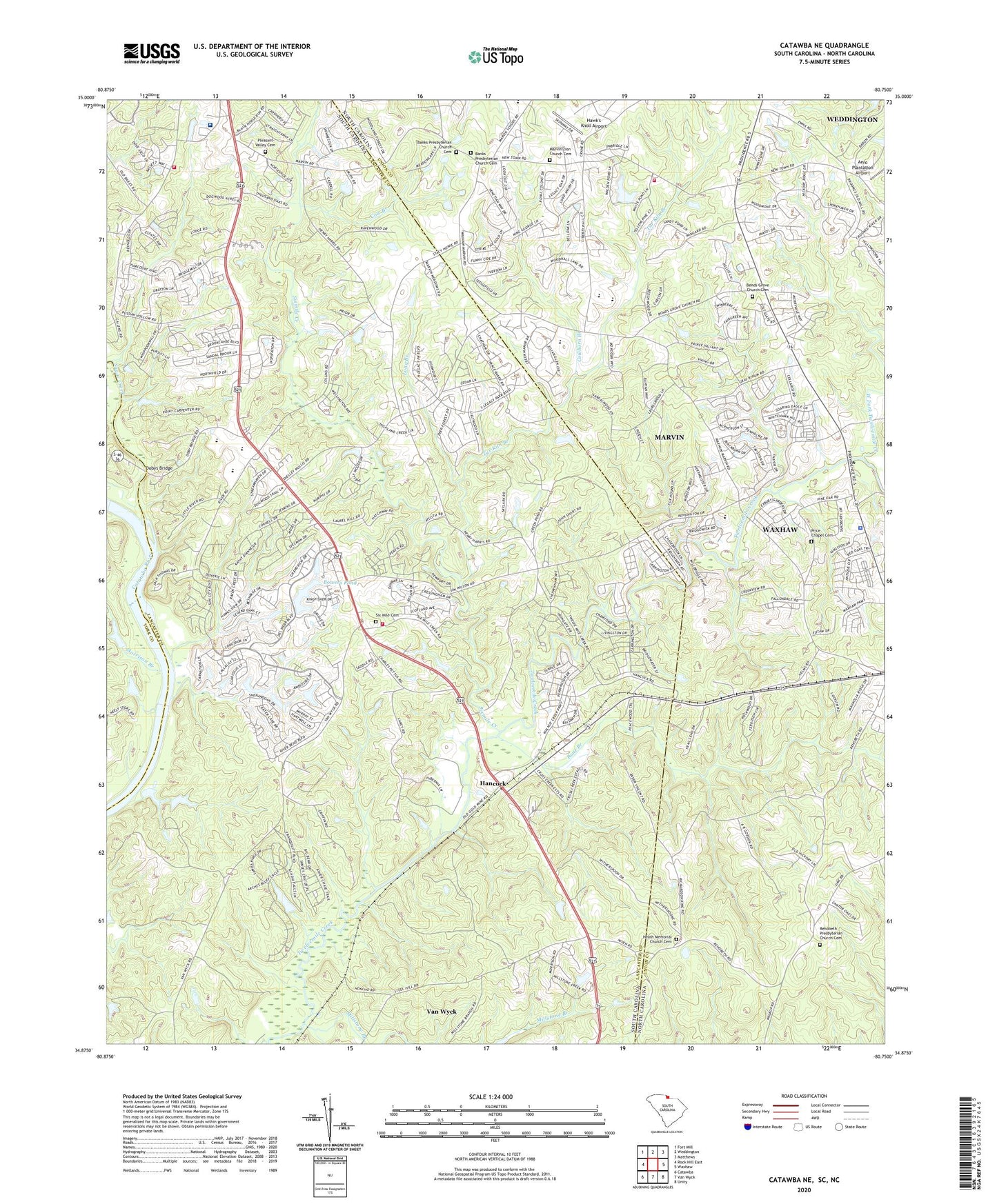
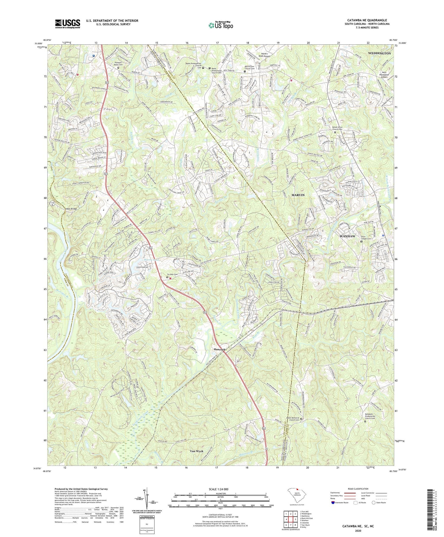
Catawba NE South Carolina US Topo Map
Couldn't load pickup availability
2020 topographic map quadrangle Catawba NE in the states of South Carolina, North Carolina. Scale: 1:24000. Based on the newly updated USGS 7.5' US Topo map series, this map is in the following counties: Lancaster, Union, York. The map contains contour data, water features, and other items you are used to seeing on USGS maps, but also has updated roads and other features. This is the next generation of topographic maps. Printed on high-quality waterproof paper with UV fade-resistant inks.
Quads adjacent to this one:
West: Rock Hill East
Northwest: Fort Mill
North: Weddington
Northeast: Matthews
East: Waxhaw
Southeast: Unity
South: Van Wyck
Southwest: Catawba
Contains the following named places: Banks Church, Banks Presbyterian Church Cemetery, Belair, Belair Church, Bends Grove Church Cemetery, Black Horse Run, Bonds Grove Church, Bowers Pond, Bowers Pond D-1745 Dam, Cow Branch, Cowhorn Branch, Dobys Bridge, East Fork Twelvemile Creek, Elbethel Church, Elbethel School, Gold Hill Church, Gold Hill School, Hancock, Hawk's Knoll Airport, Heath Memorial Church, Heath Memorial Church Cemetery, Indian Land Church, Indian Land Elementary School, Indian Land Fire Department Station 10, Indian Land High School, Jackson Pond Dam D-1751, Johnston Pond D-1746 Dam, Long Branch, Macedonia Church, Marvin, Marvin Zion Church Cemetery, Millstone Branch, Morrison Branch, Nesbit Farms Incorporated Pond Number One D-1747 Dam, Nesbit Farms Incorporated Pond Number Two D-1749 Dam, Osceola Church, Osceola School, Pleasant Pines Church, Pleasant Valley Cemetery, Pleasant Valley Church, Pleasant Valley Fire Department Station 14, Pleasant Valley School, Price Chapel, Price Chapel Cemetery, Providence Church, Redding Springs Church, Rehobeth Church, Rehobeth Presbyterian Church Cemetery, Rone Branch, Schewzyk Pond Dam D-1750, Six Mile Cemetery, Sixmile Creek, Sixmile Creek Church, Steel Hill Church, Steel Hill School, Sugar Creek, Surgery Center at Edgewater, Tar Kiln Branch, Union Emergency Medical Services, Van Wyck Division, Waxhaw Police Department, Wesley Chapel Volunteer Fire Department Station 31, West Fork Twelvemile Creek, Wikoff Pond Dam D-1748, Wolfville, Zion Church, ZIP Code: 29707