MyTopo
Dacusville South Carolina US Topo Map
Couldn't load pickup availability
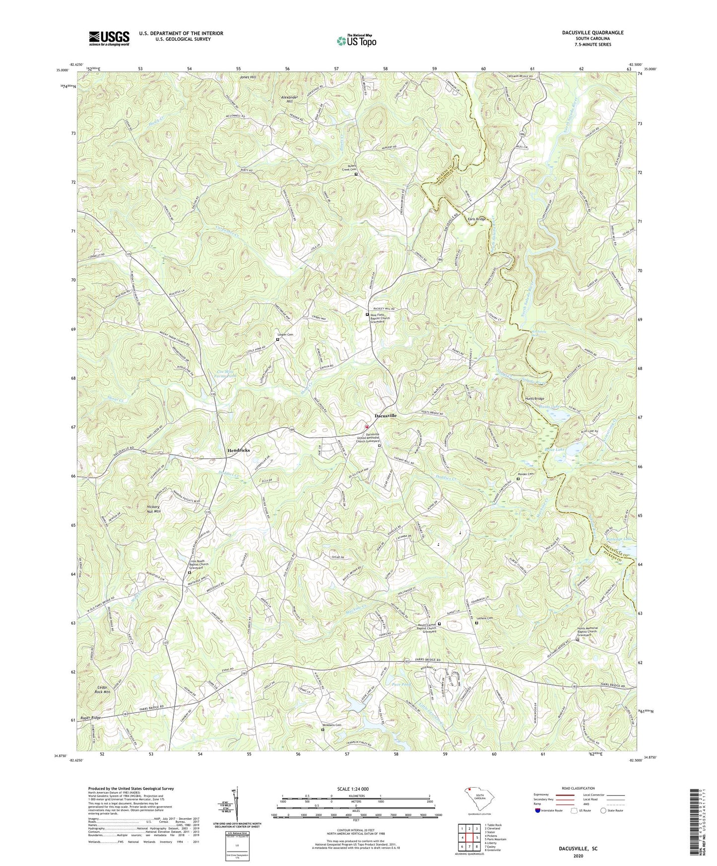
2024 topographic map quadrangle Dacusville in the state of South Carolina. Scale: 1:24000. Based on the newly updated USGS 7.5' US Topo map series, this map is in the following counties: Pickens, Greenville. The map contains contour data, water features, and other items you are used to seeing on USGS maps, but also has updated roads and other features. This is the next generation of topographic maps. Printed on high-quality waterproof paper with UV fade-resistant inks.
Quads adjacent to this one:
West: Pickens
Northwest: Table Rock
North: Cleveland
Northeast: Slater
East: Paris Mountain
Southeast: Greenville
South: Easley
Southwest: Liberty
This map covers the same area as the classic USGS quad with code o34082h5.
Contains the following named places: Alexander Hill, Armstrong Creek, Belue Lake, Beverly Hills, Carpenter Creek, Cedar Rock Mountain, Cox Mini Farms Pond, Cox Mini Farms Pond Dam D-1938, Cox Pond, Cox Pond Dam D-1939, Cross Plains School, Cross Roads Baptist Church, Cross Roads Baptist Church Graveyard, Dacusville, Dacusville Census Designated Place, Dacusville Church of God, Dacusville Elementary School, Dacusville Fire Department, Dacusville Junior High School, Dacusville United Methodist Church, Dacusville United Methodist Church Graveyard, Doddies Creek, Earls Bridge, Easley East Division, Hendricks, Hesters Store, Hickory Nut Mountain, Homers Pond, Homers Pond Dam D-1937, Hunts Bridge, Hunts Lake, Hunts Memorial Baptist Church, Hunts Memorial Baptist Church Graveyard, Hunts Mill, Jamason Pond, Jamason Pond Dam D-1927, Jameson Family Cemetery, Jones Hill, Jones Hill Church, Lathem Cemetery, Looper Cemetery, Machine Creek, Maynard School, McAdams Cemetery, McElhenny Shoal, Mica School, Mount Carmel Baptist Church, Mount Carmel Baptist Church Graveyard, Mount Tabor Church, Nine Forks Baptist Church, Nine Forks Baptist Church Graveyard, North Saluda River, Ole Salem Estates, Pace Pond, Peters Creek, Peters Creek Baptist Church, Peters Creek Cemetery, Peters Creek School, Philpat Pond, Philpat Pond Dam D-1926, Ponder Cemetery, Rich Pond, Rich Pond Dam D-1928, Rolling Green Golf Course, Rutledge Lake, Saint James Church, Shiloh Church, Shoal Creek, Shoal Creek Church, Shoal Creek School, South Carolina Noname 39003 D-1931 Dam, South Carolina Noname 39005 D-1930 Dam, South Carolina Noname 39022 D-1925 Dam, South Carolina Noname 39024 D-1929 Dam, South Saluda River, Vineland School, Whitmire Branch, ZIP Code: 29640