MyTopo
Delmar South Carolina US Topo Map
Couldn't load pickup availability
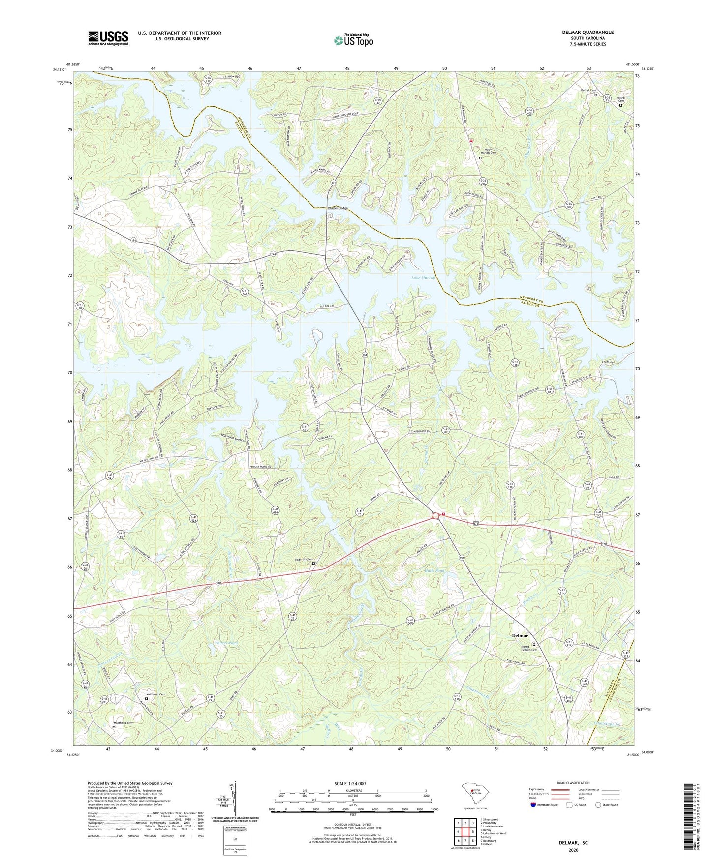
2020 topographic map quadrangle Delmar in the state of South Carolina. Scale: 1:24000. Based on the newly updated USGS 7.5' US Topo map series, this map is in the following counties: Saluda, Newberry, Lexington. The map contains contour data, water features, and other items you are used to seeing on USGS maps, but also has updated roads and other features. This is the next generation of topographic maps. Printed on high-quality waterproof paper with UV fade-resistant inks.
Quads adjacent to this one:
West: Denny
Northwest: Silverstreet
North: Prosperity
Northeast: Little Mountain
East: Lake Murray West
Southeast: Gilbert
South: Batesburg
Southwest: Emory
Contains the following named places: Batesburg-Leesville Division, Beaverdam Creek, Bethel Cemetery, Bethel Church, Bethel Number 1 Church, Big Creek, Blacks Bridge, Booser Hill Church, Bush River, Circle Fire Department Station 800, Clapboard Branch, Clouds Creek, Cool Spring School, Corinth, Delmar, Delmar Community Center, Delmar School, Fairview School, Halls Pond, Halls Pond Dam D-1603, Hawleek Creek, Holley School, Little Saluda River, Long Branch, Matthews Cemetery, Mission Church, Mount Hebron Cemetery, Mount Hebron Lutheran Church, Mount Moriah Cemetery, Mount Moriah Church, Mount Moriah School, Mount Olive Church, Nazareth Cemetery, Nazareth Church, Newberry County Rural Fire Department O'Neal, O'Neal Cemetery, Oneal School, Philippi Church, Philippi School, Pleasant Grove School, Saint Marks Church, Spring Creek, Utopia School, Vances Pond, Vances Pond Dam D-1602, West Creek, Wyses Ferry