MyTopo
Denny South Carolina US Topo Map
Couldn't load pickup availability
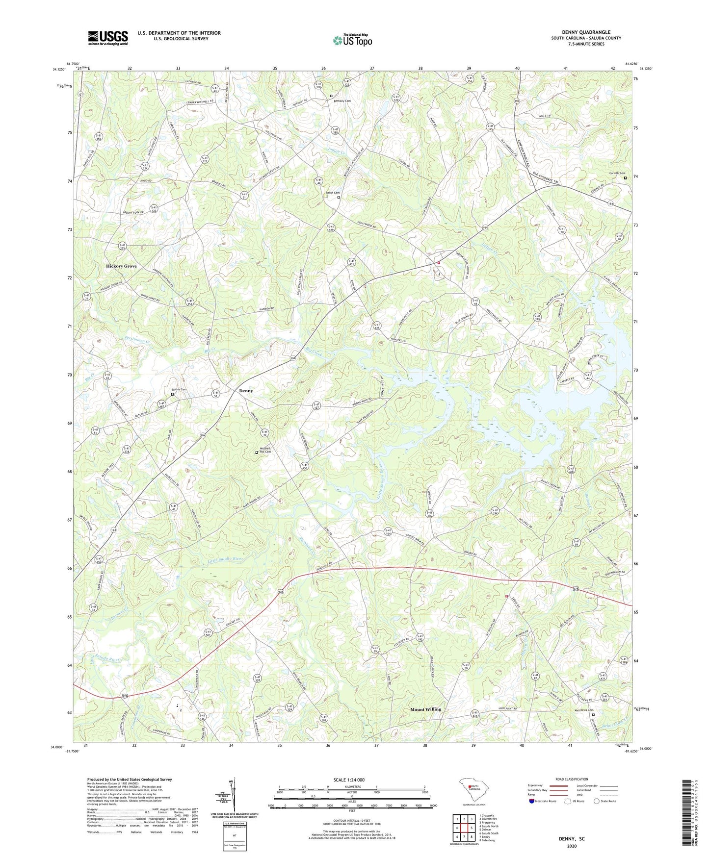
2024 topographic map quadrangle Denny in the state of South Carolina. Scale: 1:24000. Based on the newly updated USGS 7.5' US Topo map series, this map is in the following counties: Saluda. The map contains contour data, water features, and other items you are used to seeing on USGS maps, but also has updated roads and other features. This is the next generation of topographic maps. Printed on high-quality waterproof paper with UV fade-resistant inks.
Quads adjacent to this one:
West: Saluda North
Northwest: Chappells
North: Silverstreet
Northeast: Prosperity
East: Delmar
Southeast: Batesburg
South: Emory
Southwest: Saluda South
This map covers the same area as the classic USGS quad with code o34081a6.
Contains the following named places: Bethany Cemetery, Bethany Church, Bethany School, Bethlehem Church, Bethlehem School, Big Creek, Burnets Creek, Butler Cemetery, Butler Church, Butler School, Canebrake Branch, Cedar Grove School, Cherry Hill School, Corinth Cemetery, Corinth Lutheran Church, Dailey Creek, Deans Chapel, Denny, Hickory Grove, Hickory Grove Church, Hickory Grove School, Holiness Tabernacle, Hollywood Fire Department Number 700, Hollywood High School, Indian Creek, Matthews Cemetery, Merchant, Midland Fire Department Number 900, Mitchell Hill Advent Church, Mitchell Hill Cemetery, Mount Moses School, Mount Willing, North Saluda Division, Open Bible Church, Persimmon Creek, Pine Pleasant Church, Providence Church, Providence School, Richland Creek, Salem Church, Saluda County, Sardis Church, Sardis School, Smith Cemetery