MyTopo
Prosperity South Carolina US Topo Map
Couldn't load pickup availability
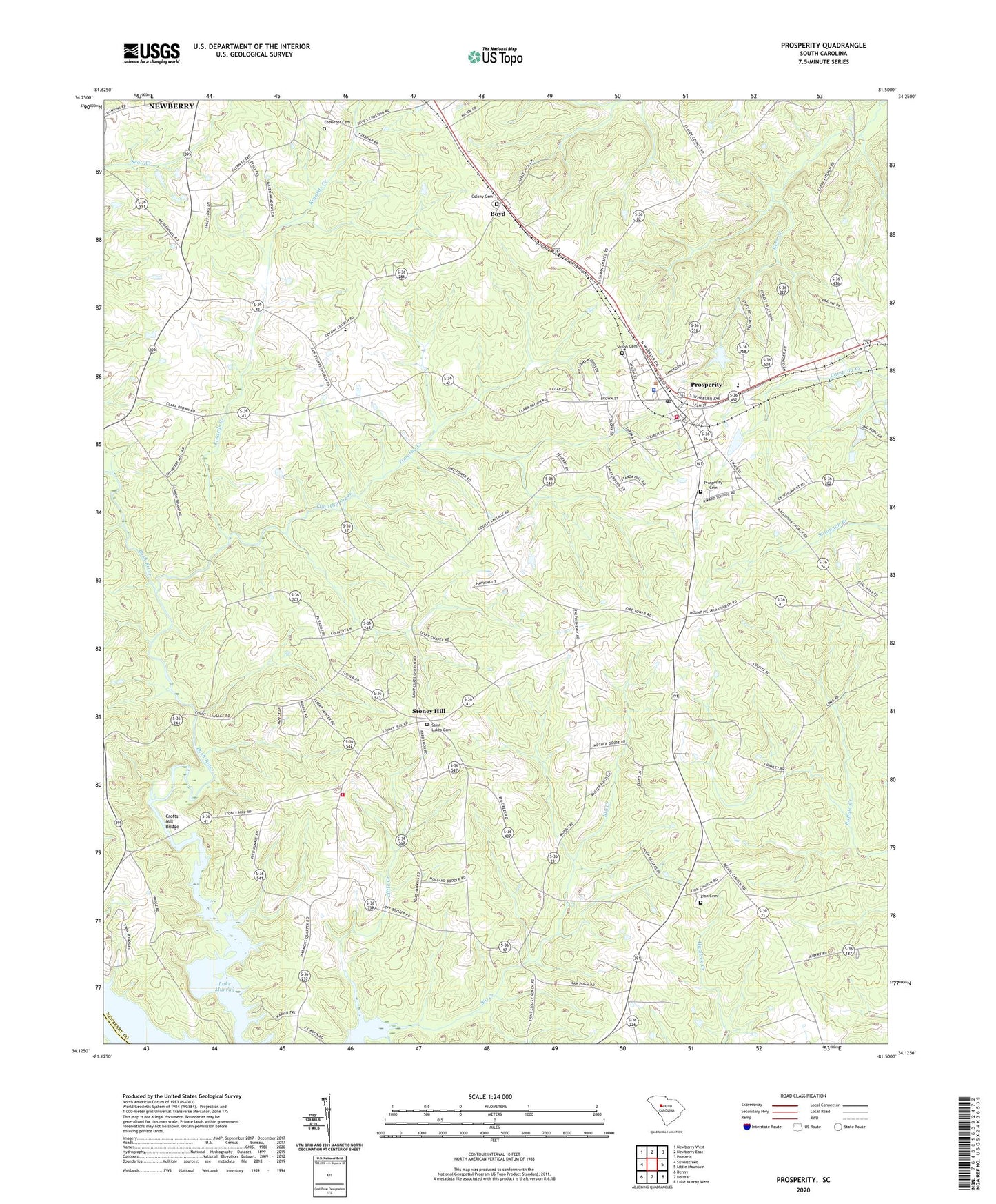
2024 topographic map quadrangle Prosperity in the state of South Carolina. Scale: 1:24000. Based on the newly updated USGS 7.5' US Topo map series, this map is in the following counties: Newberry, Saluda. The map contains contour data, water features, and other items you are used to seeing on USGS maps, but also has updated roads and other features. This is the next generation of topographic maps. Printed on high-quality waterproof paper with UV fade-resistant inks.
Quads adjacent to this one:
West: Silverstreet
Northwest: Newberry West
North: Newberry East
Northeast: Pomaria
East: Little Mountain
Southeast: Lake Murray West
South: Delmar
Southwest: Denny
This map covers the same area as the classic USGS quad with code o34081b5.
Contains the following named places: Antioch Church, Big Creek School, Boozer Chapel, Boyd, Caldwells Pond, Caldwells Pond D-1671 Dam, Colony Cemetery, Colony Lutheran Church, Crofts Mill Bridge, Ebenezer Cemetery, Ebenezer Church, Hartford School, Hopewell Church, Howard School, Kinards Creek, Kinards School, Lever Chapel, Lever Chapel School, Little Creek, Monticello School, Newberry County Rural Fire Department Prosperity Station 2, O'Neal High School, Prosperity, Prosperity Cemetery, Prosperity Elementary School, Prosperity High School, Prosperity Lookout Tower, Prosperity Police Department, Rikard School, Saint Lukes Cemetery, Saint Lukes Lutheran Church, Saluda Academy, Schumpert Mill, Shiloh Cemetery, Shiloh Church, Shiloh School, Stoney Hill, Stoney Hill Fire Department Sub - Station, Stoney Hill School, Timothy Creek, Town of Prosperity, Zion Cemetery, Zion Church, ZIP Code: 29127